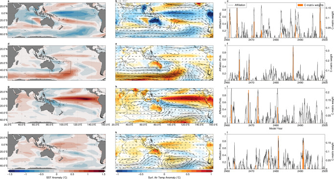
Fig. 10. Broad-scale patterns associated with marine extremes in a climate model.
a, d, g, j: anomalous sea-surface temperature; b, e, h, k: surface air temperature (colours), mid-tropospheric (500 hPa) atmospheric geopotential height anomaly (contour lines, contour interval 5 m), and wind (vectors). c, f, i, l: affiliation time-series (right) that correspond the archetypes that marine heatwaves in the a–c southeast Indian ocean, d–f southwestern Pacific near New Zealand; and g–i Great Barrier reef/Coral Sea region (indicated by box drawn in maps). Maps created with Cartopy71.

