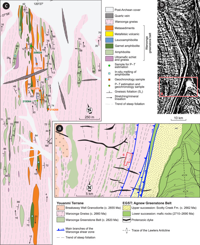
Fig. 3. Geological maps of the Waroonga shear zone.
a Geological map of the study area, across the central portion of the Waroonga shear zone (Fig. 1c for location). The rectangle shows the location of the map shown in panel c. b Merged magnetic anomaly map of the Waroonga shear zone, as part of the magnetic anomaly grid (40 m) of Western Australia, Version 1 – 2013. The full map is available on the Geological Survey of Western Australia (GSWA) website: http://www.dmp.wa.gov.au/Geological-Survey/Regional-geophysical-survey-data-1392.aspx. The rectangle shows the location of panel a. c Geological map of the sampling area, showing location of samples collected for geochronology and P–T estimations.

