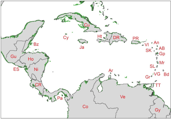
Figure 5.
NASA Landsat 5-TM image of the Caribbean mangrove areas (green patches) using the data of Ref. [4]. Abbreviations from Table 1. Base map downloaded from https://earthobservatory.nasa.gov/images/47427/mapping-mangroves-by-satellite (last accessed 3 October 2022).

