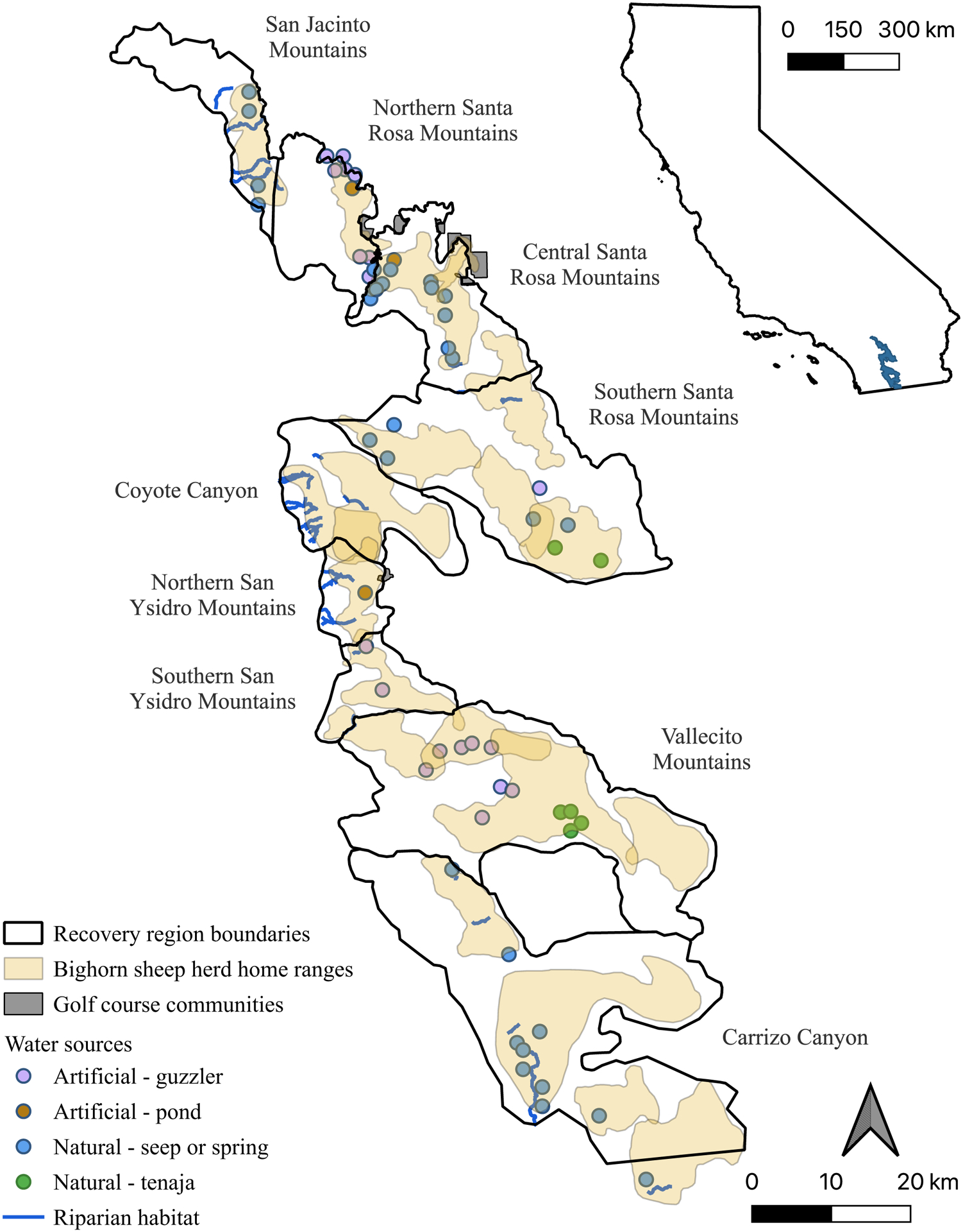
Figure 1.

Map of the study area within the Peninsular Ranges of southern California, USA. Map depicts recovery region boundaries, bighorn sheep herd home ranges, golf course communities bordering or within bighorn sheep habitat, and primary water sources. Major riparian areas have perennial or intermittent creeks and relatively large amounts of vegetation, including canopy cover and a dense understory. These areas are also utilized by deer and sometimes mountain lions. Artificial ponds and guzzlers provide year-round water through municipal sources or by collecting rainwater then delivering them to a drinking area. Guzzlers tend to be elevated, while ponds are at ground level and therefore vulnerable to contamination by rain run-off and/or animal excrement. Natural seeps and springs are small point sources of water at ground level that contain variable quantities and quality of water throughout the year. Tenajas are small rock depressions that hold water at the bottom of drainages, tend to be poor water quality, and are not dependable during the summer months. Golf course communities shown are those that bighorn sheep utilize on a regular basis; they are in urban areas where human-wildlife conflict is likely, but also have highly nutritious forage and many dependable water sources such as ponds, creeks, canals, reservoirs, and swimming pools.
