FIGURE 1.

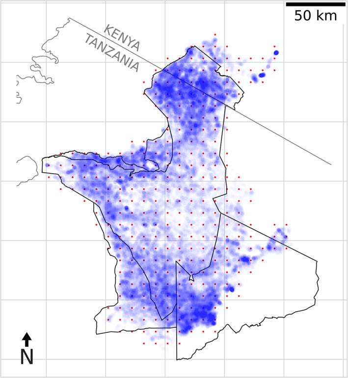
Telemetry locations and inference grid. A map of the Serengeti National Park with GPS locations shown as blue points. The red dots show the inducing grid used for inference of the latent spatial fields.

Telemetry locations and inference grid. A map of the Serengeti National Park with GPS locations shown as blue points. The red dots show the inducing grid used for inference of the latent spatial fields.