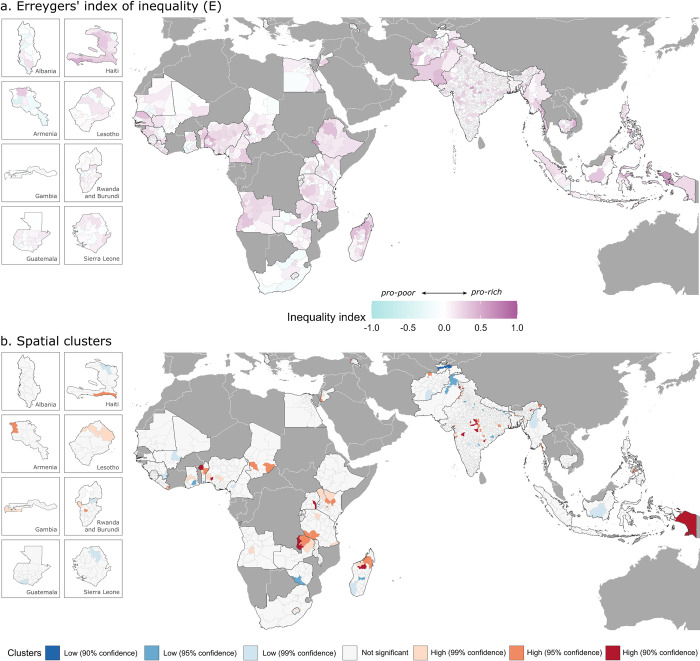
Fig 3.
Subnational estimates of Erreygers’ index (E) of socioeconomic inequality (a) and spatial clusters of administrative regions with high (red colors) and low (blue colors) degrees of inequality (b). Spatial boundaries were retrieved from Natural Earth (https://www.naturalearthdata.com/) using the “rnaturalearth” package (https://github.com/ropenscilabs/rnaturalearth).

