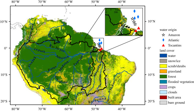
Figure 1.
Land cover (100 × 100 m resolution) in the watersheds of the Amazon River (large, western area bordered by black line) and the Tocantins River (smaller, eastern area bordered by black line). Sampling locations in the Amazon (white stars) and Tocantins (red triangles) river plumes, and in the Atlantic (blue diamonds). Sources: Land cover: Sentinel-2, 2020, resampled at 100 m resolution (https://www.arcgis.com/apps/instant/media/index.html?appid=fc92d38533d440078f17678ebc20e8e2); watersheds: Agência Nacional de Águas e Saneamento Básico (ANA) (https://metadados.snirh.gov.br/geonetwork/srv/search?keyword=Ottobacia).

