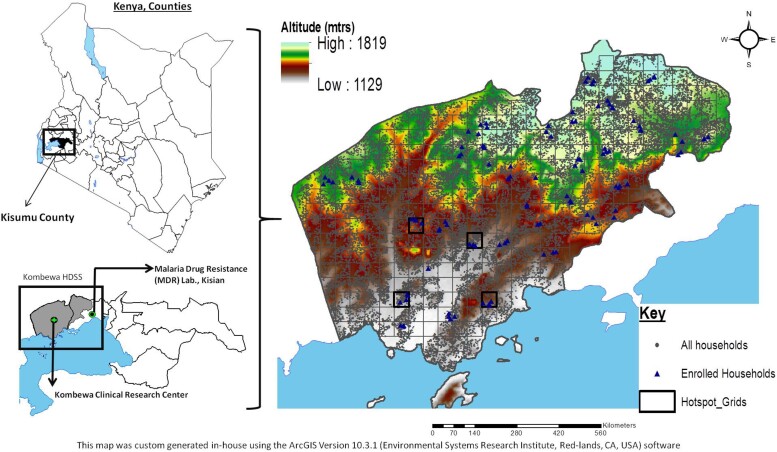
Figure 1.
Study site locations. Map showing the study area in western Kenya, which has been cartographically mapped by the HDSS using GPS, located on the northeastern shores of Lake Victoria. Each grid is 1 km2. The gray dots represent all the households on HDSS, and the blue triangle represent the households enrolled in the study. Abbreviations: GPS, Global Positioning System; HDDS, Health and Demographic Surveillance System; mtrs, meters.

