
Figure 1.
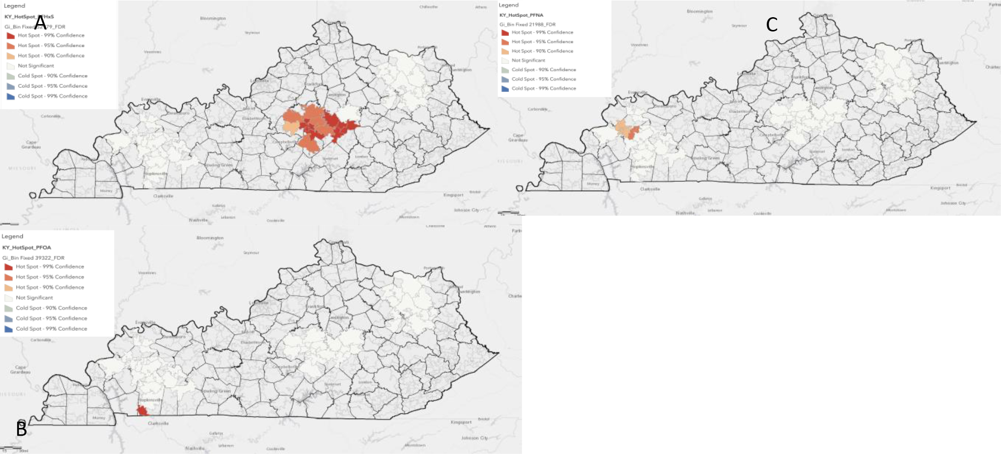
GIS spatial analysis identifies PFAS hotspots. A significant hotspot was identified for PFHxS in central Kentucky (A), PFOA in southwest KY nearby a military installation (B), and for PFNA in western Kentucky (C). Results are from zip code data collected at baseline and pre intervention circulating PFAS levels.