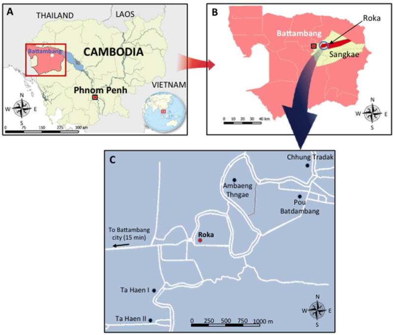
Figure 1. Geographical Location of the Iatrogenic HIV Outbreak in the Roka Commune, Cambodia, 2014 – 2015.
The map designated (A) shows Cambodia (in yellow) and the Battambang province (in pink). The map designated (B) shows the Roka commune (in red) which is located in the Sangkae district (in yellow). The map (C) shows the location of the 6 villages in the Roka commune (7985 inhabitants [inh.]). Roka village (2338 inh.) is indicated by a red circle while the other 5 villages (Ambaeng Thngae [1050 inh.], Ta Haen I [1468 inh.], Ta Haen II [1050 inh.], Pou Batdambang [731 inh.], and Chhung Tradak [1348 inh.]) are indicated by black circles. Roads are indicated by white lines.

