

Abstract

After several years of extensive exploration, a series of oil and gas reservoirs or structures have been discovered in the Dongdaohaizi sag, situated in the hinterland of the Junggar Basin. However, in recent years, some wells around the sag have failed. Herein, sedimentary facies, the plane distribution of dark mudstone, geochemical characteristics of source rocks, and the control of sedimentary facies on the distribution and development of source rocks in the Permian Pingdiquan Formation in the Dongdaohaizi sag were systematically investigated. A combined geological and geochemical method was used to fully understand the distribution law and resource potential of the source rocks in this area. Investigation results indicate that the Pingdiquan Formation primarily inherited continuous deposition, and the sedimentary facies of the sag, such as semideep lake, shore-shallow lake, prefan delta, fan delta front, and fan delta plain, were developed from the center sag to the outside. The fan delta facies, predominantly distributed in the northern margin of the sag, are characterized by lithology mainly composed of sandy conglomerate and coarse sandstone. The sandstone has a coarse particle size and poor sorting ability, while lacustrine mudstone is widely developed in the sag with a large sedimentary thickness, which is the primary source rock of the Dongdaohaizi sag. The source rocks in the Pingdiquan Formation exhibit medium-to-good quality. The organic matter is categorized as types II1–III, and the thermal evolution maturity is in the mature-high mature stage, indicating a high resource potential. The development of the source rock in the Dongdaohaizi sag is closely related to the sedimentary environment. The sedimentation rate of fan delta facies is high and burial is fast, bringing a large amount of terrestrial organic matter to the lake, thereby increasing the nutrition and organic matter quantity of the lake. Due to the stable water of the lake, low energy at the bottom, and medium conditions of strong reduction, a large amount of organic matter accumulated in the deep to semideep lake facies of the study area, resulting in the development of thick dark mudstone with a thickness of over 400 m. The abundance of organic matter has reached a good level, and the maturity and content of organic matter are high, signifying a high hydrocarbon-generation potential.
1. Introduction
The Junggar Basin, situated in Western China, holds significant importance as one of the largest petroliferous basins in the region. It is rich in petroleum resources, and great progress has been made after decades of extensive exploration and research.1−7 Specifically, the Dongdaohaizi sag, situated in the hinterland of the Junggar Basin, has been a subject of exploration for many years, leading to the discovery of various oil and gas reservoirs and structures.8−11 However, in recent years, some wells around the Dongdaohaizi sag have failed successively. Only a few wells, namely, Di 20, Baiji 1, Baijia 5, and Lunan 3, have produced oil and gas with low exploration degrees and few drilling activities. Specifically, drilling in the Permian has been concentrated mainly in the northeast region of the sag, with only Dinan 1, 2, 3, 7, and 8 being drilled.12 Moshen 1 and Pen 8 in the Mosuowan area of the Western Dongdaohaizi sag were also drilled into the Permian. Low oil production is achieved in Dinan 1 of the Pingdiquan Formation and Dinan 7 of the Wutonggou Formation in the Permian. However, Dinan 8 of the Wutong Formation in the Permian has achieved high-yield oil flow.13−15 The oil and gas reservoirs discovered in the Dishuiquan oilfield, the middle section of the Dinan uplift, and the Lunan 1 well block are primarily related to the source rocks of the Pingdiquan Formation. Furthermore, the oil and gas reservoirs in the Jurassic Cainan Oilfield contribute to the source rocks of the Pingdiquan Formation in the Dongdaohaizi sag. Therefore, the source rocks in the Pingdiquan Formation in the Dongdaohaizi sag hold great oil and gas resource potential.
The Dongdaohaizi sag suffers from a shortage of exploration wells and insufficient basic geological data. In addition, there is a lack of systematic studies regarding the sedimentary development characteristics of the Pingdiquan Formation and the stratigraphic distribution of the Pingdiquan Formation source rocks in the Dongdaohaizi sag. Specifically, the quality of the Pingdiquan Formation source rocks, the potential and scale of hydrocarbon generation, and whether it is an effective hydrocarbon supply sag or a hydrocarbon-rich sag remain poorly understood. The early Pingdiquan Formation source rock data are primarily concentrated in the periphery of the sag due to limitations caused by previous exploration, production realities, and insufficient seismic data. Therefore, the development of the source rock in the central area of the Dongdaohaizi sag is mostly indirectly inferred from the data for the periphery of the sag.
This study investigates the hydrocarbon-generation potential of the Dongdaohaizi sag by increasing the drilling data of the Permian in the sag to obtain a more accurate and detailed evaluation of the hydrocarbon-generation potential. Furthermore, based on previous research results, a systematic approach was used to examine the sedimentary characteristics, distribution of dark mudstones, and geochemical characteristics of source rocks in the Permian Pingdiquan Formation in the Dongdaohaizi sag by combining geological and geochemical methods. Based on the division of sedimentary facies, the development characteristics of source rocks in different sedimentary facies were analyzed, and the origin of organic matter was explained. The solution to these problems will enhance the understanding of the hydrocarbon accumulation mechanism in the Pingdiquan Formation and provide the basis for further exploration of oil and gas in this area, which is of great significance in both theoretical research and practical oil and gas exploration.
2. Geologic Set
2.1. Structural Position
The Junggar Basin, located north of the Xinjiang Uygur Autonomous Region, is an important part of the Central Asian orogenic belt, covering an area of about 1.3 × 1 × 105 km2. It is renowned for being one of the largest oil- and gas-bearing superimposed basins in China.16 The Dongdaohaizi sag is located in the northeast of the Junggar Basin, with a length of 100 km from east to west and a width of 70 km from south to north, covering an area of 7000 km2. The Dongdaohaizi sag is bordered by the Dinan uplift to the north, the Fukang sag to the south, the Mobei and Mosuowan uplifts to the west, and the Baijiahai uplift to the east, and is connected to the Wucaiwan sag at its northeastern edge (Figure 1a). Structurally, it is located between the Dishuiquan and Dongdaohaizi North Fault Zones and is distributed in a narrow strip toward northeast–southwest. The shape of the sag resembles a trumpet opening to the west and contracting to the northeast, and its surface is currently covered by desert, representing an asymmetric double fault graben depression.
Figure 1.

Comprehensive geological map of the Dongdaohaizi sag in the Junggar Basin: (a) location and tectonic unit; (b) combination of lithology, thickness, source rocks, reservoirs, and caprocks; (c) structural map of the top boundary of the Pingdiquan Formation.
2.2. Characteristics of Stratigraphic Development
The Junggar Basin exhibits diverse geological strata, including the Carboniferous, Permian, Triassic, Jurassic, Cretaceous, Tertiary, and Quaternary strata.17 However, there is a lack of drilling data for the Permian and Triassic in the Dongdaohaizi sag, with available drilling data limited to the Dinan 1, 2, 3, and 8 wells and their surroundings in the northeast margin. Nonetheless, based on drilling stratigraphic and field geological survey data in the adjacent area, the Permian and Triassic strata in the study area are well developed. From the top to the bottom, the strata identified in the area include the Jiangjunmiao Formation (P2j), Pingdiquan Formation (P2p), Wutonggou Formation (P3wt), Baikouquan Formation (T1b), Kelamayi Formation (T2k), and Baijiantan Formation (T3b) (Figure 1b).
The Jiangjunmiao Formation primarily consists of grayish-brown silty mudstone, interbedding of mudstone, and gray argillaceous siltstone, where gray argillaceous siltstone is locally developed. An unconformity contact is observed between the Jiangjunmiao Formation and the underlying strata. The predominant rock colors of this formation are grayish-brown and gray, mainly distributed within the sag. It represents the initial sedimentary caprock in the study area following the formation of the Junggar Basin.
The Pingdiquan Formation is primarily composed of gray glutenite, argillaceous siltstone, siltstone-fine sandstone, brownish-gray conglomerate, and gravelly mudstone. Locally, dark gray, grayish-black, and grayish-brown silty mudstones are present, along with grayish-white argillaceous limestone in the upper part. This formation is well developed in the Dongdaohaizi sag, exhibiting predominant gray, dark gray, and gray-black rock colors. The strata are developed in most areas of the Dinan and Baijiahai uplifts, with their maximum thickness reaching 800 m within the sag.
The Wutonggou Formation mainly consists of gray-green mudstone, silty mudstone with gray muddy siltstone, gravel-bearing siltstone, and gray sand conglomerates at the bottom. The rock color of the formation is gray-green and gray, indicating a reductive sedimentary environment. It exhibits an unconformal contact with the underlying strata.
The Baikouquan Formation comprises huge-thick variegated gravel bearing unequal grain and gravelly sandstones intercalated with thin gray mudstone. The formation is well developed in the sag and partially absent in the eastern part of the Dinan uplift. It exhibits an unconformity contact with the underlying strata.
The upper part of the Karamay Formation comprises medium-thick brown mudstone, sandy mudstone, variegated calcareous fine sandstone, argillaceous siltstone, pebbly fine sandstone, pebbly sandstone, glutenite, and fine sandstone with equal thickness interbedding, and the bottom develops thick gray fine conglomerate. The formation is well developed in the Dongdaohaizi sag and partially absent in the eastern part of the Dinan uplift. The contact relationship between the formation and the underlying strata is a conformity contact.
The Baijiantan Formation comprises huge-medium thick, gray mudstone, sandy mudstone, medium thick light gray, fine sandstone, and siltstone, which are interbedded with the same thickness, and a carbonaceous mudstone is developed at the bottom. The formation is well developed in the Dongdaohaizi sag and gradually thinned from the southwest to the northeast. The contact relationship with the underlying strata is a conformity contact.
2.3. Structural Features
The Permian Pingdiquan Formation in the Dongdaohaizi sag is a southwest-dipping stratum with a deeply buried area, ranging from about 2000 m in the northeast margin to about 7500 m in the southwest. The faults are not developed in the study area but in the northeast margin. The Dishuiquan Fault is developed north of the study area, and the Baijiahai Fault is developed east.18,19 No Permian Pingdiquan Formation exists in the Dinan and Baijiahai uplifts (Figure 1c).
3. Samples and Methods
3.1. Samples
The logging, seismic, and mudstone thickness data used were provided by the Sinopec Shengli Oilfield Exploration and Development Research Institute. A total of 72 cores and cuttings were collected from nine wells in the Pingdiquan Formation of the Dongdaohaizi sag, Junggar Basin. The 72 core samples were powdered and analyzed for total organic carbon (TOC). The powder samples were divided into 200 mg subsamples. The subsamples were treated with HCl at 60 °C to remove carbonate and then washed with distilled water to remove HCl. After washing, the subsamples were placed in a dry environment at 50 °C overnight, and the carbon content was determined using an LECO CS-230 analyzer with an accuracy of 2 ppm or a relative standard deviation less than or equal to 0.5%. Then, 100 g of each broken sample was placed in a container of the OGE-II instrument for rock-eval pyrolysis. The samples were heated from 300 to 600 °C at 50 °C/min in a helium atmosphere, and their rock evaluation parameters (S1, S2, and Tmax) were measured. S1 is the residual hydrocarbon content in rock samples, S2 is the amount of newly generated hydrocarbon in the pyrolysis process of kerogen in rock samples, and the maximum pyrolysis peak temperature (Tmax) is the temperature when S2 production is the largest and can be used to judge the maturity of organic matter in source rocks.20 Parallel analysis of the relative double difference and deviation of S1, S2, and Tmax in the pyrolysis analysis of source rock was conducted, where the relative double difference of S1 and S2 was ≤10% and the deviation of Tmax was ≤2 °C. Measurements of vitrinite reflectance (Ro) and observation of macerals were performed using a Leica microscope and a CRAIC spectrophotometer, respectively. These instruments were calibrated using the Saphir standard at an accuracy of 1 μm.21 Thirty-nine core samples were crushed into powders smaller than 0.09 mm. After being heated in a 78 °C water bath, chloroform was transformed into steam, which was cooled using a condenser tube. A liquid was formed at the top of the sample and poured over the sample powder, causing the organic matter in the sample to dissolve in chloroform. The organic matter in the sample was continuously evaporated and poured back and forth to completely dissolve in chloroform. Finally, the electronic balance AC210S was used to determine the organic matter content dissolved by chloroform in the sample using the mass method, and a relative double difference parallel analysis was conducted to ensure that the relative double difference was <0.002%.
3.2. Methods
The study of sedimentary facies is crucial for understanding sedimentary environments and restoring paleogeography. Various facies symbols obtained from geological, seismic, and logging data are used to identify sedimentary environments and facies.22 The geological method involves studying the lithological structure of sedimentary rocks and sediments to determine rock types and analyze their origins. By comprehensively comparing the color, lithology, and structure of sedimentary rocks and sediments in the region, sedimentary facies are analyzed, paleogeography and paleoenvironment are reconstructed, and facies models are established. The logging method focuses on extracting change characteristics (such as amplitude and shape) from logging curves in a group of logging responses that reflect the formation characteristics. This method helps to describe the formation, apply various pattern recognition methods, and investigate the lithology and sedimentary environment of the formation. The seismic facies method uses parameters such as amplitude, continuity, frequency, internal structure, external shape, and interval velocity to determine the type and spatial distribution range of seismic facies. In practical application, seismic reflection (internal structure and external shape) with high reliability is often selected as the primary basis for identifying seismic facies type, while other parameters serve as auxiliary information. The genetic type of the sedimentary system is determined through the plane transformation from seismic to sedimentary facies. In the process of transformation, it is combined with the paleogeographic background of the basin, making full use of the internal relationship between drilling and logging data and seismic facies.
Numerous parameters are used to quantitatively characterize organic matter abundance, including the TOC, chloroform asphalt “A,” and S1 + S2, which are affected by the thermal evolution of mudstone to varying degrees.23 When the degree of thermal evolution is high, the chloroform asphalt “A” cannon accurately indicates the abundance of organic matter in mudstone. However, when the depth of mudstone increases, the TOC does not decrease significantly compared to other indicators. Therefore, the TOC is more reliable for evaluating organic matter abundance in mudstone with various thermal evolution stages.24,25
The types of organic matter greatly influence the hydrocarbon-generation products of source rocks and determine their hydrocarbon-generation evolution and product characteristics.26 Evaluation methods include elemental analysis (usually using the correlation between H/C and O/C), hydrogen and oxygen index of pyrolysis, maceral analysis of kerogen, biomarkers, and carbon isotope analysis of kerogen. The direct evaluation results may slightly differ in each method. The carbon isotope characteristics of kerogen are very similar to those of its hydrocarbon-generating parent material, and its value is minimally affected by the degree of thermal evolution of the source rock. Therefore, the type of source rock parent material can be inferred from the carbon isotope composition of kerogen.
Maturity is based on effective hydrocarbon generation and expulsion, making the thermal evolution degree of source rocks critical.8 The commonly used methods are organic macerals and the pyrolysis analysis of source rocks. Ro is the most effective, widely used, and only internationally comparable parameter to characterize the thermal evolution of source rocks.27 An increase in the Tmax with higher evolution degrees indicates a good correlation between the Tmax of the different types of organic matter and Ro. The threshold for hydrocarbon generation, Tmax, is typically set at 435 °C. The range of 435–445 °C represents the low-mature stage, 445–480 °C represents the mature stage, 480–510 °C represents the high-mature stage, and above 510 °C indicates the overmature stage. However, Tmax can also be influenced by other factors, including the type of organic matter present, as distinct boundaries exist for different organic matter types.
4. Characteristics of Sedimentary Facies in the Study Area
The sedimentary environment plays a vital role in controlling the distribution of the source rocks. In addition, it determines the types and distribution characteristics of sediments and provides an environment for biological activities, reproduction, and prosperity of hydrocarbon-generating parent materials and burial environment, which further determine the formation, advantages, and disadvantages of high organic matter abundance source rocks.27
4.1. Sedimentary Environment
4.1.1. Pristane/Phytane
The ratio of pristane-to-phytane is an important geochemical indicator reflecting the redox environment of sedimentary water. This ratio is mainly affected by the sedimentary environment, followed by the maturity of organic matter.28,29 For mature samples, the paleosedimentary oxidation–reduction environment of the sample can be distinguished by the ratio of pristane-to-phytane; when the organic matter of the sample is subjected to oxidation before or during sedimentation, its pristane-to-phytane ratio is relatively large (>2.5), and when the sample is subjected to a reducing environment (in super saline and carbonate sedimentary environments), its pristane-to-phytane ratio is relatively low (<0.8). The source rock in the Dongdaohaizi sag is generally in the mature-high mature stage, and the ratio of pristane-to-phytane is mostly less than 0.8, belonging to deep water and a strong reducing environment (Figure 2).
Figure 2.

Intersection diagram of pristane-to-phytane ratio and Pr/nC17 extracts from Permian source rock in the Dongdaohaizi sag.
4.1.2. Color of Sedimentary Rock
The color of sedimentary rock is one of the important bases for identifying rocks and analyzing paleogeographic conditions, which are mainly caused by iron-containing compounds or free carbon-containing coloring substances, namely pigments. For example, gray and black rocks are mainly caused by organic matter (carbonaceous and asphaltene) and dispersed sulfide (pyrite and marcasite). The higher the content of these substances, the darker the color, indicating that the rocks were formed under reduction or strong reduction conditions.30−33 The sandstone in the Pingdiquan Formation in the Dongdaohaizi sag is mainly light gray and grayish green, while the mudstone is mainly gray and dark gray, representing a strongly reducing environment with deep water (Figure 3).
Figure 3.

Color of sedimentary rock in the Pingdiquan Formation in the Dongdaohaizi sag: (a) well Cheng 3 (3402.41 m and fine gray-green sandstone) and (b) well Dinan 1 (3630.54 m and gray sandy mudstone).
4.2. Sedimentary Facies Symbols
Sedimentary facies symbols are the comprehensive sedimentary characteristics of the sediments in the sedimentary environment, which can reflect the sedimentary environment and sedimentary facies characteristics of the study area. The restoration of the sedimentary environment and the study of sedimentary facies are based on the symbols of the sedimentary facies. Sedimentary facie symbol indicators mainly include lithologic, logging, and seismic characteristics.
4.2.1. Lithologic Characteristics
The research on sedimentary characteristics is based on lithological characteristics. The types, colors, sedimentary structures, and assemblages of rocks reflect different sedimentary environments.34 Through comprehensive analysis of core and logging data in the Permian Pingdiquan Formation in the Dongdaohaizi sag, the lithology of the Permian is mainly glutenite, sandstone, siltstone, argillaceous siltstone, sandy mudstone, and mudstone (Figure 4). Among them, the content of glutenite, coarse-medium sandstone, silt-fine sandstone, argillaceous sandstone, sandy mudstone, mudstone, and others are 26.7, 15, 7.7, 4.1, 6.7, 33, and 6.8%, respectively (Figure 5). The clastic grains of the rocks are large and poorly sorted and are mainly composed of glutenite and a variegated conglomerate. The bottom gravel is developed on the scouring surface, and the bedding structure under a strong hydrodynamic environment, such as plate cross and massive beddings, is also developed, reflecting the characteristics of rapid accumulation near the source (Figure 6).
Figure 4.

Thin section identification of Permian rocks in the Pingdiquan Formation in the Dongdaohaizi sag: (a) well Dinan 1 (2651 m, coarse sandstone, and intergranular pores); (b) well Dinan 1 (2655 m, glutenite, and intergranular pores); (c) well Dinan 1 (2922 m, medium sandstone, and intergranular pores); (d) well Dinan 3 (2796 m, glutenite, and intergranular pore); (e) well Dinan 1 (2909 m, medium sandstone, and intragranular dissolved pore); and (f) well Cai 16 (3023 m, coarse sandstone, and calcite cementation).
Figure 5.

Lithological distribution map of Permian rock samples in the Dongdaohaizi sag.
Figure 6.

Core photos of different types of sandstone in the Permian system in the Pingdiquan Formation in the Dongdaohaizi sag: (a) well Dinan 1, 3219.5 m, glutenite; (b) well Dinan 8, 3960 m, variegated conglomerate; (c) well Dinan 1, 3362.54 m, block bedding; (d) well Dinan 8, 4062 m, glutenite; (e) well Dinan 1, 3221 m, scouring surface; and (f) well Dinan 1, 2912 m, planar cross-bedding.
4.2.2. Single-Well Facies Analysis
Based on the core and drilling data of the study area, comprehensive histograms of single-well facies analysis were prepared. However, due to the limited drilling data in the study area, Dinan 1, Dinan 8, and Cai 53 around the study area were selected for analysis.
The Permian Triassic strata of Dinan 1 mainly develop fan delta and lake sediments, developing fan delta plains, fan delta fronts, and shore-shallow lake sedimentary environments (Figure 7). However, the Permian Pingdiquan Formation in the study area mainly develops mudstone and silty mudstones. The natural gamma ray (GR) value is low, mainly in the form of a toothed box curve, and the deep-shallow lateral resistivity, RT and RI, is high, mainly in the form of a box curve. This reflects the fact that the Pingdiquan Formation in the study area is mainly in a shore-shallow lake sedimentary environment.
Figure 7.

Comprehensive histogram of the Permian Triassic single-well facies in Dinan 1.
The Permian Triassic strata of Dinan 8 mainly develop the lake and fan delta sediments, developing fan delta plains, fan delta fronts, and shore-shallow lake sedimentary environments. The Permian Pingdiquan Formation in the study area mainly develops mudstone and calcareous mudstone. The natural GR value is high, mainly in the form of the dentate box curve, and the deep-shallow lateral resistivity value is relatively low, which exhibits the characteristic of the dentate box curve. This reflects the fact that the Pingdiquan Formation in the study area is mainly in the shore-shallow lake sedimentary environment.
The Permian Triassic strata in Cai 53 mainly develop a fan delta and lake, developing a fan delta plain, fan delta front, and shore-shallow lake sedimentary environment. Gray and silty mudstones have developed in the Pingdiquan Formation of the Permian in the study area. The natural GR value is low, mainly in the form of a toothed curve, and the deep-shallow lateral resistivity is high, mainly in the characteristics of a box curve. This reflects the fact that the Pingdiquan Formation is mainly in the shore-shallow lake sedimentary environment.
4.2.3. Characteristics of Seismic Facies
In this study, the traditional seismic facies analysis method was used to analyze the internal and external aspects of seismic reflection. The first aspect involves identifying the internal reflection structure. In a seismic profile, the internal reflection structure refers to the extension and distribution of seismic reflection waves in a stratigraphic sequence. The second aspect focuses on the external structure of the seismic reflection. The distribution and external shape of seismic phase units in three-dimensional space are defined as the external geometry of seismic reflection.35 The seismic facies were analyzed in this study from the response characteristics of geological factors, such as the geometric shape characteristics of the sedimentary body and the internal lithology and structure of the seismic section.
By analyzing the internal seismic reflection characteristics and external seismic reflection structure of the Pingdiquan Formation in the Dongdaohaizi sag, the seismic facies characteristics of disorderly filling, lenticular reflection, oblique progradation, mound reflection, and sheet subparallel reflection were identified (Table 1). The reflection characteristics of disorderly filling, lenticular reflection, oblique progradation, and mound reflection appear in the north of the study area near the south of the Dixi uplift and in the east near the Baijiahai area, which were identified as the fan delta plain and fan delta front. Sheet subparallel reflections were discovered in the central part of the study area, which was identified as a lake sedimentary environment. In the case of fewer drilling data, the distribution range of sedimentary facies was limited using seismic internal and external reflection characteristics.
Table 1. Identification Symbol of Seismic Facies of the Pingdiquan Formation in the Dongdaohaizi Sag.

4.3. Distribution Characteristics of Sedimentary Facies
The Permian Pingdiquan Formation in the Dongdaohaizi sag is mainly developed by inherited continuous deposition. According to the previous paleogeomorphology and heavy mineral content analyses, the source direction is mainly from the Dinan uplift north of the sag.11,36,37 During the sedimentary period of the Permian Pingdiquan Formation, fan delta plains, fan delta fronts, shore-shallow lakes, and semideep lakes were mainly developed in the study area (Figure 8). The origin of Dinan 1, 2, and 3 in the north and northeast of the study area is mainly from the Dinan uplift. The Pingdiquan Formation in Dinan 8 is a shore-shallow lake sedimentary environment. The sedimentary center of the sag is located in the central part of the sag, where a semideep lake sedimentary environment is developed. The Middle Permian deposited a thick Pingdiquan Formation with a maximum thickness of about 800 m, providing oil generation for the sag.
Figure 8.

Sedimentary facies plan of Pingdiquan Formation in the Dongdaohaizi sag.
4.4. Sedimentary Evolution Model
In the early Permian period of the Dongdaohaizi sag, the origin provided by the Dinan uplift formed a proluvial fan. Over time, the proluvial fan continued to expand, and fan delta deposition was formed in the period of the Pingdiquan Formation deposition (Figure 9). The origin of the Dinan uplift continuously supplied the study area. Late Hercynian and Indosinian movements gradually uplifted the northeast margin of the study area, causing the entire strata to tilt to the southwest. During the deposition period of the Wutonggou and Baikouquan Formations, the fan delta continued to advance, and the lake area gradually narrowed. After the sedimentary period of the Baikouquan Formation in the Triassic, the lakes in the sag began to expand to the periphery. The sedimentary period of the Kelamayi Formation in the Triassic is a fan delta. At the end of the Triassic, the interior of the sag evolved into a shore-shallow lake sedimentary environment, and the northeast margin was a fan delta sedimentary environment.
Figure 9.

Sedimentary model of the Pingdiquan Formation in the Dongdaohaizi sag.
5. Characteristics of Source Rocks in the Study Area
5.1. Distribution Characteristics of Dark Mudstone
The Dongdaohaizi sag in the Junggar Basin has great hydrocarbon-generation potential, and the source rock of the Pingdiquan Formation is the primary source rock of the Permian.12,38,39 The Pingdiquan Formation, located at the footwall of the Dishuiquan Fault, has several source rocks and a large sedimentary thickness. Drilling data show that the lithology of the Pingdiquan Formation is mainly gray-black mudstone and dark gray-silty mudstone, with a small amount of tuff, oolitic limestone, and carbonaceous mudstone.8,36,38 The effective hydrocarbon-generation potential of source rocks depends on the thickness and distribution range of shale, which is also an important indicator for analyzing the hydrocarbon-generation potential of source rocks.40 The thickness of the Pingdiquan Formation in Dinan 1, Dinan 2, Dinan 3, Dinan 8, and Cai 46 is more than 550 m, and the thickness of dark mudstone is more than 230 m. The formation thickness of Dinan 2 is 769 m, and the average thickness of the dark mudstone is more than 400 m. Dinan 7 is located in the Dinan uplift. The thickness of the Pingdiquan Formation is 286 m, the thickness of dark mudstone is 226 m, and the ratio of dark mudstone to formation thickness is 79%. The lower Wuerhe Formation of the Middle Permian (P2w, equivalent to P2p in the East) is encountered in Moshen 1 of the Mosuowan uplift in the western sag. The thickness of the formation is 267 m, and the thickness of dark mudstone is 93 m, accounting for 34.8% of the total thickness (Table 2).
Table 2. Mudstone Thickness of the Pingdiquan Formation in the Dongdaohaizi Sag and Adjacent Areas.
| area | well | formation | formation thickness (m) | gray-green mudstone thickness (m) | brown mudstone thickness (m) | dark mudstone thickness (m) |  |
|---|---|---|---|---|---|---|---|
| Dongdaohaizi sag | Dinan 1 | P2p | 592 | 0 | 0 | 262 | 44.3 |
| Dinan 2 | P2p | 769 | 0 | 16 | 413 | 53.7 | |
| Dinan 3 | P2p | 645 | 0 | 6 | 283 | 43.9 | |
| Dinan 7 | P2p | 286 | 0 | 9 | 226 | 79.0 | |
| Dinan 8 | P2p | 640 | 0 | 75 | 237 | 37.0 | |
| Wucaiwan sag | Cai 46 | P2p | 570 | 0 | 13 | 265 | 46.5 |
| Mosuowan uplift | Moshen 1 | P2w | 267 | 68 | 0 | 93 | 34.8 |
| Pen 8 | P2w | 39 | 0 | 14 | 9 | 23.1 | |
| Shimo 1 | P2p | 455 | 0 | 8 | 280 | 61.5 |
The plane distribution of dark mudstone of the Pingdiquan Formation in the Dongdaohaizi sag is restricted by the range of lakes, depth of water, and injection of surrounding rivers. Generally, the deeper the water, the smaller the hydrodynamic force and the thicker the dark mudstone. Due to no exploration well drilled into the Permian in the middle of the study area, only mudstone data of Dinan 1, Dinan 2, Dinan 3, and Cai 46 exist in the northeast margin. According to the thickness of the dark mudstone of single wells in the study area, the profile of linked wells of dark mudstone of Dinan 1, Dinan 2, Dinan 3, and Cai 46 (Figure 10) and distribution map of dark mudstone of the Pingdiquan Formation in the Dongdaohaizi sag (Figure 11) were drawn. The distribution of mudstone in the central part of the study area is mainly predicted by the characteristics of thickness in the south and thinness in the north, wedge-shaped as a whole, mudstone to formation ratio, seismic profile, and sedimentary facies. The thickness of dark mudstone in the Dongdaohaizi sag increases gradually from the northeast to the southwest, ranging from 100 to 600 m. The sedimentary center of the depression is shifted to the southwest. The isoline area with a thickness of more than 300 m is a deep semideep lake facies, and high-quality source rocks with large thicknesses will likely develop in the inner area. The relationship between the thicknesses of dark mudstone and sedimentary facies is obvious.
Figure 10.

Dark mudstone distribution profile of the Pingdiquan Formation in the Dongdaohaizi sag.
Figure 11.

Contour map of the dark mudstone thickness of the Pingdiquan Formation in the Dongdaohaizi sag.
5.2. Geochemical Characteristics of Source Rocks
In a sedimentary basin, only effective source rocks can provide commercial hydrocarbon accumulation. In addition, an effective source rock must have enough organic matter and a good organic matter type, and the evolution must process from organic matter to hydrocarbon.12,41,42 Therefore, in this study, the geochemical characteristics of organic matter abundance, organic matter type, and organic matter maturity were investigated to determine which rocks have the conditions of source rocks, which source rocks are effective, and what their hydrocarbon-generation potential is.43−45 According to the drilling results obtained from the study area, there are only 13 exploration wells drilled in the Permian in the Dongdaohaizi sag and adjacent areas, and most of them have not been drilled in the Permian. Among them, only nine wells were drilled in the Pingdiquan Formation using the source rock analysis data. To comprehensively study the Pingdiquan Formation source rocks in the Dongdaohaizi sag, a comprehensive evaluation of the study area was conducted mainly through the analysis and test data of core and cuttings combined with drilling data.
5.2.1. Abundance of Organic Matter
A sufficient amount of organic matter in rocks is the material for oil and gas formation and the main factor determining the hydrocarbon-generation capacity of rocks. Previous studies on various indicators of continental sedimentary source rocks have formed a relatively unified evaluation standard: the lower limit of organic carbon content is 0.4%, chloroform asphalt is 0.015%, and the hydrocarbon-generation potential is 2 mg/g.46
The source rock samples of the Pingdiquan Formation in the Dongdaohaizi sag are mainly from Dinan 1, 2, 3, 7, and 8, most of which are dark mudstone with a small amount of carbonaceous mudstone. As shown in Table 3, the TOC content of the Pingdiquan Formation in the Dongdaohaizi sag ranges from 0.11 to 6.72%, with an average content of 2.52%. Although the data range of the TOC is large, the TOC value greater than 1% accounts for about 70%, which indicates that the TOC is generally high and the source rock is good. The hydrocarbon-generation potential (S1 + S2) of the 72 samples from the Pingdiquan Formation in the Dongdaohaizi sag ranges from 0.02 to 10.40 mg/g. About 65% of the 72 samples were above 2 mg/g, with an average value of 4.34%, indicating a medium source rock. The chloroform asphalt “A” in 39 tested samples from the Pingdiquan Formation was generally low, and about 5% of the samples were distributed in the range of 0.015–0.05%, indicating a general source rock. In addition, about 21% of the samples were distributed in the range of 0.05–0.1%, indicating a medium source rock, and the proportion of good source rock is about 25%. Based on the indices of the study area, it is considered that the Permian Pingdiquan Formation source rocks in the Dongdaohaizi sag are generally good.
Table 3. Source Rock Evaluation Data of the Pingdiquan Formation and Its Surrounding Area in the Dongdaohaizi Saga.
| area | formation | TOC (%) | chloroform asphalt “A” (%) | hydrocarbon-generation potential (mg/g) | Ro (%) | Tmax (°C) |
|---|---|---|---|---|---|---|
| Dongdaohaizi sag | P2p |  |
 |
 |
 |
 |
| Wucaiwan sag | P2p |  |
 |
 |
||
| Mosuowan uplift | P2p |  |
 |
 |
The data in the table are as follows:  .
.
The sedimentary characteristics of the Dongdaohaizi sag were determined through its structural characteristics. The sedimentary center of the Pingdiquan Formation in the Dongdaohaizi sag is in the interior of the sag, where thick lacustrine dark mudstone is deposited. Dark mudstone is mainly deposited near the Baijiahai uplift and is limited in the west. Since there is no exploration well in the Dongdaohaizi sag and the exploration degree in the surrounding area is relatively high, to better understand the difference between the organic matter abundance of the Pingdiquan Formation source rocks and the surrounding area, a detailed comparison is made between the Dongdaohaizi sag and the surrounding area (Table 3).
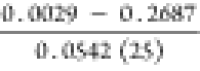
The TOC of the Pingdiquan Formation in the Dongdaohaizi and Wucaiwan sags is 2.52 and 2.46%, respectively, on average, whereas the TOC of the Mosuowan area is relatively small, with an average of 0.65%. The TOC of the Dongdaohaizi and that of the Wucaiwan sags are similar, significantly higher than that of the Mosuowan uplift. This reflects that the organic matter abundance of the Pingdiquan Formation source rock in the Dongdaohaizi sag is good and belongs to a good source rock. The range of the 39 samples based on chloroform asphalt “A” in the Dongdaohaizi area varies greatly, with a range of 0.0011 to 0.9082% and an average content of 0.0810%. In addition, the chloroform asphalt “A” in the Wucaiwan area ranged from 0.0082 to 0.4841%, with an average content of 0.1083%. However, chloroform asphalt “A” in the Mosuowan area in the west was not high, with an average range of 0.0029 to 0.2687% and an average content of 0.0542%. The chloroform asphalt “A” content in the eastern part of the sag was better than that in the western part, reflecting that the dark mudstone in the eastern part of the sag is better than that in the western part. The hydrocarbon-generation potential (S1 + S2) of the Dongdaohaizi sag varies greatly, ranging from 0.02 to 10.4 mg/g, with an average of 4.34 mg/g. This difference is due to the presence of thin carbonaceous mudstones deposited in Dinan 2 and 3. The hydrocarbon-generation potential of the Wucaiwan area is 0.16 and 29.35 mg/g, with an average of 7.48 mg/g. The hydrocarbon-generation potential of the Mosuowan area in the western sag is generally low, ranging from 0.12 to 3.16 mg/g with an average of 0.81 mg/g.
Since there is no exploration well in the target formation in the Dongdaohaizi sag, the distribution of strata in the sag is inferred only based on the seismic data. To better infer the plane distribution of the TOC of source rocks in the Dongdaohaizi sag, the measured samples were grouped according to sedimentary facies (Table 4). Combined with the structural characteristics, sedimentary facies, seismic facies, and dark mudstone isotach map of the Pingdiquan Formation, the plane isoline distribution map of the TOC of the Pingdiquan Formation in the Dongdaohaizi sag (Figure 12) was drawn. The average TOC of the Pingdiquan Formation in the Dongdaohaizi sag was better on the side near the Baijiahai uplift, which is consistent with the sedimentary and subsidence centers of the sag.
Table 4. Corresponding Relationship among Sedimentary Facies, Dark Mudstone, and Organic Matter Abundance of the Pingdiquan Formation in the Dongdaohaizi Sag.
| sedimentary facies | sample number | the average thickness of brown mudstone (m) | the average thickness of dark mudstone (m) |  |
 |
average TOC (%) | average (S1 + S2)(mg/g) |
|---|---|---|---|---|---|---|---|
| Fan delta front | 32 | 30.3 | 70.6 | 32 | 52 | 0.754 | 0.993 |
| Prefan delta | 15 | 6.0 | 218.5 | 46 | 47 | 1.941 | 4.661 |
| Shore-shallow lake | 6 | 15.7 | 244.5 | 51 | 54 | 1.586 | 4.773 |
| Semideep lake | 19 | 24.6 | 575.8 | 69 | 72 | 2.768 | 4.872 |
Figure 12.

Contour map of TOC of the Pingdiquan Formation in the Dongdaohaizi sag.
5.2.2. Types of Organic Matter
By analyzing the content of carbon, hydrogen, and oxygen elements in the kerogen of the Pingdiquan Formation in the Dongdaohaizi sag, the H/C of most samples was calculated to be less than 1.0, whereas the O/C was less than 0.2.39 The H/C of Dinan 1 was also less than 1.0, while the O/C was less than 0.2, indicating the characteristics of type III kerogen. However, in Dinan 7, the H/C was between 0.5 and 1.0, while the O/C was between 0.05 and 0.15, indicating the characteristics of type II2 kerogen. The H/C values of four samples in Cai 46 were between 1 and 1.5, and the corresponding O/C was less than 0.05, indicating a type I kerogen. The remaining samples were between type II and type III kerogen. From the kerogen type diagram of organic matter (Figure 13a), the kerogen types of samples from Dinan 1 and 7 were mainly type II2–III, indicating the characteristics of humic organic matter. The samples from Cai 46 were mainly type I–II1 kerogens, showing the characteristics of sapropel organic matter.
Figure 13.

Organic matter type map of the Pingdiquan Formation in the Dongdaohaizi sag: (a) intersection diagram of kerogen atomic ratios H/C and O/C39 and (b) carbon isotope map of the Dongdaohaizi sag.
The carbon isotope value of kerogen is less affected by maturity, which is one of the most effective methods to classify kerogen types. Huang (1993) considered that the carbon isotope value of type I kerogen is less than −28‰, type II kerogen is between −28 and −25‰, and type III kerogen is generally greater than −25‰. The kerogen carbon isotope values of the Pingdiquan Formation in the Dongdaohaizi sag range from −19.83 to −27.74‰, indicating the type III and partial type II characteristics. Figure 13b shows that the carbon isotope values of kerogen in Dinan 1 and 7 are greater than −25‰, indicating that they are type III kerogens. The kerogen isotope values of the two samples in Cai 46 were between −28 and −25‰, indicating that they are type II kerogen, while the others are mainly type III kerogen. Therefore, the hydrocarbon source rocks of the Pingdiquan Formation in the Dongdaohaizi sag are less mixed with type II kerogen and more inclined to the characteristics of type III kerogen.
Based on the above classification of organic matter, the organic matter types of the Pingdiquan Formation in the Dongdaohaizi sag are primarily type II1–III and some are type I kerogens. The type of organic matter is mainly humic, mixed with a small amount of sapropylic organic matter. The samples are mainly distributed in the Dinan area, which is close to the origin and has a large proportion of terrigenous organic matter input. Consequently, there may be source rocks with good organic matter types in the deeper part of the sag. The distribution map of kerogen types in the Pingdiquan Formation was created by combining the sedimentary facies, seismic facies, and organic matter types in a single well (Figure 14). Finally, the organic matter type of the Pingdiquan Formation in the Dongdaohaizi sag is mainly humic.
Figure 14.

Distribution of kerogen types in source rocks of the Pingdiquan Formation in the Dongdaohaizi sag.
5.2.3. Maturity of Organic Matter
The maturity of organic matter is an important content in the study of source rocks, and it is one of the criteria to measure the maturity of organic matter.47 The Ro and the maximum pyrolysis temperature, Tmax, of source rocks are indicators to judge the evolution degree of the source rocks. The Ro is a function of the irreversible temperature and effective heating time, which is an intuitive and effective method to study organic matter maturity. The results show that the Ro increases with an increase in depth (temperature).
Table 5 presents the statistics of pyrolysis characteristics of source rock samples from the Pingdiquan Formation in the eastern Dongdaohaizi area. The Ro values of Dinan 1 are mainly distributed in the range of 0.6–1.93% and Tmax in the range of 440–472 °C, which is in the mature stage. The measured samples of the Pingdiquan Formation in Cai 11 are less, with Ro values of 0.88 and 1.51%. The Ro values of Cai 25 are mainly distributed in the range of 0.66–1.29%, whereas the Ro values of Cai 46 are mainly distributed in the range of 0.71–1.04% and Tmax in the range of 435–450 °C. Most of these values are in the mature evolution stage.
Table 5. Maturity of Source Rocks of the Pingdiquan Formation in the Dongdaohaizi Saga.
| well | formation | sample description | Ro (%) | Tmax (°C) | types of organic matter |
|---|---|---|---|---|---|
| Dinan 1 | P2p | mudstone, tuff |  |
 |
mainly type III kerogens |
| Dinan 2 | P2p | mudstone | 1.18 | ||
| Dinan 3 | P2p | mudstone and sandy mudstone |  |
 |
|
| Cai 11 | P2p | mudstone, carbonaceous mudstone |  |
||
| Cai 25 | P2p | mudstone |  |
||
| Cai 46 | P2p | mudstone |  |
 |
The data in the table are as follows:  .
.
Note that the number of samples was insufficient, which is bound to affect the evaluation results. Furthermore, it is noteworthy that more than half of the source rocks reached the mature stage. A detailed analysis was conducted on the samples based on different single wells to understand the maturity of the Pingdiquan Formation source rocks in the Dongdaohaizi sag.
The Ro of the Pingdiquan Formation in Dinan 1 ranged from 0.60 to 1.93% and Tmax from 440 to 472 °C, indicating a mature stage. Figure 15a shows a certain correlation between Tmax-depth and Ro-depth of Dinan 1 in the Pingdiquan Formation, indicating that Ro reflects the maturity characteristics of Dinan 1. Generally, Ro corresponds to the threshold of oil generation between 0.5 and 0.7%. Tissot BP and Welte PH48 suggested that the oil generation threshold temperature of type I kerogen is the highest, corresponding to Ro of 0.7%; type II kerogen is the lowest, corresponding to Ro of 0.5%; type III kerogen is between the former two, corresponding to Ro of 0.6%. Most of the main source rocks in the Dinan area are type III kerogens. Therefore, the hydrocarbon-generation threshold should correspond to a Ro = 0.6%. In this way, Figure 15a shows that the threshold depth was determined to be about 2650 m.
Figure 15.

Relationship between Tmax-depth and Ro-depth in the Pingdiquan Formation: (a) Dinan 1; (b) Dinan 3; and (c) Cai 46.
The Ro of Dinan 3 in the Pingdiquan Formation is generally low, ranging from 0.55 to 0.67%, and Tmax is between 437 and 452 °C, indicating a low-mature stage. Figure 15b shows the relationship between the Tmax-depth and Ro-depth of the Pingdiquan Formation in Dinan 3. The figure shows that when the depth is between 2250 and 2450 m, Tmax is 440–450 °C, while the corresponding Ro value is 0.55–0.67%. The Tmax value is more objective to reflect maturity, and based on this, it can be inferred that Dinan 3 has reached the maturity stage. Moreover, the measured Ro value in the depth range of 2250–2450 m is comparatively smaller. The Ro distribution of Cai 46 in the Pingdiquan Formation ranges from 0.71 to 1.04%, with an average of 0.83%, and Tmax from 435 to 450 °C (Figure 15c). At a depth of 3228 m, the measured Ro is 1.04%, and the corresponding Tmax is 438 °C. Generally, Ro indicates that the source rock of the Pingdiquan Formation is in a mature stage, and the measured Ro can better reflect the maturity characteristics of Cai 46.
6. Results and Discussion
The sedimentary environment of terrigenous source rocks controls the distribution and development of source rocks, determines the abundance, type, and maturity of organic matter, and directly affects the hydrocarbon-generation potential of the source rocks. Based on the sedimentary facies, the average thickness of dark mudstone, the ratio of dark mudstone to formation thickness, the ratio of mudstone to formation thickness, the average TOC, and the average hydrocarbon-generation potential of the Pingdiquan Formation in the Dongdaohaizi sag were counted (Table 5), and Figure 10 shows this count. According to the sedimentary facies (Figure 3), dark mudstone thickness (Figure 5), TOC contour map (Figure 6), and kerogen type distribution map (Figure 8), the dark mudstone is very thick and has a medium organic matter abundance in the prefan delta facies, shore-shallow lake facies, and semideep lake facies. Specifically, in the semideep lake facies, the average thickness of dark mudstone is more than 400 m, and the organic matter abundance of source rocks has reached a good category, making it a favorable hydrocarbon-generation area. Therefore, the development of source rocks in the Pingdiquan Formation in the Dongdaohaizi sag is closely related to the sedimentary environment (Figure 16).
Figure 16.

Relationship between the thickness ratio of dark mudstone to the formation, thickness ratio of mudstone to the formation, average TOC, average hydrocarbon-generation potential, and sedimentary facies of the Pingdiquan Formation in the Dongdaohaizi sag.
The thickness of dark mudstone of the Permian Pingdiquan Formation in the Dongdaohaizi sag increases gradually from fan delta facies at the edge of the sag to semideep lake facies at the center of the sag. However, the thickness of mudstone in the lacustrine area of the sag is the largest, with an average thickness of more than 400 m. Semideep and shore-shallow lakes are widely distributed in the Pingdiquan Formation of the Dongdaohaizi sag, and the dark mudstone deposition is stable, which is the most favorable area for the development of source rocks in the study area. The lake has a wide water area, which can gather a large amount of terrigenous organic matter from the surrounding rivers. As a result, the nutrient and organic matter content of the lake increases, promoting the growth and development of low-aquatic-weight organisms such as algae, plankton, and bacteria. The lake possesses a stable water body with a considerable depth, resulting in low environmental energy at its bottom. The water medium conditions are mostly reduction, strong reduction, which is favorable to the preservation of organic matter, and evolution to hydrogen-rich components, which are favorable for hydrocarbon generation. The primary organic matter in the lake bottom mud is mainly the remains of lower aquatic organisms such as plankton and algae, as well as higher plant residues from the rivers and lakes. The abundance, species, and later evolution of high-quality organisms determine the high hydrocarbon-generation potential of this type of dark mudstone with high maturity and abundant organic matter (Figure 17).
Figure 17.

Development pattern of source rock in the Dongdaohaizi sag.
At the early stage of the Pingdiquan Formation in the Dongdaohaizi Sag, the fan delta facies were developed on a small scale (Figure 18). The study area was dominated by lacustrine deposits, and thick, dark mudstones were developed. Due to less injection of external clastic sediments, stable water bodies, and the proliferation of aquatic lower organisms, the organic matter type of the source rock was good, mainly type II1 kerogen. In the late stage of the Pingdiquan Formation, the development scale of the fan delta facies increased, with the prefan delta being the main type in Dinan 8. Due to the injection of terrigenous debris, the type of kerogen in the study area became worse, mainly type II2. In the early middle period of the P3w Formation sedimentation, the fan delta continued to expand, and a large amount of terrigenous detritus was injected. The source rock type was the worst, and the kerogen type was dominated by type III. The source rock in the sag is deeply buried, the source rock has reached the stage of high- over maturity, with large thickness of organic matter, wide distribution, good type, and high maturity, so it has high hydrocarbon-generation potential. At the same time, a set of stable argillaceous deposits deposited in the late P3w Formation is a stable regional caprock in the study area, which provides “self-generation and self-storage” conditions for the Pingdiquan Formation in the Dongdaohaizi Sag and has rich exploration potential.
Figure 18.

Pattern map for the development of the source rock-delta environment of the Pingdiquan Formation in the Dongdaohaizi sag.
7. Conclusions
In this study, the sedimentary facies, plane distribution of dark mudstone, geochemical characteristics of source rocks, and control of sedimentary facies on the distribution and development of source rocks of the Permian Pingdiquan formation in the Dongdaohaizi sag, Junggar Basin, were systematically studied. The findings from this study are summarized as follows.
The Permian Pingdiquan Formation in the Dongdaohaizi sag is mainly developed by inherited continuous deposition. The sedimentary facies of the sag, such as semideep lake, shore-shallow lake, prefan delta, fan delta front, and fan delta plain, are developed from the center to the outside.
The thickness of dark mudstone of the Pingdiquan Formation in the study area gradually increases from the northeast to the southwest, with a thickness range of 100–600 m. The sedimentary center of the sag shifted to the southwest, and the average thickness of the dark mudstone is more than 400 m. It is possible to develop thick, high-quality source rocks in the inner areas of the sag.
The organic carbon content of the Pingdiquan Formation source rock is high, with an average of 2.52%, and the average value of chloroform asphalt “A” is 0.0810%. The hydrocarbon-generation potential is medium, with an average of 4.34 mg/g. The organic matter type of the Pingdiquan Formation source rocks is mainly type II1–III kerogen, which is humic. The Ro of the Permian Pingdiquan Formation source rocks in the northeast margin of the study area is high, ranging from 0.55 to 1.93%, with an average of 0.91%. Tmax’s value ranging from 433 to 472 °C, with an average of 445 °C, indicating a mature stage. It is speculated that the entire abdomen of the sag has entered a high overmature stage.
The development of source rocks in the study area is closely related to the sedimentary environment. The thickness of dark mudstones and source rocks in the Pingdiquan Formation gradually increases from fan delta facies in the margin to semideep lake facies in the sag’s abdomen. The lacustrine environment in the sag accumulates a large amount of organic matter, and the lower aquatic organisms multiply, which determines the high hydrocarbon-generation potential of dark mudstone with high maturity and abundant organic matter. The depositional environment of fan delta facies around the sag is favorable for preserving and evolving organic matter, and the organic matter abundance is high.
Acknowledgments
This work was supported by the Natural Science Foundation of Shandong Province: the mechanism of gas–water mutual drive in the process of strong injection and strong production of carbonate underground gas storage (No. ZR2022MD033).
Author Contributions
X.H.: conceptualization, methodology, validation, investigation, writing-original draft, writing-review and editing. X.Z.: resources, data curation, supervision. J.X.: conceptualization, methodology, writing-review and editing, supervision, project administration, funding acquisition. H.C.: software, validation, formal analysis, visualization. X.Z.: conceptualization, methodology, resources. Q.P.: validation, formal analysis, investigation. Z.L.: investigation, resources, data curation. L.Z.: software, formal analysis.
The authors declare no competing financial interest.
References
- Teng G. E.; Jiang Q. G.; Tao C.; Zheng L. J.; Xie X. M. Research progress, challenges and prospects of source rocks in China. Sino-Global Energy 2010, 15 (12), 37–52. [Google Scholar]; CNKI:SUN:SYZW.0.2010–12–008
- Li B. Y.; Liu L. F.; Wei Q. Q.; Shang X. Q.; Wu Y. L. Hydrocarbon Origin and Reservoir Forming model of Permian and Triassic Petroleum, Baijiahai Swell, Junggar Basin. Geol. Sci. Technol. Inform. 2014, 33 (05), 141–148. [Google Scholar]; CNKI:SUN:DZKQ.0.2014–05–020
- Chen J. P.; Wang X. L.; Deng C. P.; Liang D. G.; Zhang Q. Y.; Zhao Z.; Ni Y. Y.; Zhi D. M.; Yang H. B.; Wang Y. T. Geochemical characteristics of source rocks and crude oil in Junggar Basin. Acta Geol. Sin. 2016, 90 (1), 37–67. [Google Scholar]; CNKI:SUN:DZXE.0.2016–03–002
- Du Z. L.; Liu H. J.; Zhang Z. H. Geochemical characteristics of Middle Permian source rocks in the southern margin of Junggar Basin. J. Xi’an Shiyou Univ. (Nat. Sci. Ed.) 2016, 31 (3), 1–7. 10.3969/j.issn.1673-064X.2016.03.001. [DOI] [Google Scholar]
- Ma L.; Zhang Y.; Zhang Z. H.; Zhang G. L.; Wang S. Z. The geochemical characteristics of the Fengcheng Formation source rocks from the Halaalate area, Junggar Basin, China. J. Pet. Sci. Eng. 2020, 184, 106561. 10.1016/j.petrol.2019.106561. [DOI] [Google Scholar]
- Hu X.; Xie J.; Cai W. C.; Wang R.; Davarpanah A. Thermodynamic effects of cycling carbon dioxide injectivity in shale reservoirs. J. Pet. Sci. Eng. 2020, 195, 107717 10.1016/j.petrol.2020.107717. [DOI] [Google Scholar]
- Lotfy M. M.; Gawad E.; Abdelghafar A. Hydrocarbon source-rock potential of the Jurassic succession in eastern part of the North Western Desert Egypt. Egyptian J. Pet. 2020, 29 (3), 243–249. 10.1016/j.ejpe.2020.09.002. [DOI] [Google Scholar]
- Qiao J. Q.Hydrocarbon accumulation characteristics of the Permian reserviors in the eastern Dongdaohaizi sag Junggar basin China Univ. Pet. 2017, doi: CNKI:CDMD:2.1019.805452. [Google Scholar]
- Bai X. N.; Luo X. P.; Liu M. P.; Xing S. H. Correlation and oil source analysis of reservoir pore hydrocarbon and inclusion hydrocarbon in Dongdaohaizi area. J. Xi’an Shiyou Univ.(Nat. Sci. Ed.) 2017, 32 (3), 9–18. 10.3969/j.issn.1673-064X.2017.03.002. [DOI] [Google Scholar]
- Liu F. M.; Chen S. J. Origin of crude oil in Dinan uplift: Junggar Basin. J. Chongqing Univ. Sci. Technol. (Nat. Sci. Ed.) 2015, 17 (6), 14–18. 10.3969/j.issn.1673-1980.2015.06.004. [DOI] [Google Scholar]
- Zhang H. X.; Chen S. J.; Yang D. S.; Ma J.; Guan X.; Zou X. L.; Huang H. Oil and gas source correlation and exploration potential analysis of peripheral structures in Dongdaohaizi sag. Acta Sedimentol. Sin. 2017, 35 (02), 393–404. 10.14027/j.cnki.cjxb.2017.02.016. [DOI] [Google Scholar]
- Zhou L.Analysis of Permian Triassic reservoir forming conditions and evaluation of favorable zones in Dongdaohaizi sag; Shandong University of Science and Technology: Junggar Basin, 2019. [Google Scholar]
- Yu F. L.Hydrocarbon accumulation in Wutonggou Formation; Northeast Petroleum University: Dongdaohaizi sag, 2015. [Google Scholar]
- Li L.Sedimentary system and favorable reservoir prediction of Wutonggou Formation in the northern slope of the Dongdaohaizi sag; Southwest Petroleum University, 2016. [Google Scholar]
- Gao G.; Titi A.; Yang S. R.; Tang Y.; Kong Y. H.; He W. J. Geochemistry and depositional environment of fresh lacustrine source rock, A case study from the Triassic Baijiantan Formation shales in Junggar Basin, northwest China. Org. Geochem. 2017, 113, 75–89. 10.1016/j.orggeochem.2017.08.002. [DOI] [Google Scholar]
- Feng T. R.Tectonic stratigraphic sequence and basin evolution of Permian in Junggar Basin China Univ. Geosci. 2017. CNKI:CDMD:2.1017.125875. [Google Scholar]
- He D. F.; Zhang L.; Wu S. T.; Li D.; Zhen Y. Tectonic evolution stages and characteristics of Junggar Basin. Oil Gas Geol. 2018, 39 (05), 5–21. 10.11743/ogg20180501. [DOI] [Google Scholar]
- Gao X. F.Structural characteristics of strike slip faults and their reservoir control in Dongdaohaizi sag; Southwest Petroleum University, 2016. [Google Scholar]
- Zheng M. L.; Tian A. J.; Yang T. Y.; He W. J.; Chen L.; Wu H. S. Tectonic evolution and hydrocarbon accumulation in eastern Junggar Basin. Oil Gas Geol. 2018, 39 (05), 67–77. [Google Scholar]
- Peters K. E. Guidelines for evaluating petroleum source rock using programmed pyrolysis. AAPG Bull. 1986, 70, 318–329. 10.1306/94885688-1704-11D7-8645000102C1865D. [DOI] [Google Scholar]
- Luo Q. Y.; Hao J. Y.; Skovsted C. B.; Xu Y. H.; Liu Y.; Wu J.; Zhang S. N.; Wang W. L. Optical characteristics of graptolite-bearing sediments and its implication for thermal maturity assessment. Int. J. Coal Geol. 2018, 195, 386–401. 10.1016/j.coal.2018.06.019. [DOI] [Google Scholar]
- Li B.Sedimentary Characteristics Study of the Ziniquanzi Formation in the Southern Margin of Junggar Basin; China University of Petroleum, 2011. [Google Scholar]
- Chen J. P.; Sun Y. G.; Zhong N. N.; Huang Z. K.; Deng C. P.; Xie L. J.; Han H. Hydrocarbon generation and expulsion efficiency and model of lacustrine source rocks under geological conditions. Acta Geol. Sin. 2014, 88 (11), 2005–2032. [Google Scholar]
- Zhong N. N.; Lu S. F.; Huang Z. L.; Zhang Y. S.; Xue H. T.; Pan C. C. Evolution of TOC value and its controlling factors during hydrocarbon generation evolution of source rocks. Sci. Sin. 2004, S1, 120–126. 10.3969/j.issn.1674-7240.2004.z1.014. [DOI] [Google Scholar]
- Qiao J. Q.; Liu L. F.; An F. L.; Xiao F.; Wang Y.; Wu L. J.; Zhao Y. Y. Hydrocarbon potential evaluation of the source rocks from the Abu Gabra Formation in the Sufyan Sag, Muglad Basin. Sudan J. Afr. Earth Sci. 2016, 118, 301–312. 10.1016/j.jafrearsci.2015.12.024. [DOI] [Google Scholar]
- He Y. X.Volcanics-Forming Environment and its Hydrocanbon Significance of the Lower Permian Volcanic Rock in Northwestern Margin; China University of Petroleum (Beijing): Junggar Basin, 2018. [Google Scholar]
- Liu G. D.Petroleum Geology; Petroleum Industry Press, 2009. [Google Scholar]
- Wang T. G. Discussion on Sedimentary Environmental Biomarkers in Some Crude Oils and Source Rocks in China. Geochimica 1990, 03, 256–263. 10.19700/j.0379-1726.1990.03.009. [DOI] [Google Scholar]
- Liu Y.; Zhan C. F. Exploring the geological factors affecting Pr/Ph values and their hydrocarbon generation evolution. Chinese Pet. Chem. Stand. Qual. 2014, 34 (5), 203. [Google Scholar]
- Zhu X. M.Sedimentary petrology; Petroleum Industry Press, 2010; pp 7-8. [Google Scholar]
- Liu G. D.Petroleum Geology; Petroleum Industry Press, 2009; pp 44–47. [Google Scholar]
- Zhang J. L.; Xie J.. Reservoir sedimentary facies; Petroleum Industry Press, 2008; p 108. [Google Scholar]
- Li B.Proceedings of 30 years of exploration and development in the Eastern Junggar Basin; Petroleum Industry Press, 2012; p 144. [Google Scholar]
- Zhang C. M.; Wang X. L.; Zhu R.; Qu J. H.; An Z. Y. Litho Facies Classification of Baikouquan Formation in Mahu Sag Junggar Basin. Xinjiang Pet. Geol. 2016, 37 (5), 606–614. 10.7657/XJPG20160521. [DOI] [Google Scholar]
- Liang Y. S.Geological Structure, Formation and Evolution of Chepaizi High in Western Junggar Basin; China University of Geosciences, 2019. [Google Scholar]
- Zhang H. X.Oil and gas sources and accumulation of key structures in the north ring of Dongdaohaizi sag; Southwest Petroleum University: Junggar Basin, 2014. [Google Scholar]
- Li B. Y.; Liu L. F.; Wei Q. Q.; Shang X. Q.; Wu Y. L. Source rock distribution and potential evaluation of Permian Pingdiquan Formation in Cainan exploration area. Sci. Technol. Eng. 2014, 14 (24), 195–202. 10.3969/j.issn.1671-1815.2014.24.035. [DOI] [Google Scholar]
- Ding X. H. Origin and accumulation stages of hydrocarbon in Dongdaohaizi sag Junggar Basin. Sci. Technol. Eng. 2016, 16 (10), 80–84. 10.3969/j.issn.1671-1815.2016.10.015. [DOI] [Google Scholar]
- Jin J.; Luo X. P.; Liao J. D.; Yu Q. L.; Wang D. W.; Zhao W. Geochemical characteristics of source rocks of Pingdiquan Formation in Dongdaohaizi sag, Junggar Basin. J. Chengdu Univ. Technol. (Sci. Technol. Ed.) 2015, 42 (02), 196–202. 10.3969/j.issn.1671-9727.2015.02.07. [DOI] [Google Scholar]
- Chen J. P.; Zhao C. Y.; He Z. H. Discussion on evaluation criteria for hydrocarbon generation potential of organic matter in coal measures. Pet. Explorat. Dev. 1997, 1, 1–5. [Google Scholar]; CNKI:SUN:SKYK.0.1997–01–000
- Hu S. Y.; Wang X. J.; Cao Z. L.; Li J. Z.; Gong D. Y.; Xu Y. Formation conditions and exploration direction of large and medium gas reservoirs in the Junggar Basin NW China. Pet. Explorat. Dev. 2020, 47 (2), 266–279. 10.11698/PED.2020.02.04. [DOI] [Google Scholar]
- Xie J.; Hu X.; Liang H. Z.; Li Z.; Wang R.; Cai W. C.; Nassabeh S. M. M. Experimental investigation of permeability heterogeneity impact on the miscible alternative injection of formation Brine–Carbon dioxide. Energy Rep. 2020, 6, 2897–2902. 10.1016/j.egyr.2020.10.012. [DOI] [Google Scholar]
- Qin L. M. Molecular geochemical characteristics and formation environment of Jurassic source rocks in the hinterland and southwest margin of Junggar Basin. Acta Sedimentol. Sin. 2013, 31 (04), 738–746. [Google Scholar]
- Wang J.; Li E. T.; Chen J. High quality source rock characteristics and hydrocarbon generation mechanism of Permian Lucaogou Formation in Jimusaer sag Junggar Basin. Geol. Rev. 2020, 66 (03), 755–764. 10.16509/j.georeview.2020.03.016. [DOI] [Google Scholar]
- Li J.; Jiang Z. L.; Luo X.; Wang D. L.; Han Z. X. Geochemical characteristics of coal-measure source rocks and coal-derived gas in Junggar Basin, NW China. Pet. Explorat. Dev. Online 2009, 36 (3), 365–374. 10.3321/j.issn:1000-0747.2009.03.012. [DOI] [Google Scholar]
- Jia C. Z.; Zou C. N.; Li J. Z.; Li D. H.; Zheng M. Evaluation criteria, main types, basic characteristics and resource prospects of tight oil in China. Acta Petr. Sin. 2012, 33 (3), 343–350. 10.7623/syxb201203001. [DOI] [Google Scholar]
- Wang Y.; Cao J.; Li X. Y.; Zhang J. K.; Wang Y. C. Cretaceous and Paleogene saline lacustrine source rocks discovered in the southern Junggar Basin, NW China. J. Asian Earth Sci. 2019, 185, 104019. 10.1016/j.jseaes.2019.104019. [DOI] [Google Scholar]
- Tissot B. P.; Welte D. H.. Petroleum Formation and Occurrence, Spring-Velag: Berlin, 1978. [Google Scholar]