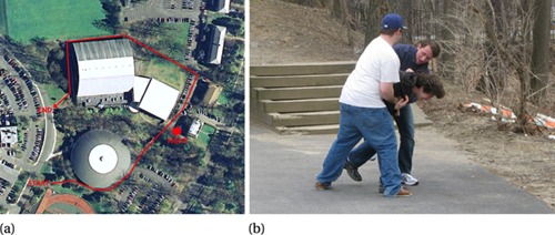
Figure 1.

(a) The area on the Union College campus where the studies were conducted (image from Google Maps, maps.google.com). The route run by the confederate and the subjects is shown in red. (b) A close-up view of the fight from the point where the subjects passed closest to it.
