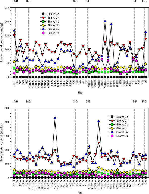
Figure 2.

Heavy metal contents in source river and locations of the east (top) and west (down) pilot wetland. Refer to sampling location map in Figure 1. X-axis: River: source river (corresponding to “A” on top X-axis); the first letter “E”: east wetland, “W”: west wetland; the second letter (corresponding to letters on top X-axis) “B”: pretreatment zone, “C”: root-channel zone I, “D”: water lifting and falling zone, “E”: root-channel zone II, “F”: deep purification zone, “G”: wetland outlet; the third letter “H”: high ditch, “L”: low ditch, “P”: plant bed, “x”: the exit of functioning zone; the numbers after “B”, “D”, “F”: locations along hydraulic pathways; the numbers after “H”, “L”: ditch sequence; the numbers after “P”: plant bed sequence; the last letter “a”, “b”, “c”: locations along hydraulic pathways in ditches. Sites on plant beds are for collecting soil and the rest are for sediments.
