

Abstract
A hill station is a town or city situated in mountain regions in the tropics founded during the western colonization in the nineteenth and early twentieth centuries. Hill stations have moderate temperatures, and are known for their relatively good natural environments, which generate valuable ecosystem services that benefit the local population. However, rapid urbanization threatens the sustainability of these areas. This study evaluates the sustainability of the urbanization process of Baguio City, a hill station city in Southeast Asia and the summer capital of the Philippines, by determining the relationship between its velocity of urbanization and velocity of urban sustainability based upon various perspectives. From an equal weight perspective (of the triple bottom line of sustainability components, namely environmental, social, and economic) and a pro-economic perspective, the results revealed that the urbanization of Baguio City has been moving toward a “sustainable urbanization.” However, from the environmental and eco-sustainable human development perspectives, the results indicated that it has been moving toward an “unsustainable urbanization.” The paper discusses the implications of the findings for the planning of sustainable development for Baguio City, including some critical challenges in sustainability assessment and the applicability of the framework used for future sustainability assessments of the other hill stations in Southeast Asia.
Electronic supplementary material
The online version of this article (doi:10.1007/s13280-014-0498-7) contains supplementary material, which is available to authorized users.
Keywords: Baguio, Hill station, Human–environment system, Sustainable development, Social–ecological system, Sustainable urbanization
Introduction
Urbanization has brought improvements to social welfare and economic development, while cities have been playing important roles in our society, e.g., as a symbol of creativity, imagination and power of humanity, the cradles of innovation and knowledge creation, the heart of socio-cultural transformations, and engines of economic growth (Wu 2010). Yet, urbanization is one of the many human activities that have a serious impact on the natural environment, both locally and globally (Grimm et al. 2008; Wu 2010; Seto et al. 2011). Urban areas now contain about half of the world’s population; yet they cover less than 3 % of the earth’s terrestrial surface, and are responsible for approximately 80 % of greenhouse gas emissions and 75 % of global energy consumption (MA 2005; UN 2010). This dualistic nature of urbanization (Wu 2010) should be balanced and must form part of the sustainability goal of humankind.
Poor urban development planning can lead to many negative socio-economic impacts (e.g., poor quality of life) (Bloom et al. 2008), while urbanization itself is arguably the most drastic form of land transformation that results in irreversible landscape changes. The three components of the triple bottom line of sustainability (TBLS), namely environmental, social, and economic, represent a nested hierarchy as societies cannot thrive without a functioning life-support system; and without functioning social structures and institutions, economies cannot flourish (Fischer et al. 2007; Mori and Christodoulou 2012). Based on these structural relationships, a sustainable city or community must achieve a balance among environmental protection, social well-being and economic development (PCSD 1997; Wu 2010). Proper landscape and urban planning might help in the attainment of sustainable urbanization.
Sustainable urbanization is an important component and an indispensable part of sustainable development (UN-Habitat/DFID 2002; Shen et al. 2012; Liu et al. 2013). It refers to the well-balanced relationship between environmental, social and economic aspects of society, and aims to achieve sustainable urban development (Drakakis-Smith 2000). In brief, sustainable urbanization is characterized by an urbanization process that satisfies the principles of sustainable development (Roy 2009). Sustainable development, also known as ecologically sustainable economic development, is a “…development that meets the needs of the present, without compromising the ability of future generations to meet their own needs” (WCED 1987, p. 43). However, critical challenges exist in achieving sustainable urbanization, including the divergence between: economic growth and environmental sustainability; economic sustainability and poverty reduction; inequity and exclusion; infrastructure deficiencies; agencies’ inadequate governance capabilities; and a realization of the benefits of interdependence between rural and urban areas (UN-Habitat/DFID 2002).
Urban sustainability assessment plays an important role in proper landscape and urban planning toward sustainable urbanization. It evaluates the rate, direction and potential impact of urbanization on ecosystem conditions, ecological capacity and the socio-economic well-being of people. It can provide vital information to policy makers and planners in the pursuit of sustainable urbanization. The effects of sustainability policies and development plans on the urban environment can be revealed through indicators (Munier 2005). Therefore, indicators are important in the monitoring and evaluation process of the progress, direction and impacts of sustainability goals (Newman and Jennings 2008).
However, there exist critical challenges in measuring urban sustainability, including proper selection of relevant indicators and methods for measurement. The body of literature on coupled human–environment systems and sustainability science has grown very rapidly. Yet, there has been no standard that requires and specifies the indicators to be used for measuring urban sustainability. This is because different practices adopt different indicators according to their own purpose of evaluation and definition of sustainability (Alberti 1996; Singh et al. 2009; Shen et al. 2011). There is, however, a growing consensus that the environmental, social and economic components of the TBLS must be considered in the evaluation of urban sustainability, and therefore, indicators for each component are necessary (e.g., Alberti 1996; Zhang 2002; van Dijk and Zhang 2005; Scipioni et al. 2009; Singh et al. 2009; Shen et al. 2011; Liu et al. 2013).
“Despite the sustained economic growth of Asian economies in the recent decades, urban poverty, inequality, slums, poor urban environmental quality and liveability, worsening disaster risks and effects of climate change pose major development challenges” (Dahiya 2012, p. S44). At the same time, there has been a resurgence of interest in hill stations1 for “quality environment” and other socio-economic development-related activities, resulting in the rapid urbanization of some, including Baguio City, the Philippines, and Bogor, Indonesia (Crossette 1999; Estoque and Murayama 2013a). Hill stations are known for their relatively good natural environments, which generate valuable ecosystem services that benefit the local population. However, rapid urbanization affects the fragile natural environment and threatens the sustainability of these areas.
There are still very few studies that assess the state and direction of urbanization in the hill stations of Southeast Asia within the context of sustainable development. Hence, this study evaluates the sustainability of the urbanization process of Baguio City, the Philippines. Once planned as a convalescence-cum-recreation center and a highland refuge to escape from “tropical fatigue,” Baguio City is now a highly urbanized multifunctional city. Baguio City has been playing two major roles: (1) as a center that stimulates economic prosperity in the Cordillera Administrative Region (CAR) in Northern Philippines; and (2) as a niche with rich historical and cultural heritage, and an endangered natural landscape that is of national significance and which needs to be protected, preserved and developed in a sustainable manner. The ultimate challenge is how to fulfill these roles harmoniously. Recognizing the importance of these roles and with the aim of gaining comprehensive understanding of the state and direction of Baguio City’s urbanization, this study measures urban sustainability based upon various perspectives.
Materials and Methods
Study Area: Baguio City
Baguio City is situated in the mountainous area of CAR in Northern Philippines (Fig. 1). Although it is geographically located within the Province of Benguet, Baguio City has been functioning independently as a chartered city since 1909. Baguio is a relatively small city with an approximate land area of 57.5 km2. It has a favorably cool climate owing to its elevation, which ranges from approximately 900 to 1600 m above sea level. Its average temperature is 8 °C lower than that in the lowlands, and seldom exceeds the average annual maximum temperature of 26 °C (Saldivar-Sali and Einstein 2007). This characteristic and the once marginally disturbed natural landscape of the area make Baguio City the summer capital of the Philippines and one of the country’s main tourist destinations. It is also the regional center of CAR, and the education and health services center north of Metro Manila.
Fig. 1.

Location of Baguio City. The two maps above show the geographic location of CAR and the Province of Benguet, where Baguio City is located. Access roads: (1) Naguilian Road (also known as Quirino Highway); (2) the Aspiras-Palispis Highway (formerly known as Marcos Highway); (3) Kennon Road (formerly known as Benguet Road); (4) Benguet–Nueva Vizcaya Road; and (5) Halsema Highway. Background image source (bottom): Google Maps
In terms of accessibility, Baguio City can be reached from the western lowland areas via three national roads, and from the eastern part of the city via two other access roads (Fig. 1). In terms of demographic characteristics, the 2000 census reveals that the city has a very young population, with approximately 69 % below 30 years of age (NSO 2003). Baguio’s annual population growth rate (APGR) has always been higher than the rate for the whole country. Surprisingly, however, people who are native to the province of Benguet, where Baguio City is situated, only account for approximately 16 % based on the “population by ethnicity” data (NSO 2003). Furthermore, only approximately 24 % of the population came from the whole CAR; instead the Ilocano group dominated the population (circa 45 %), followed by the Tagalog group (circa 21 %). This indicates that there has been a great deal of migration into the city over the past decades. Its accessibility (Fig. 1) might have played a vital role in its growth and development, establishing its centrality, influence and primacy all over Northern Philippines.
As of the 2010 census (NSO 2012), the population of Baguio City had increased from 119 669 to 318 676 since 1980 (Fig. 2). This shows that Baguio’s population had grown almost threefold in the past three decades (1980–2010). It was during this period that the urban growth and development of Baguio City accelerated. The epoch considered in this study (i.e., 2000–2010) fall within this period, though there are also some analyses of future projections up to 2020.
Fig. 2.

Population growth of Baguio City. The data used for the indicators of the TBLS are within the 1980–2010 period (between the two vertical broken lines). Note P1—Projected 2020 population using 3.32 % APGR (1980–2010 average); P2—Projected 2020 population using 2.36 % APGR (most recent); and P3—Projected 2020 population using 1.52 % APGR (determined based on the APGR decrease rate from 1980 to 2010). Data sources Estoque and Murayama (2013a) and NSO (2012)
Urban Sustainability Assessment
Singh et al. (2009) provide an overview of various sustainability indices applied in policy practice, including a review on sustainability indices formulation strategy, scaling, normalization, weighting, and aggregation methodology. They concluded that in most cases the focus of sustainability assessment is on one of the three aspects of the TBLS (environmental, social and economic). And although there have been many initiatives to measure sustainability, there are still few applications that implement an approach that is capable of integrating the three components of the TBLS (Singh et al. 2009). Shen et al. (2011) provide a comparative evaluation on the application of urban sustainability indicators into various practices. They concluded that “due to the differences between individual practices, the selection of indicators should be done with the clear understanding of the needs where these are going to be applied” (Shen et al. 2011, p. 26).
The assessment of urban sustainability can be initiated by focusing on the TBLS that takes environmental quality, social justice and economic prosperity into consideration (Elkington 1997; Pope et al. 2004). However, recent studies have argued that an indicator for an external environmental impact, called leakage effect, should also be included in the assessment in addition to the components of the TBLS (Mayer 2008; Mori and Christodoulou 2012). In their review, Mori and Christodoulou (2012) concluded that among the methods and indices for urban sustainability measurement they reviewed, no single method or index has the capability to simultaneously consider the components of the TBLS and leakage effect. They argued that there is a need for a new index. Shen et al. (2012) proposed a model for evaluating the sustainability of urbanization. The model considers both the velocity of urbanization and velocity of urban sustainability.
This current study recognizes the importance of leakage effect (Mayer 2008; Mori and Christodoulou 2012) and the potential of the concepts of the velocities of urbanization and urban sustainability (Shen et al. 2012) in sustainability assessment. It also argues that there is a need to explore different scenarios, for example, by using various perspectives (e.g., pro-economic and pro-environment), in order to gain a comprehensive understanding of the current state and future direction of the urbanization process. However, a sustainability assessment approach that can take all these aspects (leakage effect, velocities of urbanization and urban sustainability and scenario analysis, in addition to the three components of the TBLS) into consideration at the same time is still lacking. Therefore in this study, a framework for this purpose has been conceptualized and implemented. Using the framework, the sustainability of Baguio City has been assessed following these three steps: (1) determining its velocity of urbanization based on two different indicators, namely ratio of urban population and extent of impervious surface area; (2) determining its velocity of urban sustainability based on various perspectives that take into account leakage effect and the TBLS components; and (3) examining the relationship between its velocity of urbanization and velocity of urban sustainability. The details of each step, including technical definitions, are given in the next sections. The acronyms and abbreviations used in the following measurements are summarized in Table 1.
Table 1.
Acronyms/abbreviations and their descriptions used in the measurement of urbanization rate, urban sustainability and their respective velocities
| Acronyms/abbreviations | Descriptions |
|---|---|
| U R | Urbanization rate |

|
Based on urban population |

|
Based on the extent of impervious surface area |
| U S | Urban sustainability |

|
Based on the environmental component |

|
Based on the social component |

|
Based on the economic component |

|
Based on perspective 1 (the environmental, social and economic components have equal weights) |

|
Based on perspective 2 (pro-economic) |

|
Based on perspective 3 (pro-environment) |

|
Based on perspective 4 (pro-eco-sustainable human development index (E-SHDI)) |
| Vu R | Velocity of urbanization |

|
Based on urban population ( ) ) |

|
Based on the extent of impervious surface area ( ) ) |
| Vu S | Velocity of urban sustainability |

|
Based on the environmental component ( ) ) |

|
Based on the social component ( ) ) |

|
Based on the economic component ( ) ) |

|
Based on perspective 1 ( ) ) |

|
Based on perspective 2 ( ) ) |

|
Based on perspective 3 ( ) ) |

|
Based on perspective 4 ( ) ) |
Note the details of the four perspectives are given in Table 2
Measuring Urbanization Rate (UR) and Velocity of Urbanization (VuR)
Urbanization is a dynamic process that involves various stages and is usually expressed with an urbanization rate (UR) (Shen et al. 2012). UR measures the degree or extent of urbanization at a certain point in time of the urbanization process. UR therefore defines the stage of urbanization (Henderson and Wang 2004; Shen et al. 2012). It has been argued that the ratio of people living in urban areas to the total population of the study area can be used to measure UR (Zhang and Song 2003; Shen et al. 2012; Liu et al. 2013). The various stages of the urbanization process include the initial stage, an acceleration stage and a terminal stage: the initial stage represents the earliest phase of the urbanization process until the ratio of the urban population reaches 30 %; the acceleration stage corresponds to the phase where the urbanization process is rapid; while the terminal stage represents the phase where the ratio of urban population is over 70 % (Northam 1975).
This study measured the UR of Baguio City based on urban population ( ) and extent of impervious surface area (
 ). In the 2000 census, the whole population of Baguio City was already considered to be an urban population (NSO 2003). Thus, for the purpose of measuring
  , the ratio of Baguio’s population to the whole population of CAR was used. Baguio is the regional center of CAR and the only city in the region before 2011.2 To measure
  , this study used the extent of impervious surface area of Baguio City, which has been determined from remote sensing data (Estoque and Murayama 2011).
Each of the calculated UR based on  and
and  for 2000 and 2010 represents a value that measures the degree or extent of urbanization at a certain stage in the urbanization process of Baguio City. Equation (1) was used to determine the velocity of urbanization (VuR), which measures the rate and direction of change in the urbanization of Baguio City from 2000 to 2010 based on
  and
and  .
.
 |
1 |
where  and
and  are the values of UR (based on
  and
and  ) at time t1 and t2, respectively.
Measuring Urban Sustainability (US)
Indicators, Data Standardization, and Aggregation Procedures
Urban sustainability (US) is a desirable state that can be achieved through the proper use of resources to guarantee a generational equity, protection of the natural environment, minimal use of non-renewable resources, economic vitality and diversity, community self-reliance, individual well-being and satisfaction of basic human needs (Hardoy et al. 1992; Choguill 1996; Shen et al. 2012). US can be used as a measure for assessing the extent to which a city has achieved a desirable state of sustainability (Banister 1998; Shen et al. 2012). Table 2 presents the building blocks and framework for the urban sustainability assessment of Baguio City. It contains all the US indicators used in this study, which have been grouped based on the three components of the TBLS, i.e., environmental, social, and economic. The sixth column defines the types of indicators, i.e., whether an indicator is directly (+) or inversely (−) related with sustainability. In the case of Baguio City, the indicators for each component (Table 2) were based on previous studies (Zhang 2002; Spiekermann and Wegener 2003; van Dijk and Zhang 2005; Scipioni et al. 2009; Singh et al. 2009; Shen et al. 2011; Moldan et al. 2012; SCI 2012; Axelsson et al. 2013; Rezvani et al. 2013; Liu et al. 2013), supplemented by the authors’ “local knowledge” of the study area. The details of the indicators are given in Fig. S1.
Table 2.
The building blocks and framework for an urban sustainability assessment of Baguio City
| Components relative weights | Triple bottom line components | Indicators | Types | Sources | ||
|---|---|---|---|---|---|---|
| Perspective 1 | Perspective 2 | Perspective 3 | ||||
| 0.33 | 0.25 | 0.45 | Environmental | Ecosystem service value | + | Estoque and Murayama (2012, 2013b) |
| Human-to-ecosystem service value ratio | + | Estoque and Murayama (2012, 2013b) | ||||
| Ecological footprint (leakage effecta) | – | Authors’ own estimation | ||||
| 0.33 | 0.30 | 0.30 | Social | Human development index–life expectancy index | + | HDN (2013) |
| Human development index–education index | + | HDN (2013) | ||||
| Annual population growth rateb | − | Authors’ own calculation | ||||
| Crime rate | − | www.nscb.gov.ph | ||||
| 0.33 | 0.45 | 0.25 | Economic | Human development index–income index | + | HDN (2013) |
| City internal revenue allotment | + | 2002–2008 CLUPc; www.nscb.gov.ph | ||||
| Tourist arrivals | + | 2002–2008 CLUP; www.nscb.gov.ph | ||||
| Incidence of poor families | − | 2002–2008 CLUP; 2010–2020 CLUP | ||||
| Perspective 4—based on the concept of eco-sustainable human development index (E-SHDI) (Ture 2013). The details of this perspective are given in Eq. (6) described in the “Materials and Methods” section of this paper | ||||||
Note the details of the raw data are given in Fig. S1
aPotential external environmental impact
bThe annual population growth rate (APGR) was considered to be inversely related with sustainability because Baguio City has already greatly surpassed its designed population ceiling of 25 000 people (Glorioso 2006; Cariño 2009; Estoque and Murayama 2013a). Baguio City already has a population density of 5543 people km−2, and thus an increase in its APGR would exacerbate congestion
cComprehensive Land Use Plan for Baguio City
One of the challenges in the aggregation of physical and socio-economic indicators is how to deal with their different dimensions. To overcome this, all the data collected were standardized to make aggregation possible. In this study, data standardization is aimed at generating a value for each indicator that ranges from 0 to 1, where 0 is low and 1 is high with reference to sustainability. Equations (2) and (3) present the standardization procedures. Theoretically, for an indicator that is directly related with sustainability ( ), when xi = ai, then the standardized value of the indicator is 1; however, when xi = bi, then the standardized value of the indicator is 0. For an indicator that is inversely related with sustainability (
 ), when xi = bi, then the standardized value of the indicator is 1; but when xi = ai, then the standardized value of the indicator is 0.
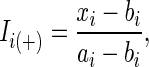 |
2 |
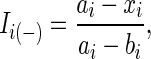 |
3 |
where xi is the original value of indicator Ii; ai is the maximum value of indicator Ii; and bi is the minimum value of Ii.
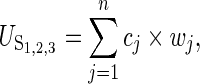
The standardized values of all the indicators for each of the three components of the TBLS that are either exactly or close to the years 2000 and 2000 were used in the analysis. The indicators for each component were all given equal relative weights. An aggregation procedure presented in Eq. (4) was used to measure the environmental ( ), social (
 ), and economic (
 ) sustainability of Baguio City. Theoretically, the individual sustainability index of the three components varies from 0 to 1. Values closer to 0 have lower sustainability, whereas values closer to 1 have higher sustainability (Table 3).
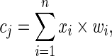 |
4 |
where cj is the sustainability index of component j; xi is the standardized value of indicator i; wi is the relative weight of indicator i; and n is the number of indicators for component j.
Table 3.
Sustainability index scale
| Index | Description |
|---|---|
| ≥0.80 | Very high |
| [0.60–0.80) | High |
| [0.40–0.60) | Medium |
| [0.20–0.40) | Low |
| <0.20 | Very low |
Note “[” means that the lower limit is inclusive, while “)” means that the upper limit is exclusive
Four Various Perspectives
In Table 2, the first three columns on the left and the last row contain the four perspectives from which the US of Baguio City was based and measured upon: (1) an equal weight perspective ( ); (2) a pro-economic perspective (
 ); (3) a pro-environment perspective (
 ); and a pro-eco-sustainable human development index (E-SHDI) perspective (
 ).
).  considers equal relative weights of the three components of the TBLS, while
  considers a much higher relative weight for the economic component.
  considers a much higher relative weight for the environmental component, whereas
  integrates the human development index (HDI) with an ecological demand, i.e., ecological footprint (EF). HDI is a widely used index for measuring the level of human development, and covers three important socio-economic indicators, namely income, life expectancy and education level (Grimm 2008; UN 2011; HDN 2013). Alternatively, EF measures the total consumption of goods and services produced and the amount of waste assimilated by the global hectare (GHA) of bioproductive lands (Rees 1992; Rees and Wackernagel 1996; Wackernagel and Rees 1997). Equation (5) was used to calculate the US of Baguio City based on the first three perspectives, while Eq. (6) was used to calculate the US of the city based on the fourth perspective.
 |
5 |
where  is the urban sustainability index based on perspectives 1, 2, and 3; cj is the sustainability index of component j; wj is the relative weight of component j; and n is the number of TBLS components.
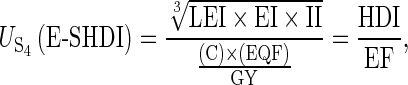 |
6 |
where LEI is the life expectancy index, EI is the education index, II is the income index (see UNDP (2013) and HDN (2013) for details of these indices), while C is the consumption, EQF is the equivalence factor, and GY is the global yield (see Wackernagel and Rees (1997) for details of these parameters).
Kai et al. (1998) proposed a sustainable HDI (SHDI) by integrating HDI with the concept of total material requirement (TMR), which is derived from the material flow accounting method. SHDI has been used and compared with the HDI (Hammer and Hinterberger 2003). Recently, Ture (2013) argued and illustrated that EF can be used as a proxy measure for TMR, hence Eq. (6). In the case of Baguio City, EF was considered as one of the indicators under the environmental component (Table 2). This is in order to take into account the potential external environmental impact, called leakage effect (Mayer 2008; Mori and Christodoulou 2012), of Baguio’s rapid urbanization.
As the EF of Baguio City was not yet known, Eq. (7) (Sutton et al. 2009) was used to estimate the EF values. Two sets of data were needed in the calculation, i.e., population and impervious surface area (ISA). For the population, the data for the 1990, 2000, and 2010 census dates (Fig. 2) were used. For the ISA, the remote sensing derived data for the years 1988, 1998, and 2009 (Estoque and Murayama 2011) were used, with the assumption that these were the most reliable data at the time of the study. Since there were mismatches on the dates between the two sets of data, one set had to be adjusted through extrapolation from the available data (in this case, the population). The city’s EF for 2020 were also projected by: (1) projecting the ISA for 2020 (ISAt) based on the 1988, 1998, and 2009 ISA data using Eq. (8); and (2) extrapolating the population for 2020 using three sets of APGR (see Fig. 2), also by following the logic of Eq. (8).
 |
7 |
where EF is the ecological footprint expressed as global hectare person−1 (GHA person−1); and x is the impervious surface area (m2) person−1 (ISA person−1) (Sutton et al. 2009).
 |
8 |
where ISAo is the impervious surface area of the base year of the projection (i.e., 2009); i is the average rate between the annual ISA expansion rate for 1988–1998 (x1) and 1998–2009 (x2), where x1 and x2 were individually determined 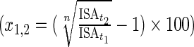 ; and n is the number of years between the base year and end year of the projection.
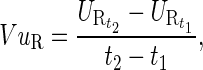
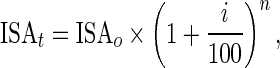
Measuring the Velocity of Urban Sustainability (VuS)
The VuS defines the rate and direction of change in urban sustainability. Equation (9) was used to calculate Baguio City’s VuS (i.e.,  ,
,  , and
, and  ) based on the environmental (
 ), social (
 ) and economic (
 ) components. The same equation was used to calculate the city’s VuS (i.e.,
  ) under the four various perspectives (
 ).
).
 |
9 |
where  and
and  represent the sustainability indices (for each component and perspective) at time t1 and t2, respectively.
Examining the Relationship Between VuR and VuS
The relationship between urbanization and sustainability defines the state and direction of the urbanization process in a particular area: in this case, Baguio City. This relationship can be clarified through the evaluation of the sustainability of urbanization using both the velocity of urbanization (VuR) and velocity of urban sustainability (VuS).
This study adopted the methodology proposed by Shen et al. (2012), i.e., the VuR–VuS coordinate, or Cartesian plane (Fig. 3), which was also applied recently by Liu et al. (2013). The plane is divided into four quadrants (Fig. 3). In quadrant I,  and
and  , where
  indicates urbanization growth, while
  suggests improvement of urban sustainability. Thus, quadrant I depicts a sustainable urbanization. In quadrant II,
  and
and  . This relationship denotes that although there is a counter-urbanization (
 ), the practice is considered sustainable (
 ). In this context, counter-urbanization may be necessary in order to improve urban sustainability. An example of this phenomenon is when socio-economic and ecological problems are alleviated or solved through an outward movement of urban people (decongestion) or a decrease in population growth (by birth or migration). In quadrant III,
  and
and  . This relationship denotes the process of counter-urbanization and a decline of urban sustainability during the urbanization process. In quadrant IV,
  and
and  . This relationship shows urbanization growth, but urban sustainability is declining.
Fig. 3.

The Vu R–Vu S Cartesian plane for evaluating sustainability of urbanization. Source adapted from Shen et al. (2012)
Results
Velocity of Urbanization (VuR) in Baguio City
The results of the VuR measurement show that both  and
and  had a positive velocity (
 and
and  ), suggesting that the urbanization of Baguio City has been accelerating (Table 4a). The positive value of
  shows that the relative proportion of the population of Baguio City to the population of CAR (
 ) in 2010 was higher than in 2000, indicating that Baguio City’s population growth within this period was faster than the whole region. For
  , its positive value was due to the substantial increase in the extent of impervious surface area of Baguio City (
 ) from 2000 and 2010. Between
  and
and  , however,
  had a much higher
  (Table 4a). This suggests that the velocity of urbanization of Baguio City was faster if the extent of impervious surface area is used as an indicator than if ratio of urban population is used. The relationship between the APGR and per capita land consumption can help explain this trend. That is, although APGR was much lower during the 2000–2010 period than during the preceding period (Fig. 2), the per capita land consumption in Baguio City during the 2000–2010 period was slightly higher than during the preceding period (Table S1). Nevertheless, both indicators are useful as they both reflect the actual situation on the ground. They are independent from each other; for instance, it does not necessarily mean that if population growth was higher, the expansion of impervious surface area was also faster, and vice versa.
Table 4.
The Vu R and Vu S and their components
| 2000 | 2010 | Velocity | ||
|---|---|---|---|---|
| a. Urbanization rate | ||||
Baguio–CAR population ratio ( ) ) |
0.1848 | 0.1971 |

|
0.0012 |
Extent of impervious surface area in Baguio City ( ) ) |
0.3431 | 0.5192 |

|
0.0160 |
| b. Component sustainability index | ||||
Environmental ( ) ) |
0.5124 | 0.2200 |

|
−0.0294 |
Social ( ) ) |
0.6302 | 0.7138 |

|
0.0084 |
Economic ( ) ) |
0.4091 | 0.7856 |

|
0.0377 |
| c. Urban sustainability index | ||||
Perspective 1 ( ) ) |
0.5172 | 0.5731 |

|
0.0056 |
Perspective 2 ( ) ) |
0.5012 | 0.6227 |

|
0.0121 |
Perspective 3 ( ) ) |
0.5219 | 0.5095 |

|
−0.0012 |
Perspective 4 ( ) ) |
0.3494 | 0.3425 |

|
−0.0007 |
Velocity of Urban Sustainability (VuS) in Baguio City
The results show that both the  and
and  of Baguio City were positive, indicating that the sustainability of the social and economic components improved from 2000 to 2010 (Table 4b). Based on the sustainability index scale in Table 3, the sustainability index of the social component (
 ) in 2000 was already “high.” This was largely due to the HDI values for the LEI and EI indices of the province of Benguet where Baguio City is located, which were relatively high during this period. In 1997, Benguet was ranked first in EI and seventh in LEI in the entire country (HDN 2013). In 2010, the
  of Baguio City increased, and this was again largely attributed to the improvement of the HDI components. In 2009, Benguet was ranked second for both EI and LEI. The increase in Baguio’s
  was not however enough for its “high” sustainability to improve to “very high” sustainability. Meanwhile, the sustainability of Baguio’s economic component (
 ) in 2000 was only “medium,” but this improved to “high” sustainability in 2010 (Table 4b). The increase in Baguio’s
  was due to the improvement of the HDI’s II and internal revenue allotment, in addition to the decrease on the incidence of poor families. In 1997, Benguet’s II was ranked fourth, and in 2009, it was ranked first in the entire country. In 2009, Benguet was also ranked first in the country in terms of the overall HDI (HDN 2013). In contrast, the results show that the
  of Baguio City was negative, indicating that the sustainability of the environmental component degraded from 2000 to 2010 (Table 4b). The sustainability of Baguio’s environmental component (
 ) in 2000 was “medium,” but this declined to “low” sustainability in 2010. The decline in Baguio’s
  was due to the decrease in the ecosystem service value (ESV) and human-to-ESV ratio, coupled with the increase of EF.
The results also show that both the  and
and  were positive, indicating an improvement in Baguio’s urban sustainability if it was to be measured from an equal weight perspective (of the TBLS components) and a pro-economic perspective, respectively (Table 4c). In 2000, Baguio’s urban sustainability (
 ) was “high.” This was maintained up to 2010 as the increase was not enough for the sustainability level to improve to “high” sustainability. Nevertheless, the increase in the city’s
  was due to the improvement in the
  and
and  from 2000 to 2010. Based on
  , the city’s urban sustainability in 2000 was “medium,” but this improved to “high” sustainability in 2010 (Table 4c). This was due to higher relative weight given to the economic component (
 ), which also demonstrated an improvement from 2000 to 2010.
In contrast, the results show that  was negative, indicating that the urban sustainability of Baguio City had been declining if it was to be assessed from a pro-environment perspective (Table 4c). The decline in the city’s
  was due to the steep decline of the environmental component (
 ), which had also been given much higher relative weight. Nevertheless, the city’s “medium”
  was maintained up to 2010, despite the decrease in the value. Furthermore, the results also show that
  was negative, indicating that from a pro-E-SHDI perspective the urban sustainability of Baguio City had also been declining (Table 4c).
  , however, had a relatively lower decline compared with
  . Compared with the other three measurements (
 ,
,  , and
, and  ),
),  values were much lower, which also have a sustainability description of “low” in 2000 and 2010. This was due to relatively high values of the EF, a sole indicator of the environmental component, in this iteration as a proxy measure for ecological demand. The decrease in the
  values from 2000 to 2010 indicates that the increase in the HDI was relatively lower than the increase in the EF.
Relationship Between VuR and VuS of Baguio City
Figure 4 presents the evaluation of Baguio City’s urbanization process in the context of sustainability based on the two velocities of urbanization ( and
and  ), and (a) the three velocities of US based on the environmental, social and economic components (
 ,
,  , and
, and  ); and (b) the four velocities of US based on the four perspectives (
 and
and  ). Based on the VuR–VuS Cartesian plane (Fig. 3), the velocities of urbanization and urban sustainability for the individual TBLS components (Fig. 4a) and the four perspectives (Fig. 4b) are found in quadrants I (sustainable urbanization) and IV (unsustainable urbanization).
Fig. 4.

Comparison of the sustainability of urbanization based on the two velocities of urbanization ( and
and  ), and (a) the three velocities of urban sustainability of the environmental, social, and economic components (
 ,
,  , and
, and  ); and (b) the four velocities of urban sustainability based on the four various perspectives (
 )
)
In particular, Fig. 4a shows that the  and
and  were allocated in quadrant I, while the
  was allocated in quadrant IV. This indicates that the urbanization process of Baguio City was sustainable based on the social and economic components, but unsustainable based on the environmental component. Figure 4b shows that Baguio’s urbanization process was sustainable based on an equal weight perspective (of the TBLS components) and a pro-economic perspective (
 and
and  ), but unsustainable based on the environmental and E-SHDI perspectives (
 and
and  ).
).
Human Ecological Footprint (EF) in Baguio City
Using the estimated values of ISA person−1 as inputted in Eq. (7), the resulting estimates for EF expressed in terms of GHA person−1 was 1.41 in 1988, 2.06 in 1998, and 2.48 in 2009 (Table S1). In terms of the future projections for 2020, at the same projected quantity of ISA, the EF under a much lower projected population (with much higher per capita land consumption) will have a much higher EF, and vice versa.
The increasing trend of the EF of Baguio City indicates that the potential external environmental impact (leakage effect) of its urbanization has been increasing. For comparison purposes, the EF of the Philippines in 2008 was 0.98, while its total biocapacity was only 0.62 GHA person−1 (WWF 2012). In the same year, the world’s EF was 2.70, while the world’s biocapacity was only 1.78 GHA person−1. Thus, the estimated 2009 EF of Baguio City is far higher than the country’s 2008 EF and biocapacity, and the world’s 2008 biocapacity. If the current urban development trend continues, i.e., at the average expansion rate of impervious surface area (Table S1) and P3 APGR (Fig. 2), the EF of Baguio City in 2020 will greatly surpass both the Philippines’ and world’s current biocapacities (Table S1).
Discussion
Proper selection of indicators is one of the critical challenges in urban sustainability assessment. Indicators might not be exactly the same across different cases, but what is important in the selection of indicators is that an indicator should be measurable over space and time and more importantly, has relevance to policy making and is usable in decision making (Alberti 1996; Astleithner et al. 2004). In this study, though there might be other indicators that were not included, the indicators used have relevance to policy and decision making. Moreover, they were able to capture the overall patterns of the three components of TBLS; patterns that are associated with the landscape changes and urbanization process of Baguio City, depicting the actual situation on the ground.
Highly connected with the selection of indicators is the issue on the sources of reliable data. At the country, regional and global levels, data for some important indicators, e.g., HDI and EF, are readily available (www.footprintnetwork.org; www.hdn.org.ph; www.undp.org; www.worldbank.org). Their availability helps facilitate a number of studies at these levels (e.g., Hammer and Hinterberger 2003; Siche et al. 2008; Sutton et al. 2009; Ture 2013). While there might be a much lesser concern on the availability of data in the developed countries, there is a much greater concern in the developing countries, especially at the local level. Consequently, some important data have to be derived from other studies using various techniques, as in the case of Baguio City. In cases where data are available, temporal inconsistency is another problem that deters the usability of such data for change detection analysis, which is vital for sustainability assessment. This issue on temporal inconsistency was also experienced in the case of Baguio City, which resulted in the exclusion of some other potentially relevant, more specific indicators like water consumption rate, waste generation rate, injury rate and public transport services (Zhang 2002; van Dijk and Zhang 2005; Scipioni et al. 2009; Shen et al. 2011), including fire incidence and annual per capita savings. Thus, if more specific indicators are to be used, there is a need to promote data awareness/consciousness, not only at the national level, but also at the local level.
The method for measuring US is another important issue. Several approaches for this purpose have been proposed in the literature (see Singh et al. 2009; Shen et al. 2011; Mori and Christodoulou 2012). In recent studies, Ture (2013) was able to calculate new rankings of countries based on the concept of E-SHDI (using the HDI and EF), while Liu et al. (2013) were able to measure the sustainability of the coastal Liaoning area in China, also by using HDI and EF. In the case of Baguio City, HDI and EF were also used, but in combination with other indicators. HDI considers only three socio-economic indicators, thus it does not capture all facets of social and economic components (e.g., crime rate), and so does the EF in the case of the environmental component (see van den Bergh and Verbruggen 1999; van Kooten and Bulte 2000; Fiala 2008; Nourry 2008). In this study, EF was included mainly to estimate and monitor the potential external environmental impact or leakage effect of the urbanization of Baguio City. The actual degradation of the natural environment of Baguio City has been determined using the changes in ESV as proxy measures. Interesting as they are, a full review of sustainability assessment approaches was not tackled in this article. However, the reader is referred to Singh et al. (2009), Shen et al. (2011), and Mori and Christodoulou (2012) for more examples and reviews.
This study estimated the EF of Baguio City as a proxy measure for leakage effect and integrated it with the environmental component of the TBLS. The integration of EF in the measurement of urban sustainability stresses the need to take into consideration not only internal, but also external environmental impact when evaluating Baguio’s urban sustainability. This is essential because the effects of Baguio’s urban systems on the region’s natural capital and ecosystem services go beyond the city’s urban boundaries. A city may appear sustainable owing to the inflows of the needed resources from other areas, but the continuous depletion of resources in those other areas might lead to their own “unsustainability” (Mayer 2008). While Baguio focuses on economic development within its jurisdiction, it also depends on other areas for its imports of ecosystem goods (supply of resources and food) and exports of environmental impact (disposition of waste, emission of pollutants and indirect usage of ecosystem services). Therefore, Baguio City’s dependence on other areas and consequent potential leakage effects also need to be considered when planning for its sustainable development.
This study shows that UR and VuR can vary depending on what or which indicators are used in the assessment. The use of the extent of impervious surface area as an indicator, in addition to the proportion of urban population, adds to the existing approaches in measuring rate and velocity of urbanization. The proposed indicator takes advantage of the continuous advancement of remote sensing technologies, which enables rapid mapping and change detection analysis of impervious surface areas. This study also shows that US and VuS can vary depending on or from which perspective sustainability is measured. Nonetheless, it is important that the different objectives, interests and perspectives of the varying “actors” in a coupled human–environment system are represented, explored, analyzed and taken into consideration in any sustainability assessment. This study might be one of the few, if not the first, to measure sustainability in a single case study area based upon various perspectives and techniques, especially in a hill station that really needs ecologically sustainable economic development. This type of measurement is useful, considering that a hill station-based urban ecosystem has arguably a more complex social–ecological or human–environment system that requires inter-disciplinary, multidimensional approaches.
The sustainability assessment for Baguio City has been very challenging. There are some caveats that need to be considered whenever the results are to be used: (1) temporal inconsistencies of the data—some of the data (indicators) used do not fall exactly on the period considered; (2) the estimation of the EF was based on a proxy measure; and (3) the data collected from other studies (see Tables 2 and S1) also have some limitations. These limitations are mostly data-related, so the increasing availability of data might help address these limitations in future studies. As this study has used Baguio City’s major indicators of sustainability, it can still provide valuable insights about the current state and direction of the urbanization process of this highly valued hill station, vital in planning for its future sustainable development.
Conclusions
Based on the empirical results and subsequent analyses, this study concludes that:
urbanization rate (UR) and velocity of urbanization (VuR) can vary depending on the indicators used. For Baguio City, however, although the UR based on urban population and extent of impervious surface area were not the same, their respective VuR have indicated that the city’s urbanization has accelerated;
the social (
 ) and economic (
 ) sustainability of Baguio City have improved, but its environmental (
 ) sustainability has declined; and
urban sustainability (US) and velocity of urban sustainability (VuS) can vary depending on or from which perspective they are measured. From an equal weight perspective (of the TBLS components) (
 ) and a pro-economic perspective (
 ), the results have indicated that the urbanization process of Baguio City has been moving toward a “sustainable urbanization.” However, from the environmental perspective (
 ) and E-SHDI perspective (
 ), the results have indicated that it has been moving toward an “unsustainable urbanization.”
These findings show an evident divergence between socio-economic growth and environmental sustainability in the case of Baguio City, and this poses critical challenges toward its sustainable urbanization. In the recent past, the environmental component has not received the attention it really deserves. Therefore, it is vital for the Philippine national and local government to reassess Baguio City’s carrying capacity. It is important that Baguio’s remaining natural resources should not be taxed beyond their limits so that the future quality of living condition in the city will not be compromised. There is a need to advance ecologically sustainable economic development in order for Baguio City to be able to promote an acceptable living standard in the future, and ensure the availability of natural resources, the life-support systems, not only for the present, but also for future generations.
The huge imbalance between the socio-economic and environmental components raises doubts on Baguio City’s overall sustainability. It is in this context that sustainability assessments/measurements based upon various perspectives must be considered in policy debates to help shed light on how to balance the dualistic nature of Baguio City’s urbanization. This study further concludes that:
the integration of velocity of urbanization (VuR) based on two different indicators and velocity of urban sustainability (VuS) under four various perspectives has provided a type of sustainability assessment that has never been attempted before; and
the framework implemented in this study allows different perspectives for exploratory analysis, and is able to integrate a measurement index that can take leakage effect into account.
The approach introduced in this study contributes to the field of sustainability science in particular, and to the advancement of coupled human–environment systems studies in general. This study also provides a basis for other sustainability assessments in the future. It can be reproduced in other hill stations of Southeast Asia, for example in Bogor (Indonesia), Dalat (Vietnam), and Pyin Oo Lwin (formerly Maymyo) (Myanmar). The same set of indicators can be used for these hill stations, and in case where data for the indicators used in this study are not available, the framework’s flexibility allows other indicators to be used. Comparative studies might help advance our understanding of the current state and future directions of the urbanization process in these areas in the context of sustainable development.
Electronic supplementary material
Acknowledgments
This study was supported by the Japan Society for the Promotion of Science (JSPS) under a grant for postdoctoral fellowship (ID No. P 13001). Any opinions, findings, conclusions or recommendations expressed in this paper are those of the authors and do not necessarily reflect those of the JSPS. The authors thank the anonymous reviewers for their valuable comments and suggestions.
Biographies
Ronald C. Estoque
is a postdoctoral fellow at the University of Tsukuba, Japan. His current research includes the sustainability assessment of the hill stations of Southeast Asia using various tools and techniques, including Geographic Information Science/Systems, Remote Sensing, and social–ecological system approaches.
Yuji Murayama
is a professor at the University of Tsukuba, Japan. His research interests focus on Geographic Information Science/Systems, spatial analysis, urban and transport geography.
Footnotes
The term ‘hill station’ is commonly used to refer to a town or city in the tropics founded by a Western colonial power during the nineteenth and early twentieth centuries. Most hill stations are sited in mountain regions at an altitude between 1000 and 2500 m above sea level, and thus enjoy relatively moderate temperatures than those recorded in the surrounding lowlands.
Tabuk, Kalinga is the region’s second city. It was first declared as such in 2007, second in 2009, and third in 2011. The first two declarations were both followed by a Supreme Court decision, reverting Tabuk back to the status of a municipality.
Contributor Information
Ronald C. Estoque, Phone: +81-29-853-4321, Email: rons2k@yahoo.co.uk
Yuji Murayama, Phone: +81-29-853-4211, Email: mura@geoenv.tsukuba.ac.jp.
References
- Alberti M. Measuring urban sustainability. Environmental Impact Assessment Review. 1996;16:381–424. doi: 10.1016/S0195-9255(96)00083-2. [DOI] [Google Scholar]
- Astleithner F, Hamedinger A, Holman N, Rydin Y. Institutions and Indicators—the discourse about indicators in the context of sustainability. Journal of Housing and the Built Environment. 2004;19:7–24. doi: 10.1023/B:JOHO.0000017704.49593.00. [DOI] [Google Scholar]
- Axelsson R, Angelstam P, Degerman E, Teitelbaum S, Andersson K, Elbakidze M, Drotz MK. Social and cultural sustainability: Criteria, indicators, verifier variables for measurement and maps for visualization to support planning. AMBIO. 2013;42:215–228. doi: 10.1007/s13280-012-0376-0. [DOI] [PMC free article] [PubMed] [Google Scholar]
- Banister D. Barriers to the implementation of urban sustainability. International Journal of Environment Pollution. 1998;10:65–83. doi: 10.1504/IJEP.1998.002231. [DOI] [Google Scholar]
- Bloom DE, Canning D, Fink G. Urbanization and the wealth of nations. Science. 2008;319:772–775. doi: 10.1126/science.1153057. [DOI] [PubMed] [Google Scholar]
- Cariño JK. Feb. 23, 2009: The centennial of the Cariño Doctrine of native title. In: Gutierrez CB, Cariño JK, editors. The Baguio centennial yearbook. Baguio City: Heritage Promotions; 2009. pp. 58–62. [Google Scholar]
- Choguill CL. Toward sustainability of human settlements. Habitat International. 1996;20:v–viii. doi: 10.1016/0197-3975(96)81830-3. [DOI] [Google Scholar]
- Crossette B. The great hill stations of Asia. Boulder: Basic Books; 1999. [Google Scholar]
- Dahiya B. Cities in Asia, 2012: Demographics, economics, poverty, environment and governance. Cities. 2012;29:S44–S61. doi: 10.1016/j.cities.2012.06.013. [DOI] [Google Scholar]
- Drakakis-Smith D. Third world cities. London: Routledge; 2000. [Google Scholar]
- Elkington J. Cannibals with forks: The triple bottom line of the 21st century business. Oxford: Capstone; 1997. [Google Scholar]
- Estoque RC, Murayama Y. Spatio-temporal urban land use/cover change analysis in a hill station: The case of Baguio City, Philippines. Procedia: Social and Behavioral Sciences. 2011;21:326–335. [Google Scholar]
- Estoque RC, Murayama Y. Examining the potential impact of land use/cover changes on the ecosystem services of Baguio city, the Philippines: A scenario-based analysis. Applied Geography. 2012;35:316–326. doi: 10.1016/j.apgeog.2012.08.006. [DOI] [Google Scholar]
- Estoque RC, Murayama Y. City profile: Baguio. Cities. 2013;30:240–251. doi: 10.1016/j.cities.2011.05.002. [DOI] [Google Scholar]
- Estoque RC, Murayama Y. Landscape pattern and ecosystem service value changes: Implications for environmental sustainability planning for the rapidly urbanizing summer capital of the Philippines. Landscape and Urban Planning. 2013;116:60–72. doi: 10.1016/j.landurbplan.2013.04.008. [DOI] [Google Scholar]
- Fiala N. Measuring sustainability: Why the ecological footprint is bad economics and bad environmental science. Ecological Economics. 2008;67:519–525. doi: 10.1016/j.ecolecon.2008.07.023. [DOI] [Google Scholar]
- Fischer J, Manning AD, Steffen W, Rose DB, Daniell K, Felton A, Garnett S, Gilna B, et al. Mind the sustainability gap. Trends in Ecology & Evolution. 2007;22:621–624. doi: 10.1016/j.tree.2007.08.016. [DOI] [PubMed] [Google Scholar]
- Glorioso RS. A bioregion in jeopardy: The strategic challenge of amenity migration in Baguio, the Philippines. In: Moss LAG, editor. The amenity migrants: Seeking and sustaining mountains and their cultures. Oxfordshire: CABI; 2006. pp. 261–277. [Google Scholar]
- Grimm M. A Human Development Index by income groups. World Development. 2008;36:2527–2546. doi: 10.1016/j.worlddev.2007.12.001. [DOI] [Google Scholar]
- Grimm NB, Faeth SH, Golubiewski NE, Redman CL, Wu JG, Bai XM, Briggs JM. Global change and the ecology of cities. Science. 2008;319:756–760. doi: 10.1126/science.1150195. [DOI] [PubMed] [Google Scholar]
- Hammer, M., and F. Hinterberger. 2003. A sustainable human development index, a suggestion for greening the UN’s index of social and economic welfare. Paper presented at: The ‘Quo vadis MFA?’ Workshop. October 2003, Wuppertal Institute, Germany.
- Hardoy JE, Mitlin D, Satterthwaite D. Environmental problems in third world cities. London: Earthscan; 1992. [Google Scholar]
- HDN (Human Development Network). 2013. 2012/2013 Philippine human development report. Manila: HDN-UNDP.
- Henderson, J.V., and H.G. Wang. 2004. Urbanization and city growth. Retrieved 27 September 2013, from http://www.econ.brown.edu/faculty/henderson/papers/UrbanizationandCityGrowth0804.pdf.
- Kai, D., F. Hinterberger, H. Schutz, and E.K. Seifert. 1998. Sustainable human development index (SHDI): A suggestion for ‘greening’ the UN’s indicator. Mimeo. Wuppertal (Germany): Wuppertal Institute for Climate, Environment and Energy.
- Liu, S., P. Zhang, X. Jiang, and K. Lo. 2013. Measuring sustainable urbanization in China: A case study of the coastal Liaoning area. Sustainability Science 8: 585–594.
- MA (Millennium Ecosystem Assessment) Ecosystems and human well-being: Current state and trends: Findings of the Condition and Trends Working Group. Washington, DC: Island Press; 2005. [Google Scholar]
- Mayer AL. Strengths and weaknesses of common sustainability indices for multidimensional systems. Environment International. 2008;34:277–291. doi: 10.1016/j.envint.2007.09.004. [DOI] [PubMed] [Google Scholar]
- Moldan B, Janouskova S, Hak T. How to understand and measure environmental sustainability: indicators and targets. Ecological Indicators. 2012;17:4–13. doi: 10.1016/j.ecolind.2011.04.033. [DOI] [Google Scholar]
- Mori K, Christodoulou A. Review of sustainability indices and indicators: Towards a new City Sustainability Index (CSI) Environmental Impact Assessment Review. 2012;32:94–106. doi: 10.1016/j.eiar.2011.06.001. [DOI] [Google Scholar]
- Munier N. Introduction to sustainability: Road to a better future. Dordrecht: Springer; 2005. [Google Scholar]
- Newman P, Jennings I. Cities as sustainable ecosystems: Principles and practices. Washington, DC: Island Press; 2008. [Google Scholar]
- Northam RM. Urban geography. New York: Wiley; 1975. [Google Scholar]
- Nourry M. Measuring sustainable development: Some empirical evidence for France from eight alternative indicators. Ecological Economics. 2008;67:441–456. doi: 10.1016/j.ecolecon.2007.12.019. [DOI] [Google Scholar]
- NSO (National Statistics Office). 2003. 2000 Census of population and housing (Baguio city): Report No. 2-11 N, Vol. 1—Demographic and housing characteristics. Manila: NSO.
- NSO (National Statistics Office). 2012. 2010 Census of population and housing reveals the Philippine population at 92.34 million (press release number 2012-27). Manila: NSO.
- PCSD (President’s Council on Sustainable Development, USA). 1997. The president’s council on sustainable development task force report. Washington, DC: PCSD.
- Pope J, Annandale D, Morrison-Saunders A. Conceptualising sustainability assessment. Environmental Impact Assessment Review. 2004;24:595–616. doi: 10.1016/j.eiar.2004.03.001. [DOI] [Google Scholar]
- Rees WE. Ecological footprints and appropriated carrying capacity: What urban economics leaves out. Environment and Urbanization. 1992;4:121–130. doi: 10.1177/095624789200400212. [DOI] [Google Scholar]
- Rees WE, Wackernagel M. Urban ecological footprints: Why cities cannot be sustainable and why they are a key to sustainability. Environmental Impact Assessment Review. 1996;16:223–248. doi: 10.1016/S0195-9255(96)00022-4. [DOI] [Google Scholar]
- Rezvani MR, Mansourian H, Sattari MH. Evaluating quality of life in urban areas (Case study: Noorabad City, Iran) Social Indicators Research. 2013;112:203–220. doi: 10.1007/s11205-012-0048-2. [DOI] [Google Scholar]
- Roy M. Planning for sustainable urbanisation in fast growing cities: Mitigation and adaptation issues addressed in Dhaka, Bangladesh. Habitat International. 2009;33:276–286. doi: 10.1016/j.habitatint.2008.10.022. [DOI] [Google Scholar]
- Saldivar-Sali A, Einstein HH. A landslide risk rating system for Baguio, Philippines. Engineering Geology. 2007;91:85–99. doi: 10.1016/j.enggeo.2006.11.006. [DOI] [Google Scholar]
- SCI (Sustainable Cities International) Indicators for sustainability: How cities are monitoring and evaluating their success. Vancouver: SCI; 2012. [Google Scholar]
- Scipioni A, Mazzi A, Mason M, Manzardo A. The dashboard of sustainability to measure the local urban sustainable development: The case study of Padua Municipality. Ecological Indicators. 2009;9:364–380. doi: 10.1016/j.ecolind.2008.05.002. [DOI] [Google Scholar]
- Seto KC, Fragkias M, Güneralp B, Reilly MK. A meta-analysis of global urban land expansion. PLoS ONE. 2011;6:e23777. doi: 10.1371/journal.pone.0023777. [DOI] [PMC free article] [PubMed] [Google Scholar]
- Shen LY, Ochoa JJ, Shah MN, Zhang X. The application of urban sustainability indicators: a comparison between various practices. Habitat International. 2011;35:17–29. doi: 10.1016/j.habitatint.2010.03.006. [DOI] [Google Scholar]
- Shen LY, Peng Y, Zhang XL, Wu YZ. An alternative model for evaluating sustainable urbanization. Cities. 2012;29:32–39. doi: 10.1016/j.cities.2011.06.008. [DOI] [Google Scholar]
- Siche JR, Agostinho F, Ortega E, Romeiro A. Sustainability of nations by indices: Comparative study between environmental index, ecological footprint and the emergy performance indices. Ecological Economics. 2008;66:628–637. doi: 10.1016/j.ecolecon.2007.10.023. [DOI] [Google Scholar]
- Singh RK, Murty HR, Gupta SK, Dikshit AK. An overview of sustainability assessment methodologies. Ecological Indicators. 2009;9:189–212. doi: 10.1016/j.ecolind.2008.05.011. [DOI] [Google Scholar]
- Spiekermann K, Wegener M. Modelling urban sustainability. International Journal of Urban Sciences. 2003;7:47–64. doi: 10.1080/12265934.2003.9693522. [DOI] [Google Scholar]
- Sutton PC, Anderson SJ, Elvidge CD, Tuttle BT, Ghosh T. Paving the planet: Impervious surface as proxy measure of the human ecological footprint. Progress in Physical Geography. 2009;33:510–527. doi: 10.1177/0309133309346649. [DOI] [Google Scholar]
- Ture C. A methodology to analyse the relations of ecological footprint corresponding with human development index: Eco-sustainable human development index. International Journal of Sustainable Development & World Ecology. 2013;20:9–19. doi: 10.1080/13504509.2012.751562. [DOI] [Google Scholar]
- UN (United Nations) World urbanization prospects, the 2009 revision. New York: UN; 2010. [Google Scholar]
- UN (United Nations) Human development report 2011. New York: UN; 2011. [Google Scholar]
- UNDP (United Nations Development Programme) Human development report: The rise of the south human progress in a diverse world—technical notes. New York: UNDP; 2013. [Google Scholar]
- UN-Habitat/DFID (United Nations Human Settlements Programme/Department for International Development) Sustainable urbanisation: Achieving agenda 21. Nairobi: UN-Habitat/DFID; 2002. [Google Scholar]
- van den Bergh JCJM, Verbruggen H. Spatial sustainability, trade and indicators: An evaluation of the ‘ecological footprint’. Ecological Economics. 1999;29:61–72. doi: 10.1016/S0921-8009(99)00032-4. [DOI] [Google Scholar]
- van Dijk MP, Zhang MS. Sustainability indices as a tool for urban managers: Evidence from four medium-sized Chinese cities. Environmental Impact Assessment Review. 2005;25:667–688. doi: 10.1016/j.eiar.2004.10.001. [DOI] [Google Scholar]
- van Kooten GC, Bulte EH. The ecological footprint: Useful science or politics? Ecological Economics. 2000;32:385–389. doi: 10.1016/S0921-8009(99)00160-3. [DOI] [Google Scholar]
- Wackernagel M, Rees WE. Perceptual and structural barriers to investing in natural capital: Economics from an ecological footprint perspective. Ecological Economics. 1997;20:3–24. doi: 10.1016/S0921-8009(96)00077-8. [DOI] [Google Scholar]
- WCED (World Commission on Environment and Development) Our common future. New York: Oxford University Press; 1987. [Google Scholar]
- Wu J. Urban sustainability: An inevitable goal of landscape research. Landscape Ecology. 2010;25:1–4. doi: 10.1007/s10980-009-9444-7. [DOI] [Google Scholar]
- WWF (World Wide Fund For Nature) Living planet report 2012: Biodiversity, biocapacity and better choices. Gland: WWF; 2012. [Google Scholar]
- Zhang, M. 2002. Measuring urban sustainability in China. PhD Thesis. Rotterdam, the Netherlands: Erasmus University.
- Zhang KH, Song S. Rural-urban migration and urbanization in China: Evidence from time-series and cross-section analyses. China Economic Review. 2003;14:386–400. doi: 10.1016/j.chieco.2003.09.018. [DOI] [Google Scholar]
Associated Data
This section collects any data citations, data availability statements, or supplementary materials included in this article.