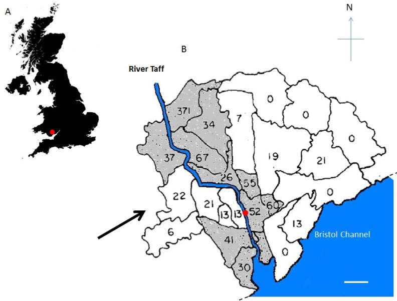
Figure 1.
Relationship between disease clusters and prevailing wind in Cardiff, Wales, United Kingdom. (A) Location of the city of Cardiff within the UK (red dot); (B) distribution of the 11 electoral wards (shown with black boundaries) in the city of Cardiff that were shown previously (53, 54) to have a highly significant (p < 0.001) increase in the incidence of Crohn’s disease. The wards with the high incidence of Crohn’s disease are seen to lie along the River Taff (blue), which flows into the Bristol Channel (blue), with the exception of a gap in the centre stretch of the windward right bank of the river (facing downstream). This gap directly faces a valley between hills to the north and south, which is open to the prevailing southwesterly winds (black arrow; with permission from [19]). The dashed line represents the continuation of the coast. The white bar represents 3 km. The red dot represents the sampling site.

