

Abstract
In recent years, the Arctic sea ice cover has undergone a precipitous decline in summer extent. The sea ice mass balance integrates heat and provides insight on atmospheric and oceanic forcing. The amount of surface melt and bottom melt that occurs during the summer melt season was measured at 41 sites over the time period 1957 to 2014. There are large regional and temporal variations in both surface and bottom melting. Combined surface and bottom melt ranged from 16 to 294 cm, with a mean of 101 cm. The mean ice equivalent surface melt was 48 cm and the mean bottom melt was 53 cm. On average, surface melting decreases moving northward from the Beaufort Sea towards the North Pole; however interannual differences in atmospheric forcing can overwhelm the influence of latitude. Substantial increases in bottom melting are a major contributor to ice losses in the Beaufort Sea, due to decreases in ice concentration. In the central Arctic, surface and bottom melting demonstrate interannual variability, but show no strong temporal trends from 2000 to 2014. This suggests that under current conditions, summer melting in the central Arctic is not large enough to completely remove the sea ice cover.
Keywords: Arctic sea ice, ice melt, surface melting, bottom melting, sea ice loss
1. Introduction
The Arctic sea ice cover is in decline. Satellite observations show a large reduction in summer ice extent [1–4]. The 2012 summer minimum ice extent was the lowest of the satellite record (starting in 1979), 2013 was the fifth lowest and 2014 the sixth lowest. Observations also indicate a reduction in ice thickness in some regions of the Arctic [5–10]. The age of the ice is also changing, with less multiyear ice and more seasonal ice [11–13].
Many factors have been identified as contributing to this decline [1], including warming surface air temperature trends [14,15], changes in atmospheric circulation and ice motion [12,16,17], preconditioning of the ice [18,19], shifts in cloud cover [20–22], advected ocean heat [23–26] and the ice albedo feedback [27–29]. Climate models project that these changes may accelerate in the future [30], possibly resulting in a transition to ice-free summers later this century [31,32].
Remotely sensed observations of sea ice extent, thickness and age provide the evidence of an Arctic sea ice cover that is smaller in extent, thinner and younger. While these observations show what is happening to the ice cover, they provide limited insight into how it is happening. For example, remote observations cannot distinguish whether changes in winter ice growth or summer melt are occurring on the ice surface or bottom. Sea ice growth, surface melt and bottom melt are directly related to forcing from the atmosphere and ocean. Therefore, information on changes in forcing can be gleaned from regional and temporal variations in ice surface and bottom melt. Previous ice mass balance studies have defined the annual cycle of ice growth and melt [33,34], assessed the impact of solar radiation on surface and bottom melt [28,29], examined a time series of mass balance near the North Pole [35] and investigated changes in the snow cover on sea ice [36]. Here, we use an ensemble of mass balance results from 41 sites spanning the western Arctic and including years from 1957 to 2014, to explore the regional and temporal variability of sea ice mass balance and forcing.
2. Approach
The local thermodynamic mass balance of sea ice comprises (i) changes in snow depth, (ii) changes in ice thickness, (iii) winter ice growth, (iv) summer surface melt, (v) summer bottom melt and (vi) changes in ice temperature [33]. Mass balance measurements have long been part of extended sea ice field campaigns [33,34,37]. The sea ice mass balance is also measured using autonomous buoys [38–40].
We compiled sea ice mass balance results made over an entire summer melt season from 41 distinct sites, including both manned camps and autonomous buoys, for the period 1957 to 2014. This dataset is a synthesis of previously published results from drifting stations [33,34,37] and autonomous buoys [27,28,35], as well as unpublished results from autonomous buoys (http://imb.erdc.dren.mil/). The summer season lasted from May to October, defined by the time period when melt generally began and ended, respectively. The location of the 41 sites on 15 July is shown in figure 1. All of these sites were located in undeformed, unponded ice. The sites are divided into three geographical groupings: Beaufort Sea (15 sites), Intermediate (13 sites) and North Pole (13 sites). Data at each of the sites include year, position on 15 July, maximum ice thickness and snow depth, ice equivalent snow melt, surface ice melt, total surface melt and bottom ice melt (table 1). Results are used to investigate the amount of surface and bottom melt, as well as regional and temporal variability in surface and bottom melting.
Figure 1.

Map showing the locations on 15 July of the 41 sea ice mass balance sites. Green designates Beaufort sites, blue is Intermediate and red is North Pole. The star denotes the position of the geographical North Pole, the coloured numbers denote how many sites in each category and the white portion represents the 1981–2010 median sea ice extent for July as determined by the National Snow and Ice Data Center. The figure was made using Google Earth. (Online version in colour.)
Table 1.
Summary of results for 41 sites of summer ice mass balance. Snow and ice units are centimetres.
| summer | 15 July latitude | 15 July longitude (neg=west) | maximum ice thickness | maximum snow depth | ice equivalent snow melt | surface ice melt | total surface melt | bottom ice melt |
|---|---|---|---|---|---|---|---|---|
| Beaufort | ||||||||
| 1959 | 77.00 | −163.00 | 290 | 28 | 10 | 38 | 48 | 11 |
| 1976 | 75.00 | −142.00 | 280 | 35 | 13 | 26 | 39 | 34 |
| 1994 | 75.00 | −142.00 | 265 | 30 | 11 | 67 | 78 | 25 |
| 1998 | 78.00 | −165.00 | 330 | 30 | 11 | 55 | 66 | 50 |
| 2006 | 74.64 | −134.34 | 380 | 5 | 2 | 59 | 61 | 80 |
| 2007 | 75.64 | −138.03 | 328 | 40 | 14 | 70 | 84 | 210 |
| 2007 | 75.58 | −157.91 | 273 | 5 | 2 | 74 | 76 | 62 |
| 2008 | 75.93 | −142.59 | 312 | 17 | 6 | 87 | 93 | 177 |
| 2013 | 74.09 | −138.97 | 228 | 24 | 9 | 62 | 71 | 74 |
| 2013 | 74.56 | −145.70 | 350 | 15 | 5 | 76 | 81 | 113 |
| 2014 | 77.19 | −156.40 | 172 | 48 | 17 | 30 | 47 | 40 |
| 2014 | 75.44 | −168.05 | 165 | 10 | 4 | 43 | 47 | 44 |
| 2014 | 74.31 | −150.41 | 196 | 27 | 10 | 53 | 63 | 156 |
| Intermediate | ||||||||
| 1957 | 82.00 | −165.00 | 300 | 39 | 14 | 17 | 31 | 24 |
| 1958 | 84.00 | −145.00 | 316 | 37 | 13 | 30 | 43 | 26 |
| 2006 | 87.09 | −82.89 | 310 | 15 | 5 | 25 | 30 | 10 |
| 2008 | 84.62 | −139.32 | 182 | 22 | 8 | 49 | 57 | 92 |
| 2008 | 80.91 | −119.93 | 307 | 17 | 6 | 50 | 56 | 55 |
| 2008 | 86.57 | −84.85 | 213 | 9 | 3 | 42 | 45 | 25 |
| 2008 | 86.14 | −63.06 | 249 | 40 | 14 | 20 | 34 | 12 |
| 2008 | 84.66 | 108.73 | 292 | 5 | 2 | 55 | 57 | 69 |
| 2012 | 83.88 | −103.80 | 260 | 22 | 8 | 50 | 58 | 20 |
| 2012 | 85.50 | −45.41 | 6 | 51 | 18 | 32 | 50 | 53 |
| 2013 | 81.68 | −124.24 | 225 | 16 | 6 | 0 | 6 | 10 |
| 2013 | 79.20 | −14.69 | 215 | 51 | 18 | 67 | 85 | 22 |
| 2013 | 82.61 | −62.38 | 349 | 8 | 3 | 61 | 64 | 48 |
| North Pole | ||||||||
| 2000 | 86.68 | 5.55 | 185 | 30 | 11 | 30 | 41 | 30 |
| 2002 | 85.93 | 32.79 | 255 | 31 | 11 | 15 | 26 | 28 |
| 2004 | 87.89 | 158.11 | 222 | 39 | 14 | 0 | 14 | 22 |
| 2004 | 85.85 | 68.26 | 227 | 33 | 12 | 15 | 27 | 11 |
| 2004 | 88.89 | 20.58 | 272 | 35 | 13 | 1 | 14 | 10 |
| 2004 | 87.83 | 52.03 | 211 | 27 | 10 | 19 | 29 | 40 |
| 2005 | 88.67 | −13.49 | 240 | 25 | 9 | 46 | 55 | 20 |
| 2007 | 86.27 | −3.76 | 215 | 22 | 8 | 23 | 31 | 65 |
| 2007 | 86.68 | 12.97 | 243 | 22 | 8 | 80 | 88 | 95 |
| 2007 | 88.00 | 51.33 | 223 | 15 | 5 | 50 | 55 | 15 |
| 2008 | 83.94 | 1.57 | 199 | 4 | 1 | 22 | 23 | 81 |
| 2010 | 88.10 | −10.89 | 177 | 36 | 13 | 2 | 15 | 45 |
| 2012 | 84.74 | 3.64 | 284 | 40 | 14 | 45 | 59 | 57 |
| 2013 | 87.61 | 16.51 | 175 | 35 | 13 | 0 | 13 | 75 |
| 2013 | 86.79 | −4.28 | 218 | 8 | 3 | 22 | 25 | 38 |
3. Results
Snow plays a complex role in the mass balance of sea ice. In winter, snow is a thermal insulator reducing ice growth. In spring, it is a highly reflecting surface reducing ice melt. Figure 2 displays the maximum snow depth at each of the mass balance sites. The maximum snow depth typically occurred in mid-May. Snow depths varied both regionally and temporally, with large differences from place to place and year to year. Overall, snow depths ranged from 5 to 50 cm, with a mean of 25 cm, a median of 27 cm and a standard deviation of 13 cm.
Figure 2.

Maximum snow depth for each of the 41 sites. Data are colour coded and grouped by region: Beaufort (green), Intermediate (blue) and North Pole (red). Within a group, data are sorted oldest to most recent. The numbers on the x-axis designate the year of the summer the measurements were made. (Online version in colour.)
The total amount of surface and bottom melt is presented in figure 3. The top panel shows total surface melt, including both snow melt and ice melt. Snow melt is represented by the ice equivalent snow melt (Si) using the expression
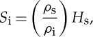 |
where Hs is the snow depth, ρs is the snow density set to 300 kg m−3 and ρi is the ice density set to 900 kg m−3. The overall mean total surface melt was 48 cm, the median was also 48 cm and the standard deviation was 23 cm. The snow cover completely melted at all 41 sites. However, at one Intermediate site (in 2013) and a few North Pole sites (in 2004, 2010 and 2013), there was very little surface ice melt. The total amount of surface melt ranged from 6 cm at an Intermediate site, during the summer of 2013, to 93 cm in the summer of 2008 in the Beaufort Sea.
Figure 3.

Total surface ice melt and bottom melt for each of the 41 sites. Total surface melt includes the ice equivalent snow melt (light colour) and the surface ice melt (dark colour). Data are colour coded and grouped by region: Beaufort (green), Intermediate (blue) and North Pole (red). Within a group, data are sorted oldest to most recent. The numbers on the x-axis designate the summer the measurements were made. (Online version in colour.)
Bottom melt exhibited more variability than surface melt ranging from 10 to 210 cm. The 210 cm bottom melt case occurred in the Beaufort Sea in the summer of 2007. Bottom melt for the 41 sites had a mean of 53 cm, a median of 40 cm and a standard deviation of 45 cm. The large difference between the mean and the median was due to four sites in the Beaufort Sea, where there was more than 1 m of bottom melt.
The overall mean of the combined surface and bottom melt is 101 cm, the median is 88 cm and the standard deviation is 61 cm. The smallest amount of combined melt observed was 16 cm, at an Intermediate site in 2013, and the largest amount was 294 cm, in the Beaufort Sea during the summer of 2007. In general, there is more melt in the Beaufort Sea, with seven of the 10 largest melt amounts occurring at Beaufort sites.
We used the mass balance dataset to explore relationships between surface and bottom melt and with other parameters such as year, melt season duration, latitude, seasonal change in ice extent and atmospheric pressure indices (such as the Arctic Oscillation Index). Most comparisons showed very little correlation. Somewhat surprisingly, there does not appear to be a strong relationship between surface and bottom melt (figure 4a) and the coefficient of determination (R2) is 0.27. While the mean values of surface and bottom melt were similar, at a given site there could be considerable variability between the two. Of the 41 cases, only seven have roughly equal surface and bottom melt amounts (within 10%). Fifteen sites have more bottom than surface melt, whereas 19 have more surface melt than bottom. The variability is large. For example, for surface melt of about 20 cm, bottom melt varies from 10 to 85 cm. This result demonstrates that there is not a strong general connection between the atmospheric and oceanic forcings that control surface and bottom melt.
Figure 4.

Scattergrams of (a) total surface melt versus total bottom melt and (b) total surface melt versus latitude. Each of the three regions has its own symbol and colour. (Online version in colour.)
Total surface melt (snow plus ice) versus latitude is plotted in figure 4b. While there is a weak trend of decreasing surface melt moving northward, the results show considerable scatter and R2 is only 0.27. For example, the variability of total surface melt is from 40 to 95 cm at a latitude of 75° N and from 10 to 60 cm at 88° N. This variability implies that there are interannual differences in atmospheric forcing that can overwhelm the influence of latitude.
One-to-one parameter comparisons, like those in figure 4, will intrinsically exhibit scatter due to the multiple factors that combine to determine the amount of surface melt and bottom melt. These factors include the duration of the melt season, summer snowfalls, cloudiness, local ice concentration, storms and ice motion. Unfortunately with only 41 sites, there is insufficient data to fully populate an extensive multivariate analysis that includes the above listed factors. However, we can explore relationships by averaging individual values of surface and bottom melt, and thereby smoothing some of the variability between individual sites and years.
Table 2 presents the mean, median, standard deviation, maximum and minimum for the three regions and for two time periods of pre-2000 and 2000–2014. The regional results are presented graphically in figure 5 as a box plot showing mean, median, standard deviation, maximum and minimum. An analysis of variance shows that there is no significant difference in mean snow depth for the Beaufort (24 cm), Intermediate (26 cm) and North Pole (27 cm) regions. Surface melting shows a decrease in the mean, moving from the southernmost site in the Beaufort (66 cm), to the Intermediate (42 cm), and finally to the North Pole (34 cm). The decrease in surface melt as a function of latitude is much clearer for the mean values than it is for the individual points plotted in figure 4b. T-tests comparing surface melt in the different regions show the Beaufort sites had statistically significant (p<0.01) more surface melting than either the Intermediate or North Pole sites. Note that p represents the probability that there is no difference between the two means.
Table 2.
Summary of mean, median, standard deviation, maximum and minimum for various parameters for the three regions and two time periods. The number in parentheses is the number of cases in the group. The units are centimetres.
| maximum ice thickness | maximum snow depth | ice equivalent snow melt | surface ice melt | surface ice plus snow melt | bottom ice melt | |
|---|---|---|---|---|---|---|
| all locations (41) | ||||||
| mean | 251 | 26 | 9 | 39 | 48 | 53 |
| median | 243 | 27 | 10 | 42 | 48 | 40 |
| s.d. | 56 | 13 | 5 | 24 | 23 | 45 |
| maximum | 380 | 51 | 18 | 87 | 93 | 210 |
| minimum | 165 | 4 | 1 | 0 | 6 | 10 |
| Beaufort (13) | ||||||
| mean | 275 | 24 | 9 | 57 | 66 | 83 |
| median | 280 | 27 | 10 | 59 | 66 | 62 |
| s.d. | 68 | 13 | 5 | 19 | 17 | 63 |
| maximum | 380 | 48 | 17 | 87 | 93 | 210 |
| minimum | 165 | 5 | 2 | 26 | 39 | 11 |
| Intermediate (13) | ||||||
| mean | 248 | 26 | 9 | 38 | 47 | 36 |
| median | 260 | 22 | 8 | 42 | 50 | 25 |
| s.d. | 88 | 16 | 6 | 19 | 20 | 25 |
| maximum | 349 | 51 | 18 | 67 | 85 | 92 |
| minimum | 6 | 5 | 2 | 0 | 6 | 10 |
| North Pole (15) | ||||||
| mean | 223 | 27 | 10 | 25 | 34 | 42 |
| median | 222 | 30 | 11 | 22 | 27 | 38 |
| s.d. | 32 | 11 | 4 | 23 | 22 | 27 |
| maximum | 284 | 40 | 14 | 80 | 88 | 95 |
| minimum | 175 | 4 | 1 | 0 | 13 | 10 |
| pre-2000 (6) | ||||||
| mean | 297 | 33 | 12 | 39 | 51 | 28 |
| median | 295 | 33 | 12 | 34 | 46 | 26 |
| s.d. | 24 | 4 | 2 | 19 | 18 | 13 |
| maximum | 330 | 39 | 14 | 67 | 78 | 50 |
| minimum | 265 | 28 | 10 | 17 | 31 | 11 |
| 2000–present (35) | ||||||
| mean | 244 | 24 | 9 | 39 | 48 | 57 |
| median | 227 | 22 | 8 | 43 | 50 | 45 |
| s.d. | 57 | 14 | 5 | 25 | 24 | 48 |
| maximum | 165 | 4 | 1 | 0 | 6 | 10 |
| minimum | 380 | 51 | 18 | 87 | 93 | 210 |
Figure 5.

Summary statistics of maximum snow depth, total surface melt and bottom melt plotted for the three regions. The solid square is the mean, the horizontal line the median, the box is ±1 s.d. and the whiskers are the maximum and minimum values of the parameter. (Online version in colour.)
There is a profound regional difference in bottom melting. The mean bottom melt in the Beaufort (82 cm) is roughly double that for the Intermediate (36 cm) and North Pole (42 cm) cases and has a much larger standard deviation and range of values. The mean value of bottom melting in the Beaufort is significantly greater than either the Intermediate or North Pole means (p<0.02). There is no statistically significant difference between the Intermediate and North Pole mean bottom melt.
Temporal trends in surface and bottom melt are explored in figure 6. These data are divided into two time periods, pre-2000 (six cases) and 2000–2014 (35 cases). The two time periods were selected based on the time series of September minimum ice extent, which shows an increasing rate of loss after 2000. Unfortunately, there are only limited data available from the earlier period. Comparing the pre-2000 results to the recent period shows a statistically significant (p<0.01) decrease in mean snow depth from 33 to 24 cm. The change in mean surface melting from 43 cm (pre-2000) to 48 cm (2000–2014) was not statistically significant. The largest change was the statistically significant (p<0.01) increase in mean bottom melt, which more than doubled from 28 to 57 cm. The largest amounts of bottom melting occurred in the Beaufort Sea region, where four of the nine cases during the 2000–2014 period have more than 1 m of bottom melt. While the number of cases in the Beaufort is limited, there was a 350% increase in the mean bottom melt from the pre-2000 (four cases) value of 30 cm compared with the 2000–2014 (nine cases) value of 106 cm.
Figure 6.

Summary statistics of maximum snow depth, total surface melt and bottom melt plotted for the two time periods. The solid square is the mean, the horizontal line the median, the box is ±1 s.d. and the whiskers are the maximum and minimum values of the parameter. (Online version in colour.)
4. Discussion
Results from 41 ice mass balance sites show significant regional and temporal variability in surface and bottom melt. The full range of melt at individual sites is from 6 cm of surface melt to 210 cm of bottom melt. When taken over the course of the summer, these differences in total melt correspond to a huge variability of net surface and bottom fluxes from just a few Wm−2 to nearly 150 Wm−2.
The interannual variability in any region is large. This is not surprising due to the many factors that contribute to melt. Surface melt is affected by clouds, incident solar radiation, the start and end dates of the melt season, air temperature and winds. Bottom melt is related to the heat content of the upper ocean, ice–ocean mixing, solar input to the upper ocean and the ice concentration. Averaging results over individual sites within a region shows that latitude is a rough proxy for incident solar irradiance and temperature, with the average value of surface melt decreasing moving northward. However, it is apparent that interannual differences in atmospheric forcing can overwhelm the influence of latitude.
Away from the ice edge, at the Intermediate and North Pole sites, there is interannual variability in surface and bottom melt, but no evident temporal trend in either over the observational record. In all cases but one, the combined amount of surface and bottom melt at these sites is not enough to completely melt first year ice and is never enough to completely melt multiyear ice that is thicker than 2.5 m. More generally, under current conditions, summer melting is not large enough at the Intermediate and North Pole sites to completely remove the sea ice cover.
The story is different in the Beaufort Sea, near the edge of the summer ice cover. Here, most sites record enough melting to completely melt first year ice and on two occasions completely melt multiyear ice. These large amounts of melting in the Beaufort have been due to a significant increase in bottom melt from 2000 to 2014 compared with the pre-2000 period (p<0.01). Earlier work [28,29] has shown that solar radiation absorbed in leads plays a major role in bottom melt. Increases in the area of open water result in increases in solar heat input to the upper ocean and ultimately to increases in bottom melt. The Beaufort Sea is a region where often in recent years summer ice retreat has resulted in decreased ice concentration, leading to more solar input and more bottom melt, creating an ice albedo feedback.
Acknowledgements
We appreciate the logistics support from the University of Washington in the North Pole Environmental Observatory and the Woods Hole Oceanographic in the Beaufort Gyre Exploration Project. We thank Todd Arbetter, Alexandra Arntsen, Kerry Claffey, Bruce Elder and Chris Polashenski for their contributions to the project.
Data accessibility
All data presented in this paper are available from the lead author. Contact the lead author at donald.k.perovich@usace.army.mil. Data and more information on ice mass balance are available at http://imb.erdc.dren.mil/.
Funding statement
The authors thank the United States National Science Foundation and the National Oceanographic and Atmospheric Administration for their continued support of these sea ice mass balance studies.
Authors’ contributions
Both authors contributed to the acquisition of the data, the development of the key points, and to the writing and editing of the paper. D.K.P. did the data analysis and the graphs.
Conflict of interests
We have no competing interests.
References
- 1.Serreze MC, Holland MM, Stroeve J. 2007. Perspectives on the Arctic’s shrinking sea-ice cover. Science 315, 1533–1536. ( 10.1126/science.1139426) [DOI] [PubMed] [Google Scholar]
- 2.Comiso JC. 2012. Large decadal decline of the Arctic multiyear ice cover. J. Clim. 25, 1176–1193. ( 10.1175/JCLI-D-11-00113.1) [DOI] [Google Scholar]
- 3.Stroeve J, Holland MM, Meier W, Scambos T, Serreze M. 2007. Arctic sea ice decline: faster than forecast. Geophys. Res. Lett. 34, 09501 ( 10.1029/2007GL029703) [DOI] [Google Scholar]
- 4.Stroeve JC, Serreze MC, Holland MM, Kay JE, Maslanik J, Barrett AP. 2012. The Arctic’s rapidly shrinking sea ice cover: a research synthesis. Clim. Change 110, 1005–1027. ( 10.1007/s10584-011-0101-1) [DOI] [Google Scholar]
- 5.Rothrock DA, Percival DB, Wensnahan M. 2008. The decline in arctic sea-ice thickness: separating the regional, annual, and interannual variability in a quarter century of submarine data. J. Geophys. Res. 113, 05003 ( 10.1029/2007JC004252) [DOI] [Google Scholar]
- 6.Giles KA, Laxon SW, Ridout AL. 2008. Circumpolar thinning of Arctic sea ice following the 2007 record ice extent minimum. Geophys. Res. Lett. 35, 22502 ( 10.1029/2008GL035710) [DOI] [Google Scholar]
- 7.Haas C, Pfaffling A, Hendricks S, Rabenstein L, Etienne J-L, Rigor I. 2008. Reduced ice thickness in Arctic Transpolar Drift favors rapid ice retreat. Geophys. Res. Lett. 35, 17501 ( 10.1029/2008GL034457) [DOI] [Google Scholar]
- 8.Haas C, Hendricks S, Eicken H, Herber A. 2010. Synoptic airborne thickness surveys reveal state of Arctic sea ice cover. Geophys. Res. Lett. 37, 09501 ( 10.1029/2010GL042652) [DOI] [Google Scholar]
- 9.Kwok R, Rothrock DA. 2009. Decline in Arctic sea ice thickness from submarine and ICESat records: 1958–2008. Geophys. Res. Lett. 36 ( 10.1029/2009GL039035) [DOI] [Google Scholar]
- 10.Laxon SW, et al. 2013. CryoSat-2 estimates of Arctic sea ice thickness and volume. Geophys. Res. Lett. 40, 732–737. ( 10.1002/grl.50193) [DOI] [Google Scholar]
- 11.Rigor IG, Wallace JM, Colony RL. 2002. Response of sea ice to the Arctic oscillation. J. Clim. 15, 2648–2663. ( 10.1175/1520-0442(2002)015<2648:ROSITT>2.0.CO;2) [DOI] [Google Scholar]
- 12.Nghiem SV, Rigor IG, Perovich DK, Clemente-Colon P, Weatherly JW, Neumann G. 2007. Rapid reduction of Arctic perennial sea ice. Geophys. Res. Lett. 34, 19504 ( 10.1029/2007GL031138) [DOI] [Google Scholar]
- 13.Maslanik J, Stroeve J, Fowler C, Emery W. 2011. Distribution and trends in Arctic sea ice age through spring 2011. Geophys. Res. Lett. 38, 13502 ( 10.1029/2011GL047735) [DOI] [Google Scholar]
- 14.Rothrock DA, Zhang J. 2005. Arctic Ocean sea ice volume: what explains its recent depletion? J. Geophys. Res. 110, 01002 ( 10.1029/2004JC002282) [DOI] [Google Scholar]
- 15.Overland JE, Wang M, Salo S. 2008. The recent Arctic warm period. Tellus A 60, 589–597. ( 10.1111/j.1600-0870.2008.00327.x) [DOI] [Google Scholar]
- 16.Rampal R, Weiss J, Marsan D. 2009. Positive trend in the mean speed and deformation rate of Arctic sea ice, 1979–2007. J. Geophys. Res. 114, 05013 ( 10.1029/2008JC005066) [DOI] [Google Scholar]
- 17.Hutchings JK, Rigor IG. 2012. Role of ice dynamics in anomalous ice conditions in the Beaufort Sea during 2006 and 2007. J. Geophys. Res. 117, 00 ( 10.1029/2011JC007182) [DOI] [Google Scholar]
- 18.Nghiem SV, Chao Y, Neumann G, Li P, Perovich DK, Street T, Clemente-Colon P. 2006. Depletion of perennial sea ice in the eastern Arctic Ocean. Geophys. Res. Lett. 33, 17501 ( 10.1029/2006GL027198) [DOI] [Google Scholar]
- 19.Lindsay RW, Zhang J, Schweiger AJ, Steele MA, Stern H. 2009. Arctic sea ice retreat in 2007 follows thinning trend. J. Clim. 22, 165–176. ( 10.1175/2008JCLI2521) [DOI] [Google Scholar]
- 20.Kay JE, L’Ecuyer T, Gettelman A, Stephens G, O’Dell C. 2008. The contribution of cloud and radiation anomalies to the 2007 Arctic sea ice extent minimum. Geophys. Res. Lett. 35, 08503 ( 10.1029/2008GL033451) [DOI] [Google Scholar]
- 21.Francis JA, Hunter E, Key JR, Wang X. 2005. Clues to variability in Arctic minimum sea ice extent. Geophys. Res. Lett. 32, 21501 ( 10.1029/2005GL024376) [DOI] [Google Scholar]
- 22.Schweiger AJ, Zhang J, Lindsay RW, Steele MA. 2008. Did unusually sunny skies help drive the record sea ice minimum of 2007? Geophys. Res. Lett. 35, 10503 ( 10.1029/2008GL033463) [DOI] [Google Scholar]
- 23.Polyakov IV, et al. 2010. Arctic Ocean warming contributes to reduced polar ice cap. J. Phys. Ocean 40, 2743–2756. ( 10.1175/2010JPO4339.1) [DOI] [Google Scholar]
- 24.Woodgate RA, Weingartner T, Lindsay R. 2010. The 2007 Bering Strait oceanic heat flux and anomalous Arctic sea-ice retreat. Geophys. Res. Lett. 37, 01602 ( 10.1029/2009GL041621) [DOI] [Google Scholar]
- 25.Zhang J, Lindsay R, Schweiger A, Steele M. 2013. The impact of an intense summer cyclone on 2012 Arctic sea ice retreat. Geophys. Res. Lett. 40, 720–726. ( 10.1002/grl.50190) [DOI] [Google Scholar]
- 26.Nghiem SV, Hall DK, Rigor IG, Li P, Neumann G. 2014. Effects of Mackenzie River discharge and bathymetry on sea ice in the Beaufort Sea. Geophys. Res. Lett. 41, 873–879. ( 10.1002/2013GL058956) [DOI] [Google Scholar]
- 27.Perovich DK, Light B, Eicken H, Jones KF, Runciman K, Nghiem SV. 2007. Increasing solar heating of the Arctic Ocean and adjacent seas, 1979–2005. Attribution and role in the ice-albedo feedback. Geophys. Res. Lett. 34, 19505 ( 10.1029/2007GL031480) [DOI] [Google Scholar]
- 28.Perovich DK, Richter-Menge JA, Jones KF, Light B. 2008. Sunlight, water, and ice: extreme Arctic sea ice melt during the summer of 2007. Geophys. Res. Lett. 35, 11501 ( 10.1029/2008GL034007) [DOI] [Google Scholar]
- 29.Perovich DK, Richter-Menge JA, Jones KF, Light B, Elder BC, Polashenski CM, LaRoche D, Markus T, Lindsay R. 2011. Arctic sea ice melt in 2008 and the role of solar heating. Ann. Glaciol. 52, 355–359. ( 10.3189/172756411795931714) [DOI] [Google Scholar]
- 30.Holland MM, Bitz CM, Tremblay B. 2006. Future abrupt reductions in the summer Arctic sea ice. Geophys. Res. Lett. 33, 23503 ( 10.1029/2006GL028024) [DOI] [Google Scholar]
- 31.Zhang X, Walsh JE. 2006. Toward a seasonally ice-covered Arctic Ocean: scenarios from the IPCC AR4 model simulations. J. Clim. 19, 1730–1747. ( 10.1175/JCLI3767.1) [DOI] [Google Scholar]
- 32.Wang M, Overland JE. 2009. A sea ice free summer Arctic within 30 years? Geophys. Res. Lett. 36, 07502 ( 10.1029/2009GL037820) [DOI] [Google Scholar]
- 33.Untersteiner N. 1961. On the mass and heat budget of Arctic sea ice. Arch. Meteorol. Geophys. Bioklim. Ser. A 12, 151–182. ( 10.1007/BF02247491) [DOI] [Google Scholar]
- 34.Perovich DK, Grenfell TC, Richter-Menge JA, Light B, Tucker WB, III, Eicken H. 2003. Thin and thinner: ice mass balance measurements during SHEBA. J. Geophys. Res. 108, 8050 ( 10.1029/2001JC001079) [DOI] [Google Scholar]
- 35.Perovich DK, Richter-Menge JA, Polashenski C, Elder B, Arbetter T, Brennick O. 2014. Sea ice mass balance observations from the North Pole environmental observatory. Geophys. Res. Lett. 41, 2019–2025. ( 10.1002/2014GL059356) [DOI] [Google Scholar]
- 36.Webster MA, Rigor IG, Nghiem SV, Kurtz NT, Farrell SL, Perovich DK, Sturm M. 2014. Interdecadal changes in snow depth on Arctic sea ice. J. Geophys. Res. 119, 5395–5406. ( 10.1002/2014JC009985) [DOI] [Google Scholar]
- 37.Hanson AM. 1965. Studies of the mass budget of Arctic ice pack floes. J. Glaciol. 5, 701–709 [Google Scholar]
- 38.Richter-Menge JA, Perovich DK, Elder BC, Rigor I, Ortmeyer M. 2006. Ice mass balance buoys: a tool for measuring and attributing changes in the thickness of the Arctic sea ice cover. Ann. Glaciol. 44, 205–210. ( 10.3189/172756406781811727) [DOI] [Google Scholar]
- 39.Polashenski C, Perovich DK, Richter-Menge JA, Elder B. 2011. Autonomous observations of sea ice mass balance in seasonal ice. Ann. Glaciol. 52, 18–26. ( 10.3189/172756411795931516) [DOI] [Google Scholar]
- 40.Jackson K, Wilkinson J, Maksym T, Meldrum D, Beckers J, Haas C, Mackenzie D. 2013. A novel and low-cost sea ice mass balance buoy. J. Atmos. Oceanic Technol. 30, 2676–2688. ( 10.1175/JTECH-D-13-00058.1) [DOI] [Google Scholar]
Associated Data
This section collects any data citations, data availability statements, or supplementary materials included in this article.
Data Availability Statement
All data presented in this paper are available from the lead author. Contact the lead author at donald.k.perovich@usace.army.mil. Data and more information on ice mass balance are available at http://imb.erdc.dren.mil/.