

Abstract
Recharge of Red River water into arsenic-contaminated aquifers below Hanoi was investigated. The groundwater age at 40 m depth in the aquifer underlying the river was 1.3 ± 0.8 years, determined by tritium–helium dating. This corresponds to a vertical flow rate into the aquifer of 19 m/year. Electrical conductivity and partial pressure of CO2 (PCO2) indicate that water recharged from the river is present in both the sandy Holocene and gravelly Pleistocene aquifers and is also abstracted by the pumping station. Infiltrating river water becomes anoxic in the uppermost aquifer due to the oxidation of dissolved organic carbon. Further downward, sedimentary carbon oxidation causes the reduction of As-containing Fe-oxides. Because the release of arsenic by reduction of Fe-oxides is controlled by the reaction rate, arsenic entering the solution becomes highly diluted in the high water flux and contributes little to the groundwater arsenic concentration. Instead, the As concentration in the groundwater of up to 1 μM is due to equilibrium-controlled desorption of arsenic, adsorbed to the sediment before river water started to infiltrate due to municipal pumping. Calculations indicate that it will take several decades of river water infiltration to leach arsenic from the Holocene aquifer to below the World Health Organization limit of 10 μg/L.
Introduction
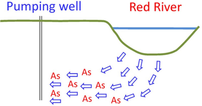
Many large Asian cities rely on groundwater for their water supply, and the abstraction of groundwater has commonly caused the development of large depression cones.1−5 In addition, some of these cities, exemplified by Kolkata6,7 and Hanoi,8,9 are situated on top of aquifers that are seriously contaminated by geogenic arsenic. Generally, the uppermost Holocene aquifers are the most-contaminated by arsenic, while underlying Pleistocene aquifers, in most cases, are low in arsenic.10,11 Because groundwater abstraction for municipal water supply occurs from the deeper Pleistocene aquifers, with groundwater low in arsenic, the change in groundwater flow patterns may cause the migration of arsenic-rich groundwater from upper aquifers into the underlying low-arsenic aquifers.8,9,12,13 The effect of municipal groundwater abstraction pumping also influences the water quality on a regional scale because depression cones extend far beyond the city limits.5,14
Both Hanoi and Dhaka are located along major rivers, and hydrogeological studies have shown1,2,15,16 groundwater abstraction to cause a very significant infiltration of river water into the underlying aquifers. The recharge of aquifers by losing rivers, often called bank infiltration, enhances the available water resource, and managed and monitored bank infiltration is a strategy that has been used extensively, particularly in Europe.17−20 Apart from increasing the quantity of the groundwater resource, bank infiltration also may improve the quality of the infiltrating surface water. During bank infiltration, processes taking place at the surface water–groundwater interface can remove nutrients, organic carbon (including organic contaminants), and pathogens such as microbes and viruses.21,22 However, the effect of Red River bank infiltration on the water quality of the aquifers below Hanoi is completely unknown, even though it is considered the main source of groundwater recharge below the city.2
The city of Hanoi has a leaky sewerage system as well as open channels carrying wastewaters and untreated sewage water through the city, both of which are leaking into the underlying aquifers.12,23,24 In addition, the aquifers beneath Hanoi are contaminated by arsenic with concentrations exceeding 300 μg/L.8,9 In contrast, the water of the Red River running along the city of Hanoi is very low in dissolved arsenic.12,25,26 Therefore, one could hope that the large scale infiltration of river water2 can improve the water quality in the aquifers and also flush out the arsenic. The time scale needed for flushing arsenic from the aquifer is currently unknown but must depend on infiltration rates, groundwater flow patterns, and residence times as well as the geochemical processes controlling the groundwater arsenic content. The latter includes the mobilization of arsenic by reductive dissolution of Fe-oxides and the adsorption and desorption of the mobilized arsenite.12,25,27 The objective of the present study is to investigate the rate of infiltration of Red River water into the underlying aquifer, clarify the geochemical processes occurring between the infiltrating water and the aquifer sediment, and predict the effect of river water infiltration on the groundwater arsenic content.
Materials and Methods
Field Area Description
Our field locality at Nam Du (20°58′25.43′′ N, 105°54′09.73′′ E) is located on the eastern boundary of the city of Hanoi, Vietnam, directly on the shore of the Red River. The geology of the area has been investigated extensively in relation with the establishment of the Nam Du well field in 2004.12 Generally, the geological sequence in the area consist of a top clay layer underlain by a up to 40 m thick Holocene aquifer consisting of fine- to medium-grained sand, comprising more fine- or coarse-grained layers. The sandy aquifer is underlaid by an aquitard of variable thickness (1–10 m) followed by a coarse-grained sand to gravel aquifer of Pleistocene age.12 Remote sensing shows the Nam Du area to belong to the meander belts of the Red River.28 A detailed geological profile of our study area, based on natural γ logging of boreholes and sediment description, is shown in Figure 1. Uppermost there is an up to 11 m thick layer of clay and silty clay, which is absent close to the river. Below follows an up to 40 m layer of fine- to medium-sized sand. Underneath, there is an up to 20 m thick layer of coarse sand and gravel. Between the two sand formations, a clay layer is found in some borings but not in all. Finally, at the bottom, there is a layer of claystone–siltstone. In accordance with the geological description of the area,12 the upper aquifer with fine-grained sand is considered to be of Holocene age, while the underlying coarse sand–gravel layer is interpreted as being of Pleistocene age. The intermediate clay lenses are probably remnants of the aquitard separating the Holocene and the Pleistocene aquifers, which elsewhere is found as a more-continuous layer.12 The claystone–siltstone corresponds to the lithology of the Neogene in the area.
Figure 1.

Hydrogeological setting at the Nam Du field site. The upper layers of clay and fine–medium-grained sand belong to the Holocene, the coarse sand–gravel to the Pleistocene, and the silt–claystone to the Neogene period. Water levels in the different boreholes are indicated by the ▼ symbol. The low measured electrical conductivity (EC) values (200–270 μS/cm) indicate the presence of river water in the whole system. Arsenic is low to absent in the river water and upper 17 m of the groundwater but is mobilized further down.
The Red River at this location is about 400 m wide. The depth of the river channel at Nam Du varies between 13.5 and 17.0 m below the ground level at the nest of boreholes on the shore (Figure 1). The mid channel depth is 15.3 m and is situated within the Holocene aquifer. The groundwater below Hanoi has been exploited since 1894, and groundwater abstraction presently amounts to >900 000 m3/day.27 Groundwater is being pumped mainly from six major well fields distributed throughout the city.2 As a result, large coalescing depression cones have developed below the city of Hanoi in both the Holocene and Pleistocene aquifers, which are partially connected.8,12 The well field at Nam Du is composed of a gallery of pumping stations close to the river.12 The pumping station included in our field site (Figure 1) is part of this gallery of pumping stations, but the flow toward the pumping station is the result of the drawdown caused by the entire pumping activity below Hanoi.12 The hydrostatic pressure in our wells screened in the Pleistocene aquifer is about 6 m lower than those in the nest screened in the Holocene aquifer (Figure 1), indicating a strong downward gradient induced by the pumping. The pumping combined with the less-permeable Holocene deposit on top of the highly permeable Pleistocene causes predominantly vertically downward groundwater flow, providing the shortest passage through the Holocene. The pressure difference between the Holocene and Pleistocene aquifers is also found elsewhere in the city, but its magnitude varies from locality to locality.2,12
Groundwater Sampling and Analysis
To investigate the hydrogeological and geochemical processes, we have collected three sets of data (Figure 1); (A) Detailed water sampling of the sediment porewater performed on a sandbank in the river, (B) water sampling in a nest of boreholes located on the river shore with screens installed at different depths in the Holocene aquifer, and (C) water sampling in boreholes and the nearest pumping station screened in the Pleistocene aquifer.
To sample the interface between river and groundwater, we used a 1 cm diameter drive-point piezometer and a 50 mL syringe for extracting the water. Sampling was carried out in shallow water, approximately 25 cm deep, on a sandbank in the river located about 50 m from the shore, with a depth resolution of 0.2–0.5 m until 3 m below the surface (Figure 1). At each depth the internal volume of the piezometer was emptied at least three times before taking the sample. On the shore, a nest of 11 wells (Figure 1) was installed in the depth range 4.9–40 m. Additionally, four wells ranging in depth from 40 to 60 m were installed in the Pleistocene aquifer between the pumping station and the nest at the shore (Figure 1). The wells were equipped with 60 mm PVC casings, a 1 m long screen, and 1 m sand trap. A quartz sand filter pack was installed, and the well was sealed using bentonite. The top end of the PVC casing was sealed to prevent the entrance of surface water during flooding. To further avoid leakage along the casing, the top of the wells were embedded in a concrete platform, each well within a protective steel casing and steel screw cap. Directly after completion, the wells were pumped to remove the water affected by the drilling operation. Sampling of the wells was done more than three months after their installation in 2010–2011. The pumping well is screened 48–65 m below the surface.
Groundwater was sampled from the boreholes using a Grundfos MP1 submersible pump. A total of five borehole volumes were flushed before taking the sample. O2, pH, and electrical conductivity (EC) were measured with probes in a flow cell mounted directly on the sampling tube. Samples for other parameters were collected in 50 mL syringes and filtered through 0.2 μm Sartorius Minisart cellulose acetate filters. Aqueous As(V) and As(III) were separated by passing the water through a disposable anion exchange cartridge.29 The cartridge was, together with the filter, carefully flushed with N2 before use. Arsenite was determined as the As concentration in the water filtered through a cartridge, and As(V) was calculated as the difference between the total As and As(III) concentrations. In the field, Fe(II) was measured spectrophotometrically, and alkalinity was determined by Gran titration. Samples for cations were preserved with 2% of a 7 M HNO3 solution and refrigerated until analysis in the laboratory. Samples for NH4+, Cl– and SO42– were collected in 20 mL polypropylene vials and frozen immediately after sampling. In the laboratory cations were analyzed by flame atomic absorption spectrophotometry. Arsenic was determined on the same instrument using a HVG hydride generator and a graphite furnace. Anions were analyzed by ion chromatography using a Shimadzu LC20AD/HIC-20A Super. Detection limits were As, 0.013 μM; Mn, 0.91 μM; Ca, 0.50 μM; NH4, 5.6 μM; PO4, 1.1 μM; NO3, 3.2 μM; and SO4 2.1, μM. For further details on procedures and methods, consult Postma et al.25
Samples for tritium–helium dating were taken in duplicate in clamped copper tubes in 2015 and analyzed by the Institut für Umweltphysik, Universität Bremen. 3H concentrations were determined by the 3He in growth method. The accuracy of the dates is given by the standard deviation as ±0.8 years (Jürgen Sültenfuß, personal communication)
Results and Discussion
River Water Infiltration
Tritium–helium dating of water sampled from the boreholes in the nest screened in the Holocene aquifer (Figure 1) is shown in Figure 2. The groundwater is extremely young in screens at all depths, indicating the fast infiltration of river water into the underlying aquifer. The oldest groundwater age of 8 years is found at 30 m depth. This piezometer is located in one corner of the well cluster, and here, a clay layer (not shown in Figure 1) was encountered during drilling from 26 to 28 m depth, which was not present in the other drillings just a few meters away. Below this clay layer, the groundwater apparently has a larger residence time, yielding a higher groundwater age. The 30 m depth screen also shows a maximum in the dissolved As(III) concentration (Figure 3) and in the NH4 concentration (not shown), reflecting that the longer groundwater residence time allows more As(III) and NH4 to build up. The remaining screens yield groundwater ages ranging from less than one year to 1.3 years in the screen at 40 m depth. Duplicate measurements are, except for the 30 m screen (Figure 2), within 0.05 years, indicating a high precision. However, the estimated accuracy of ±0.8 years is high compared to the measured ages. In addition there is uncertainty as to whether infiltration occurs from the deeper or the more shallow parts of the channel. Using the vertical distance between the mean channel depth of 15.3 m and the groundwater age of 1.3 ± 0.8 years at 40 m yields a vertical transport rate of 19 m/year with an uncertainty range of 12–49 m/year.
Figure 2.

Red River water infiltration into the aquifer: tritium–helium groundwater ages, plotted in duplicate at all depths, show the presence of young water down to 40 m depth. The electrical conductivity (EC) in the groundwater is close to the value of 205 μS/cm in the river water. The partial pressure of CO2 is 10–3.3 in river water and 10–2.3 to 10–2.8 in the groundwater.
Figure 3.

Effect of redox processes on the groundwater chemistry in the Holocene aquifer at Nam Du. Symbols designate field data, and lines indicate reactive transport model predictions with adsorption of As(III) disabled. In the model, the upper cell consumes 0.27 mM DOC, which reduces O2 and NO3 in the infiltrating water. Further down, the oxidation of organic carbon and reduction of As-containing Fe-oxides are controlled by rate equations in the model of Postma et al.33 Model lines are given for 60 years but are nearly identical for other times <100 year.
A further indicator for river water intruding into the aquifer is the electrical conductivity of the groundwater (Figure 2). Shallow groundwater on the shores of the Red River 30 km NW of Hanoi, unaffected by pumping, has an EC in the range 750–1000 μS/cm.25 River water, however, has an EC of around 200 μS/cm, and the difference is due to mineral weathering mainly occurring in the soil zone. The strong contrast in EC between river water and normal groundwater makes the EC a good indicator for intrusion of river water into aquifers. As shown in Figures 1 and 2, river water and groundwater in the Holocene and Pleistocene aquifers, as well as water of the pumping station, all have an EC in the range of 200–320 μS/cm, indicating rapid recharge from the river to be the dominant source of water in the aquifer.
An additional useful tracer parameter is the partial pressure of CO2 (PCO2). River water has a low PCO2 value of 10–3.3, close to that in the atmosphere (PCO2 = 10–3.4). However, water infiltrating through soils, or through organic rich sediment, is exposed to root respiration and organic decay that generate CO2. At our field site 30 km upstream along the Red River, the groundwater, therefore, has a PCO2 in the range of 10–1.0 to 10–1.4.25Figure 2 shows how all the water in the aquifer below the river has a PCO2 in the range of 10–2.3 to 10–2.8. These low partial pressures of CO2 also indicate the recharge of river water into the aquifer without being exposed to extensive organic matter decay or respiration. This is consistent with fast recharge of water through the bottom of the river.
Redox Processes
The river water has an O2 concentration of 0.24 mmol/L, only slightly below the concentration of 0.27 mmol/L in equilibrium with the atmosphere.30 In addition, river water contains 28 μmol/L of nitrate. At a depth of a few meters below the surface, both oxygen and nitrate have disappeared from the groundwater (Figure 3). At the same time, the river water and one sample at 1 m depth contain about 0.6 mmol/L dissolved organic carbon (DOC), while the remaining groundwater has a DOC concentration near 0.1 mmol/L. As the river water infiltrates, the DOC appears to be filtered by the uppermost sediment. Stoichiometric calculation suggest that the oxidation of 0.27 mmol/L DOC would be sufficient for the complete removal of dissolved oxygen and nitrate from the infiltrating river water. There is no evidence for Fe-oxides functioning as electron acceptor for DOC oxidation in the top sediment layers because Fe(II) appears in the groundwater at greater depth. This pattern of DOC filtration by the uppermost sediment layer and concomitant removal of dissolved O2 and nitrate was also observed at other bank infiltration sites.18,19,21,31 Below 10 m depth, the Fe(II) concentration starts to increase in the infiltrating water (Figure 3), probably because the degradation of sedimentary organic carbon causes reductive dissolution of Fe-oxides. Similar Fe(II) increases attributed to reductive dissolution of Fe-oxides have been observed at other sites with ongoing bank infiltration.18,21
The distribution of arsenic in the river and groundwater is displayed in Figure 1 and in detail for the Holocene aquifer in Figure 3. The river water and the shallow groundwater are free of arsenic, while it is present in the deeper groundwater of the Holocene, the Pleistocene aquifers, and the water of the pumping station. This distribution indicates that the infiltrating river water is mobilizing arsenic from the aquifer sediment. Postma et al.32,33 found the rate of arsenic mobilization from the sediment into the groundwater to depend on the burial age of the aquifer sediment with the youngest sediments being most reactive. The geochemical processes controlling the groundwater arsenic content were quantified in a 1D reactive transport model, up to a burial age of 6000 years, using the code PHREEQC-3.34 In the model, the oxidation of organic matter causes the reduction of arsenic-containing Fe-oxides, resulting in the release of Fe(II) and As(III) to the groundwater. Both organic carbon and Fe-oxides become consumed over time and less-reactive as well. The oxidation of organic matter and the reduction of Fe-oxides are controlled by separate rate equations that quantify their decreasing rates over time (eqs 1 and 2 in the Supporting Information). The rate equations were calibrated using the groundwater chemistry of four sites on the Red River floodplain 30 km northwest of Hanoi,33 where both the burial age of the Holocene aquifer sediment and the vertical flow rate of the groundwater are known.
The application of the model developed for the field area 30 km north of Hanoi to the Nam Du field site assumes that floodplain sediment is similar at the two sites. This appears a reasonable assumption given that remote sensing28 shows that both sites to belong to the Red River meander belts, and they also have comparable Holocene sediments. Accordingly, we have applied the model to the Nam Du data (see the Supporting Information for the PHREEQC input file). The main difference between the two field sites is the much-faster vertical flow rate at Nam Du of 19 m/year compared to 0.5 m/year in the undisturbed aquifers north of Hanoi.32 The burial age of aquifer sediments adjacent to the river at Nam Du is not known, but as an end-member case, we assume the aquifer to be very young (<100 years). With that assumption, the organic carbon and iron oxides have the highest possible reactivity, and the calculated release rates of Fe(II) and As(III) will accordingly be maximum rates. Any older sediment would consequently show lower Fe(II) and As(III) release rates. The composition of the solution entering into the 1D model is that of river water. The results calculated by the model for 60 years of infiltration are shown as the solid lines in Figure 3 but would be nearly identical for other times <100 years. To simulate, in addition, the consumption of DOC in the uppermost sediment, we have added a constant rate of organic carbon degradation of 5.1 mM C/year in the upper layer of the model, matching the removal of O2 and NO3 in the incoming water by DOC oxidation (Figure 3). Below the top layer, the oxidation rate of sedimentary organic carbon is calculated from the rate equation, and the main electron accepting process is the reductive dissolution of Fe-oxides. Figure 3 shows the modeled release of Fe(II) to the groundwater, which corresponds to a rate of 35 μM Fe/year. In the bottom 4 m of the profile, a small amount of Fe(II) becomes precipitated as siderite, but higher up in the profile, all Fe(II) stays in solution. A comparison with field data shows the modeled values to be slightly higher than the field data, but the assumption that the Holocene aquifer at Nam Du is young appears reasonable. Otherwise, the modeled Fe(II) concentration would be much higher than the measured Fe(II) values because the Fe(II) release of an old low-reaction sediment would be significantly lower.
Fe-oxides being reduced in the model contain 1.2 mmol As(V) per mol of Fe, a value based on analysis of Fe-oxides by reductive dissolution in sediment samples from four sites with a different burial age of the aquifer sediment on the Red River floodplain.33 During the reduction of Fe-oxides in the aquifer, As(V) becomes reduced to As(III) and is released to the groundwater. Using the model, we can evaluate how much of the As measured in the groundwater could possibly be derived from reductive dissolution of As-containing Fe-oxides from sediment that is considered to be <100 years old. For any older sediment, the arsenic release rate would be lower. To keep all As(III) released from reduced Fe-oxides in solution, we have disabled the adsorption of As(III) in the model. Figure 3 compares the measured As(III) in the groundwater with the model prediction assuming reductive dissolution of As-containing Fe-oxide being the only source of As(III) in the water. The modeled As profile in Figure 3 corresponds to an As(III) release rate of 0.052 μM As(III)/year. For the 19 m/year vertical flow rate, the modeled As(III) concentration at 40 m depth is 0.11 μM, while the uncertainty range of 12–49 m/year in the vertical flow rate corresponds to a As(III) concentration range of 0.04–0.17 μM.
Figure 3 clearly shows the modeled As concentration, released by reductive dissolution of Fe-oxides in 70 year old sediment, to be much lower than the As concentration measured in the aquifer. Any older sediment would have a lower reactivity and, therefore, a lower As(III) release rate. Therefore, most of the As(III) present in the groundwater cannot be released by reductive dissolution of As-containing Fe-oxides. Note that the same release rate of 0.052 μM As(III)/year yields a modeled groundwater arsenic concentration of up to 4 μmol As(III)/L at the Dan Phuong locality upstream along the Red River.33 Because the reduction of Fe-oxides, and thereby the release of As, is kinetically controlled, the resulting groundwater concentration will depend on the groundwater flow rate.35 At the Dan Phuong site, the downward groundwater velocity is 0.5 m/year,25 while at Nam Du, it is 19 m/year. The same As(III) release rate therefore produces groundwater with a As(III) concentration that is almost 40 times higher at Dan Phuong than at Nam Du. The importance of reaction kinetics on arsenic mobilization is also evident from the much-higher arsenic concentration found in porewater in sediment along the shores of the Red River, 6 km further downstream at Van Phuc.26 Vertical flow rates here are 0.1–3.1 m/year,26 which is an order of magnitude lower than the vertical flow rate we derive for the bottom of the river channel, and therefore result in a higher arsenic concentration. In fact, the main role of redox processes for arsenic mobility in the Nam Du aquifer is to maintain anoxic conditions in the aquifer, thereby keeping arsenic in its As(III) form. If the oxidation of arsenic to As(V) should occur, it would cause a much-stronger arsenic retardation because As(V) adsorbs much more strongly to the aquifer sediment.36
As(III) Retardation
Groundwater must have been high in As(III) before water supply pumping by the city of Hanoi induced river water infiltration into the aquifer because high As(III) concentrations are seen everywhere else on the Red River floodplain in aquifers contained in young sediments.25,32 Dissolved As(III) in the groundwater is in equilibrium with As(III) adsorbed onto the sediment, and the results of a forced gradient experiment37 and push–pull tests38 indicate that arsenic sorption rapidly responds to changes in the water chemistry. The infiltration of low-arsenic river water is therefore expected to cause desorption of arsenic from the aquifer sediment. The distribution of As(III) in the groundwater over depth, with low As(III) in the upper 15 m and higher As(III) further down (Figure 3), is consequently interpreted as a leaching front, and its position will be determined by the number of pore volumes of groundwater flushed through the aquifer and the adsorption isotherm.
In a previous study,36 we experimentally investigated the adsorption of As(III) onto the Holocene aquifer sediment at the Nam Du field site using a sediment sample from 5.5 to 6 m in depth. The results showed a linear adsorption isotherm up to an aqueous concentration of at least 10 μM As(III) corresponding to a distribution coefficient, K′d of 12.6 L/kg. The adsorption of As(III) was also found to be completely reversible. For the measured aqueous concentration of 1 μM As(III) (Figure 3) and a porosity of 0.36,39 the isotherm predicts an adsorbed concentration of 59 μmol As(III) per L of contacting groundwater, corresponding to a retardation of 60. Accordingly, it will take the flushing of 60 pore volumes of groundwater through the Holocene aquifer to desorb all adsorbed As(III). Starting with an initial concentration of 1 μM As(III) in the groundwater, close to what is measured in the groundwater, and the corresponding adsorbed As(III) concentration of 59 μmol/L, we have calculated how the As(III) versus depth profile would look like at different times and compared it to the measured As(III) concentration (Figure 4). As the water moves downward, the As(III) concentration increases along the isotherm until it reaches the concentration that was present in the aquifer before river water infiltration began. Because the adsorption isotherm is linear, the shape of the leaching front will be independent of the As(III) concentration. In the model, the vertical flow rate is 19 m/year, and the leaching front moves downward with 0.32 m/year, and after 60 years of modeled river water infiltration, there is a reasonable correspondence with the field data (Figure 4). Using the uncertainty in the infiltration rate from 12 to 49 m/year, the range in front progression is 0.20 to 0.82 m/year, and the time for the leaching front to reach the same depth is from 96 to 24 years. Although groundwater abstraction in Hanoi started 100 years ago,8 we do not know when river water started to infiltrate into the aquifer at Nam Du. Van Geen et al.27 constructed a flow model for Van Phuc, on the next bend of the river 6 km further south. Here, the pumping of the Hanoi water supply has caused a flow reversal from a gaining to a losing river. The timing of the flow reversal was estimated to be between 1951 and 1971. Our estimate of 60 ± 36 years of river water infiltration is within the time space of groundwater abstraction by the Hanoi water supply but clearly associated with considerable uncertainty.
Figure 4.

Leaching and retardation of As(III) from the Holocene aquifer. The symbols are field data. Lines are leaching profiles calculated using a K′d of 12.6 L/kg and a flow velocity of 19 m/year, derived from tritium–helium dating. The calculations were carried out for an initial groundwater concentration of 1 μM As(III).
Environmental Perspective
Groundwater flow modeling2 suggest that infiltrating Red River water is the main source of groundwater recharge into the aquifers beneath Hanoi, which are heavily pumped by the municipal water supply. Infiltrating river water may be beneficial for the groundwater quality in at least two ways. First, the river water contains no arsenic, and one may hope that its infiltration will lower the groundwater arsenic content over time. The second effect will be dilution of the sewage leaking into the aquifer.23,24
It is of major importance to understand the hydrogeological and geochemical processes occurring at the river–groundwater interface to assess the future water quality in the aquifers below Hanoi. Our data from Nam Du suggest that a very fast recharge is taking place from the river channel. However, another recent study at the Van Phuc site26 located 6 km downstream from our site at Nam Du suggests much-slower infiltration to occur along the shores of the river. In future work, it would be important to delineate the relative importance of the two modes of recharge, particularly because they seem to result in a different groundwater arsenic content. While we find at Nam Du that, due to the high infiltration, the kinetically controlled reductive dissolution of As-containing Fe-oxides only contributes insignificantly to the groundwater arsenic content, the study at Van Phuc suggest that the slow infiltration rates allow much-higher arsenic concentrations to build up in the groundwater.26 An additional reason for the much-higher arsenic concentrations found in porewater of the shoreface sediment could also be that Van Phuc is located just downstream of the channel at Yen My, which drains most of the untreated urban wastewater from the city of Hanoi into the Red River,24 providing an ample source of reactive carbon.
While the infiltrating river water may readily displace the original groundwater as the result of pumping, our results indicate that a decrease in the arsenic concentration in the pumped water will take much longer. Our data indicates that it probably will take another 65 ± 39 years to flush the adsorbed As(III) from the Holocene aquifer. To reach the screens of the groundwater abstraction wells, the groundwater thereafter flows through Pleistocene deposits. Van Geen et al.27 determined the retardation of As(III) in Pleistocene sands to be 16–20, which is a factor of 3–4 lower than what we find in the Holocene. In addition, many Pleistocene sediment layers consist of highly permeable gravels that probably have an even-lower retardation. Flushing of arsenic from the Pleistocene aquifers is therefore expected to proceed much faster than from the Holocene aquifers. Thus, bank infiltration of Red River water into the Holocene and Pleistocene aquifers will likely cause the groundwater arsenic concentration to decrease, but it will take several decades.
Acknowledgments
This research has been funded by the European Research Council under the ERC Advanced Grant ERG-2013-ADG, grant agreement no. 338972.
Supporting Information Available
The Supporting Information is available free of charge on the ACS Publications website at DOI: 10.1021/acs.est.6b05065.
Description of the reactive transport model and model input file. (PDF)
The authors declare no competing financial interest.
Supplementary Material
References
- Hoque M. A.; Hoque M. M.; Ahmed K. M. Declining groundwater level and aquifer dewatering in Dhaka metropolitan area, Bangladesh: causes and quantification. Hydrogeol. J. 2007, 15, 1523–1534. 10.1007/s10040-007-0226-5. [DOI] [Google Scholar]
- Jusseret S.; Tam V. T.; Dassargues A. Groundwater flow modeling in the central zone of Hanoi, Vietnam. Hydrogeol. J. 2009, 17, 915–934. 10.1007/s10040-008-0423-x. [DOI] [Google Scholar]
- Haque S. J.; Onodera S.; Shimizu Y. An overview of the effects of urbanization on the quantity and quality of groundwater in South Asian megacities. Limnology 2013, 14, 135–145. 10.1007/s10201-012-0392-6. [DOI] [Google Scholar]
- Zhou Y.; Dong D.; Liu J.; Li W. Upgrading a regional groundwater level monitoring network for Beijing Plain, China. Geosci. Front. 2013, 4, 127–138. 10.1016/j.gsf.2012.03.008. [DOI] [Google Scholar]
- Khan M. R.; Koneshloo M.; Knappett P. S. K.; Ahmed K. M.; Bostick B. C.; Mailloux B. J.; Mozumder R. H.; Zahid A.; Harvey C. F.; van Geen A.; Michael H. A. Megacity pumping and preferential flow threaten groundwater quality. Nat. Commun. 2016, 7, 12833. 10.1038/ncomms12833. [DOI] [PMC free article] [PubMed] [Google Scholar]
- Chakraborti D.; Das B.; Rahman M. M.; Chowdhury U. K.; Biswas B.; Goswami A. B.; Nayak B.; Pal A.; Sengupta M. K.; Ahamed S.; Hossain A.; Basu G.; Roychowdhury T.; Das D. Status of groundwater arsenic contamination in the state of West Bengal, India: A 20-year study report. Mol. Nutr. Food Res. 2009, 53, 542–551. 10.1002/mnfr.200700517. [DOI] [PubMed] [Google Scholar]
- Malakar A.; Islam S.; Ali M. A.; Ray S. Rapid decadal evolution in the groundwater arsenic content of Kolkata, India and its correlation with the practices of her dwellers. Environ. Monit. Assess. 2016, 188, 584. 10.1007/s10661-016-5592-9. [DOI] [PubMed] [Google Scholar]
- Berg M.; Trang P. T. K.; Stengel C.; Buschmann J.; Pham H. V.; Van Dan N.; Giger W.; Stuben D. Hydrological and sedimentary controls leading to arsenic contamination of groundwater in the Hanoi area, Vietnam: the impact of iron arsenic ratios, peat, river bank deposits, and excessive groundwater abstraction. Chem. Geol. 2008, 249, 91–112. 10.1016/j.chemgeo.2007.12.007. [DOI] [Google Scholar]
- Winkel L. H. E.; Trang P. T. K.; Lan V. M.; Stengel C.; Amini M.; Ha N. T.; Pham H. V.; Berg M. Arsenic pollution of groundwater in Vietnam exacerbated by deep aquifer exploitation for more than a century. Proc. Natl. Acad. Sci. U. S. A. 2011, 108, 1246–1251. 10.1073/pnas.1011915108. [DOI] [PMC free article] [PubMed] [Google Scholar]
- DPHE. Arsenic contamination of groundwater in Bangladesh. In BGS Technical Report WC/00/19; Kinniburgh D. G., Smedley P. L., Eds.; British Geological Survey: Keyworth, UK, 2001. [Google Scholar]
- Zheng Y.; van Geen A.; Stute M.; Dhar R.; Mo Z.; Cheng Z.; Horneman A.; Gavrieli I.; Simpson H. J.; Versteeg R.; Steckler; Grazioli-Venier A.; Goodbred S.; Shahnewaz M.; Shamsudduha M.; Hoque M. A.; Ahmed K. M. Geochemical and hydrogeological contrasts between shallow and deeper aquifers in two villages of Araihazar, Bangladesh: Implications for deeper aquifers as drinking water sources. Geochim. Cosmochim. Acta 2005, 69, 5203–5218. 10.1016/j.gca.2005.06.001. [DOI] [Google Scholar]
- Norrman J.; Sparrenbom C. J.; Berg M.; Nhan D. D.; Nhan P. Q.; Rosqvist H.; Jacks G.; Sigvardsson E.; Baric D.; Moreskog J.; Harms-Ringdahl P.; Hoan N. V. Arsenic mobilization in a new well field for drinking water production along the Red River, Nam Du, Hanoi. Appl. Geochem. 2008, 23, 3127–3142. 10.1016/j.apgeochem.2008.06.016. [DOI] [Google Scholar]
- Mukherjee A.; Fryar A. E.; Scanlon B. R.; Bhattacharya P.; Bhattacharya A. Elevated arsenic in deeper groundwater of the western Bengal basin, India: Extent and controls from regional to local scale. Appl. Geochem. 2011, 26, 600–613. 10.1016/j.apgeochem.2011.01.017. [DOI] [Google Scholar]
- Knappett P. S. K.; Mailloux B. J.; Choudhury I.; Khan M. R.; Michael H. A.; Barua S.; Mondal D. R.; Steckler M. S.; Akhter S. H.; Ahmed K. M.; Bostick B.; Harvey C. F.; Shamsudduha M.; Shuai P.; Mihajlov I.; Mozumder R.; van Geen A. Vulnerability of low-arsenic aquifers to municipal pumping in Bangladesh. J. Hydrol. 2016, 539, 674. 10.1016/j.jhydrol.2016.05.035. [DOI] [PMC free article] [PubMed] [Google Scholar]
- Darling W. G.; Burgess W G.; Hasan M. K. Isotopic evidence for induced river recharge to the Dupi Tila aquifer in the Dhaka urban area, Bangladesh. In The Application of Isotope Techniques to the Assessment of Aquifer Systems in Major Urban Areas; IAEA: Vienna, Austria, 2002, pp 95–107. [Google Scholar]
- Hoque M. A.; McArthur J. M.; Sikdar P. K.; Ball J. D.; Molla T. N. Tracing recharge to aquifers beneath an Asian megacity with Cl/Br and stable isotopes: the example of Dhaka, Bangladesh. Hydrogeol. J. 2014, 22, 1549–1560. 10.1007/s10040-014-1155-8. [DOI] [Google Scholar]
- Eckert P.; Irmscher R. Over 130 years of experience with Riverbank filtration in Düsseldorf, Germany. J. Water Supply Res. T. 2006, 55, 283–291. [Google Scholar]
- Massmann G.; Nogeitzig A.; Taute T.; Pekdeger A. Seasonal and spatial distribution of redox zones during lake bank filtration in Berlin, Germany. Environ. Geol. 2008, 54, 53–65. 10.1007/s00254-007-0792-9. [DOI] [Google Scholar]
- Bourg A. C. M.; Bertin C. Biogeochemical processes during the infiltration of river water into an alluvial aquifer. Environ. Sci. Technol. 1993, 27, 661–666. 10.1021/es00041a009. [DOI] [Google Scholar]
- von Gunten H. R.; Karametaxas G.; Krahenbuhl U.; Kuslys M.; Giovanoli R.; Hoehn E.; Keil R. Seasonal biogeochemical cycles in riverborne groundwater. Geochim. Cosmochim. Acta 1991, 55, 3597–3609. 10.1016/0016-7037(91)90058-D. [DOI] [Google Scholar]
- Farnsworth C. E.; Hering J. G. Inorganic geochemistry and redox dynamics in bank infiltration settings. Environ. Sci. Technol. 2011, 45, 5079–5087. 10.1021/es2001612. [DOI] [PubMed] [Google Scholar]
- Hamann E.; Stuyfzand P. J.; Greskowiak J.; Timmer H.; Massmann G. The fate of organic micropollutants during long-term/long-distance river bank filtration. Sci. Total Environ. 2016, 545–546, 629–640. 10.1016/j.scitotenv.2015.12.057. [DOI] [PubMed] [Google Scholar]
- Trafford J. M.; Lawrence A. R.; Macdonald D. M. J.; Nguyen Van Dan; Tran D. N.; Ha N. T. The effect of urbanisation on the groundwater quality beneath the city of Hanoi; Technical Report WC/96/22; British Geological Survey: Nottingham, UK; 1996. [Google Scholar]
- Norrman J.; Sparrenbom C. J.; Berg M.; Dang D. N.; Jacks G.; Harms-Ringdahl P.; Pham Q. N.; Rosqvist H. Tracing sources of ammonium in reducing groundwater in a well field in Hanoi (Vietnam) by means of stable nitrogen isotope (d15N) values. Appl. Geochem. 2015, 61, 248–258. 10.1016/j.apgeochem.2015.06.009. [DOI] [Google Scholar]
- Postma D.; Larsen F.; Minh Hue N. T.; Duc M. T.; Pham H. V.; Nhan P. Q.; Jessen S. Arsenic in groundwater of the Red River floodplain, Vietnam: Controlling geochemical processes and reactive transport modeling. Geochim. Cosmochim. Acta 2007, 71, 5054–5071. 10.1016/j.gca.2007.08.020. [DOI] [Google Scholar]
- Stahl M. O.; Harvey C. F.; van Geen A.; Sun J.; Thi Kim Trang P.; Mai Lan V.; Mai Phuong T.; Hung Viet P.; Bostick B. C. River bank geomorphology controls groundwater arsenic concentrations in aquifers adjacent to the Red River, Hanoi Vietnam. Water Resour. Res. 2016, 52, 6321. 10.1002/2016WR018891. [DOI] [Google Scholar]
- van Geen A.; Bostick B. C.; Thi Kim Trang P.; Lan V. M.; Mai N.-N.; Manh P. D.; Pham H. V.; Radloff K.; Aziz Z.; Mey J. L.; Stahl M. O.; Harvey C. F.; Oates P.; Weinman B.; Stengel C.; Frei F.; Kipfer R.; Berg M. Retardation of arsenic transport through a Pleistocene aquifer. Nature 2013, 501, 204–207. 10.1038/nature12444. [DOI] [PMC free article] [PubMed] [Google Scholar]
- Mathers S.; Zalasiewicz J. Holocene sedimentary architecture of the Red River Delta, Vietnam. J. Coastal Res. 1999, 15, 314–325. [Google Scholar]
- Meng X.; Wang W.. Speciation of arsenic by disposable cartridges. In Proc. Third Int.Conf. Arsenic Exposure and Health Effects; Society for Environmental Geochemistry and Health; Denver, Colorado, 1998. [Google Scholar]
- Appelo C. A. J.; Postma D.. Geochemistry Groundwater and Pollution, 2nd ed. 2005, Balkema Publ.649 pp. [Google Scholar]
- Jacobs L. A.; von Gunten H. R.; Keil R.; Kuslys M. Geochemical changes along a river-groundwater infiltration flow path—Glattfelden, Switzerland. Geochim. Cosmochim. Acta 1988, 52, 2693–2706. 10.1016/0016-7037(88)90038-5. [DOI] [Google Scholar]
- Postma D.; Larsen F.; Thai N. T.; Trang P. T. K.; Jakobsen R.; Nhan P. Q.; Long T. V.; Pham H. V.; Murray A. S. Groundwater arsenic concentration in Vietnam controlled by sediment age. Nat. Geosci. 2012, 5, 656–661. 10.1038/ngeo1540. [DOI] [Google Scholar]
- Postma D.; Pham T. K. T.; Sø H. U.; Hoang V. H.; Vi M. L.; Nguyen T. T.; Larsen F.; Pham H. V.; Jakobsen R. A model for the evolution in water chemistry of an arsenic contaminated aquifer over the last 6000 years, Red River floodplain, Vietnam. Geochim. Cosmochim. Acta 2016, 195, 277–292. 10.1016/j.gca.2016.09.014. [DOI] [PMC free article] [PubMed] [Google Scholar]
- Parkhurst D. L.; Appelo C. A. J. Description of input and examples for PHREEQC version 3—A computer program for speciation, batch-reaction, one-dimensional transport, and inverse geochemical calculations. In U.S. Geological Survey Techniques and Methods; USGS: Reston, VA, 2013; http://pubs.usgs.gov/tm/06/a43. [Google Scholar]
- Stute M.; Zheng Y.; Schlosser P.; Horneman A.; Dhar R. K.; Datta S.; Hoque M. A.; Seddique A. A.; Shamsudduha M.; Ahmed K. M.; van Geen A. Hydrological control of As concentrations in Bangladesh Groundwater. Water Resour. Res. 2007, 43, W09417. 10.1029/2005WR004499. [DOI] [Google Scholar]
- Thi Hoa Mai N.; Postma D.; Thi Kim Trang P.; Jessen S.; Pham H. V.; Larsen F. Adsorption and desorption of arsenic to aquifer sediment on the Red River floodplain at Nam Du, Vietnam. Geochim. Cosmochim. Acta 2014, 142, 587–600. 10.1016/j.gca.2014.07.014. [DOI] [PMC free article] [PubMed] [Google Scholar]
- Jessen S.; Postma D.; Larsen F.; Nhan P. Q.; Hoa L. Q.; Trang P. T. K.; Long T. V.; Pham H. V.; Jakobsen R. Surface complexation modeling of groundwater arsenic mobility: Results of a forced gradient experiment in a Red River flood plain aquifer, Vietnam. Geochim. Cosmochim. Acta 2012, 98, 186–201. 10.1016/j.gca.2012.07.014. [DOI] [Google Scholar]
- Radloff K. A.; Zheng Y.; Stute M.; Weinman B.; Bostick B.; Mihajlov I.; Bounds M.; Rahman M. M.; Huq M. R.; Ahmed K. M.; Schlosser P.; van Geen A. Reversible adsorption and flushing of arsenic in a shallow, Holocene aquifer of Bangladesh. Appl. Geochem. 2015, 10.1016/j.apgeochem.2015.11.003. [DOI] [PMC free article] [PubMed] [Google Scholar]
- Larsen F.; Pham Q. N.; Dang D. N.; Postma D.; Jessen S.; Pham H. V.; Nguyen B. T.; Trieu H. D.; Tran L. T.; Nguyen H.; Chambon J.; Nguyen V. H.; Ha D. H.; Hue N. T.; Duc M. T.; Refsgaard J. C. Controlling geological and hydrogeological processes in an arsenic contaminated aquifer on the Red River flood plain, Vietnam. Appl. Geochem. 2008, 23, 3099–3115. 10.1016/j.apgeochem.2008.06.014. [DOI] [Google Scholar]
Associated Data
This section collects any data citations, data availability statements, or supplementary materials included in this article.