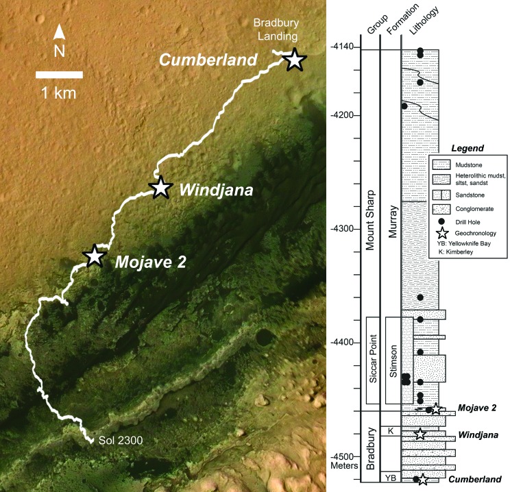
FIG. 1.
Location of the three drilled samples used for Curiosity geochronology experiments, (1) along the rover traverse (base map: Mars Reconnaissance Orbiter Context Camera images colorized with Mars Express High Resolution Stereo Camera data, NASA/JPL/MSSS/ESA/DLR/FU Berlin [G. Neukum]/Tanya Harrison/Emily Lakdawalla) and (2) within the stratigraphic column (NASA/JPL-Caltech).

