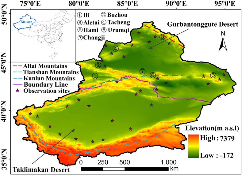
Figure 1. Study area (boundary information was obtained from State Key Laboratory of Desert and Oasis Ecology, Xinjiang Institute of Ecology and Geography, Chinese Academy of Sciences, Approval number: Xinjiang S(2018)033).
Three color lines represent three mountains. Purple line represent the boundary of south and north of Xinjiang. Purple stars represent meteorological observation sites. The numbers represent the names of the places which will be mentioned in the text. Map credit: © State Key Laboratory of Desert and Oasis Ecology, Xinjiang Institute of Ecology and Geography, Chinese Academy of Sciences; CC BY NC 4.0.

