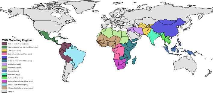
Extended Data Fig. 1. Modelling regions based on geographical and SDI regions from the GBD.
Modelling regions were defined as follows. Andean South America, Central America and the Caribbean, central sub-Saharan Africa, East Asia, eastern sub-Saharan Africa, Middle East, North Africa, Oceania, Southeast Asia, South Asia, southern sub-Saharan Africa, Central Asia, Tropical South America, and western sub-Saharan Africa. Regions in grey were not included in our models due to high-middle and high SDIs27. The map was produced using ArcGIS Desktop 10.6.

