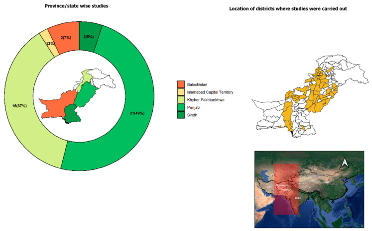
Figure 3.
Map of Pakistan (right side) showing localities from where TBPs of small ruminants were reported. Donut chart (left side) illustrates the number (percentage in parenthesis) of studies conducted in different provinces, states and the capital. Map inside the Donut chart indicates boundaries of provinces and states. Inset map shows the location of Pakistan in South Asia.

