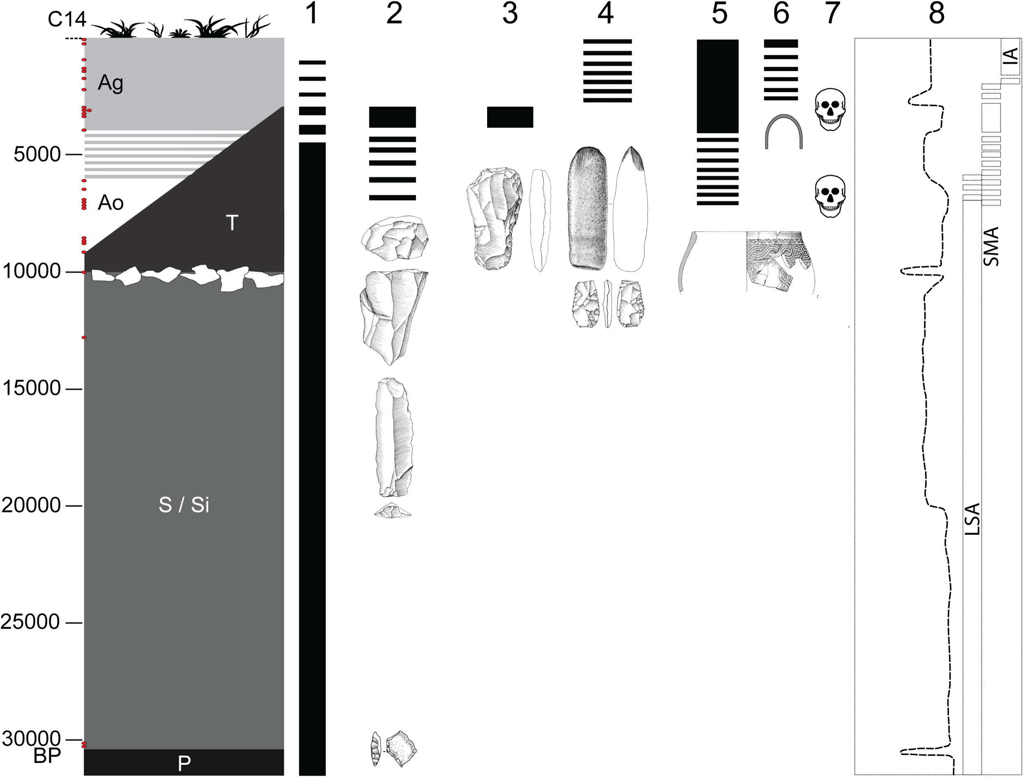
Extended Data Figure 1: Overview of the site of Shum Laka.

The left column represents generalized stratigraphy, with radiocarbon dates (uncalibrated) shown as red dots on the y-axis, and deposits indicated by their archaeological nomenclature (P, S/Si = Pleistocene; T, A = Holocene; Ao = Holocene ochre ashy layer; Ag = Holocene gray ashy layer; after ref. [76]). Columns 1–6 display chronological extents of technological traditions: 1, microlithic quartz industry; 2, macrolithic flake and blade industry on basalt; 3, bifaces of the axe-hoe type; 4, pecked grounded adze and arrow heads; 5, pottery; and 6, iron objects. Column 7 indicates the two Shum Laka burial phases. Column 8 shows climatic reconstructions based on carbon stable isotopes and pollen from organic matter extracted from sediment cores at Lake Barombi Mbo in western Cameroon (more arid conditions to the left and more humid conditions to the right [60, 76]), along with archaeological eras (LSA, Later Stone Age; SMA, Stone to Metal Age; IA, Iron Age). RMCA Collection; Drawings Y. Paquay, composition © RMCA, Tervuren; modified by E. Cornelissen [77].
