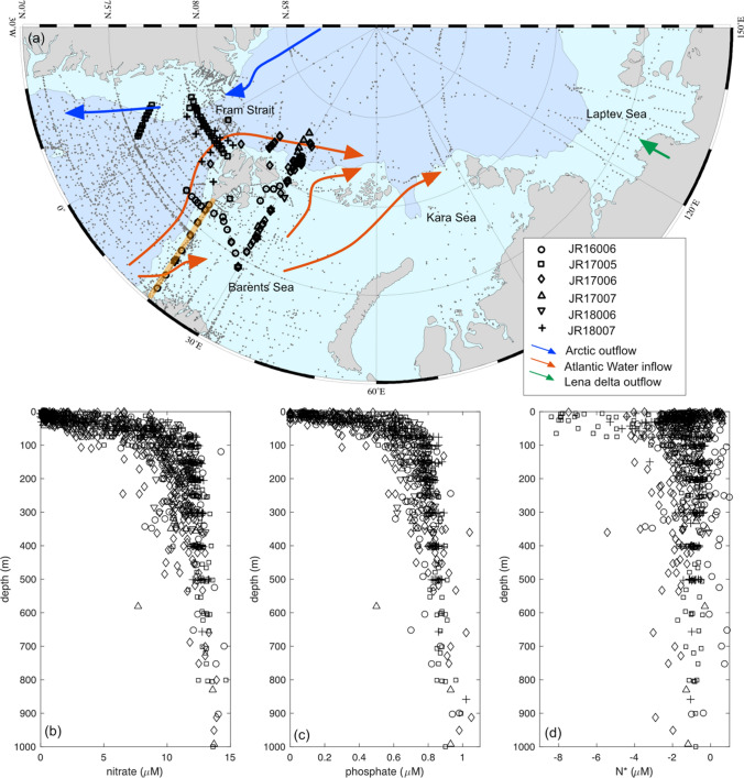
Fig. 1.
a Map of the Eurasian Arctic highlighting the Changing Arctic Ocean cruises (JR16006, JR17005, JR17006, JR17007, JR18006 and JR18007), the Codispoti et al., (2013) dataset (grey dots), the Atlantic Water inflow (orange arrows), the Arctic Water outflow (blue arrows) and the Lena Delta (green arrow). The orange line shows the M/S Norbjørn transect across the Barents Sea Opening. b nitrate, c phosphate and d N* profiles from the Changing Arctic Ocean cruises over three consecutive years (2017, 2018 and 2019) covering the Fram Strait and Barents Sea

