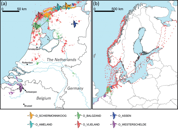
Figure 2.
Maps of GPS positions collected from the six different datasets a map of the Netherlands and bordering areas of Belgium and Germany showing locations of study sites (indicated by bird symbols) and GPS locations b map of northwest Europe showing the full extent of the GPS locations. Maps show GPS locations with hourly intervals; higher frequencies in between GPS locations are omitted in this visualisation.

